|
Keighley Several different Land branches were from the parish of Keighley.
The hamlets in Keighley in 1858 were: Braithwaite, Bogthorn, Dockroyd, Exleyhead, Fell Lane (Fellane), Harehill, Ingrow, Knowle (Knoll), Laycock, Newsholm, Oakworth, Slipperyford, Sykes and Utley . The parish church was entirely rebuilt in 1805. It was rebuilt again on the same spot starting in 1846 and completed in 1848. There were not many trees in the area and in the days before coal heat, peet was used as a source of fuel. In 1858 Sharp was one of the most common names in the area.
|
|
| The maps shows Fell Lane in relation to the town of Keighley. The North Beck (stream) was an important source of water power for mills in Keighley. Joseph Stell |
|
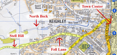
Fell Lane looking towards the town of Keighley, 2002 Fell Lane sits on a hill southwest of the town of Keighley. Older houses on the left, new houses on the right. |
| Photo by Tom Blanck, 2002 | |
|
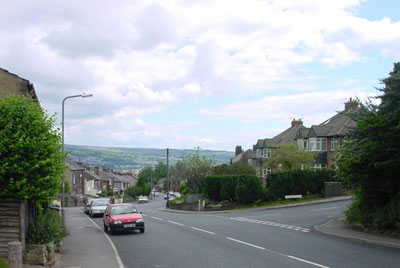
Fell Lane looking towards the town of Keighley, 2002 All of the older houses were on the north side of Fell Lane |
| Photo by Tom Blanck, 2002 | |
|
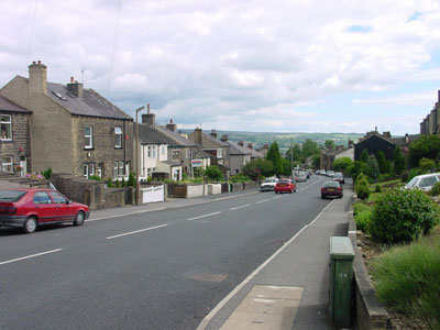
Fell Lane looking towards Stell Hill, 2002 At the end of the section marked "Fell Lane" on a current map of Keighley is an area marked "Stell Hill". Stell Hill is the highest point on this part of the road which continues out across the moors. |
| Photo by Tom Blanck, 2002 | |
|
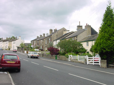
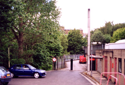
Where the North Beck enters the town of Keighley, 2002 The beck was not visible because of the vegetation. Behind the gate is a mill. |
Photo by Tom Blanck, 2002
"The town of Keighley had as its cradle slice of land around the North Beck and the River Worth. The Aire was then a distant river."The town grew rapidly with the advent of the industrial revolution in part because it was situated near the Aire Gap one of three gaps in the Pennine chain. The gap allowed for the easier construction of canal, railroad and roads that connected Lancashire and Yorkshire as the industrial north developed. "The Leeds and Liverpool Canal, of which the Keighley portion was opened in 1773, helped to put the town on the map. The railway followed in 1847, when the Leeds to Bradford line was extended a far as the town. Two years later, a key link-up was made when the local line was joined on to East Lancashire Railway at Colne." | |
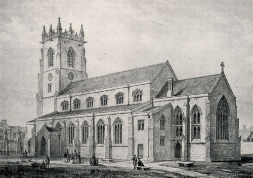 | |
| One Hundred Years The Parish of Keighley 1848-1958 by Harry Bancroft, Asa Briggs and
Eric Treacy, 1948, book collection of Maggie Land Blanck
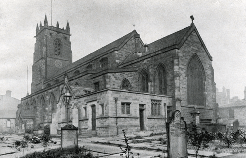
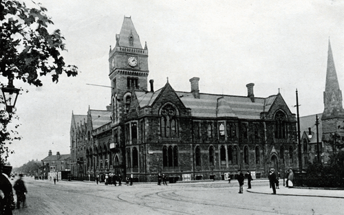
Parish Church, Keighley, 1848 In the mid 1800s the town clustered around the Church "as the village had done for centuries"* *One Hundred Years The Parish of Keighley 1848-1958 by Harry Bancroft, Asa Briggs and Eric Treacy, 1948 As the town grew and developed it's center moved away from the church.
| |
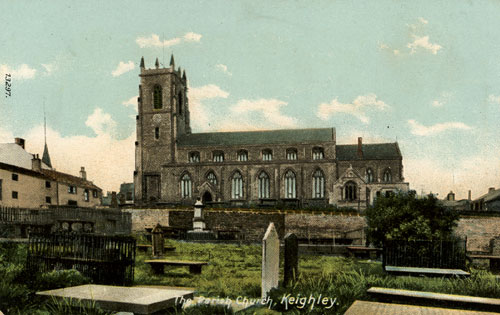 | |
| Postcard collection of Maggie Land Blanck
Parish Church, Keighley | |
|
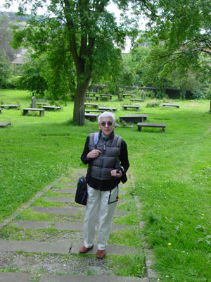
Me in the churchyard in Keighley, 2002 Every church we visited had old grave markers or memorial stones used as pavers. I am standing on such a paver. |
| Photo by Tom Blanck, 2002 | |
|
| Postcard collection of Maggie Land Blanck |
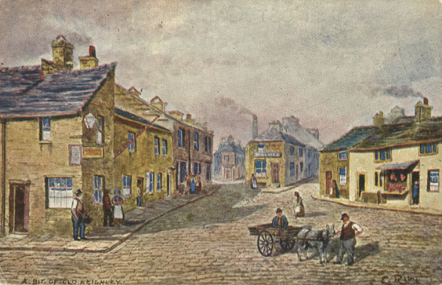
A Bit of Old Keighley |
|
| After a Water Color by Harry Turner from One Hundred Years The Parish of Keighley 1848-1958 by Harry Bancroft, Asa Briggs and Eric Treacy, 1948, book collection of Maggie Land Blanck |
|
The town increased dramatically after 1841 "out of all proportion to the
increase over the kingdom as a whole, and scores of new workers came in from other places"* The population swelled from 5,745 in 1851 to 18,258 in 1851 and 41,564 in 1901. The first cotton mill, Low Mill was built in 1780. By the mid 1800s there were over thirty mills and "cotton had given way to worsted as the basic textiles industry* *One Hundred Years The Parish of Keighley 1848-1958 by Harry Bancroft, Asa Briggs and Eric Treacy, 1948 The parish records indicate that there were cloth makers in the town as early as 1571 when John Hartley, a clothier, was buried . The wool combing trade is indicated in to 18th century records: Peter Hall yarn dealer was buried in 1724 and Abraham Binns wool comb make was buried in 1725.
|
|
| Postcard collection of Maggie Land Blanck |
|
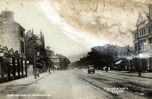
| Postcard collection of Maggie Land Blanck, January 2012
Skipton Road, Keighley, posted 1928 |
|
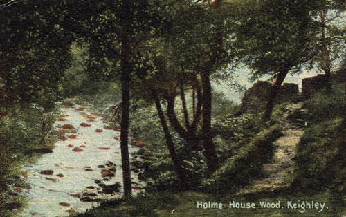
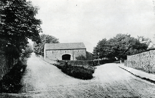
Holme House Wood Keighley Holme House Wood is directly below Stell Hill in Fell Lane. |
| Postcard collection of Maggie Land Blanck | |
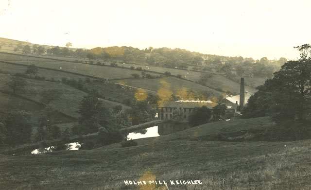 | |
| Postcard collection of Maggie Land Blanck
Holme Mill, Keithley
"Holme Mill built in 1816 by Thomas Binns.From Mills and Work Places In January 2018 Colin Kirkham wrote: "In the summer, this became very popular as an open air swimming pool for locals!!!! .... and a picnic was often taken!!!"
| |
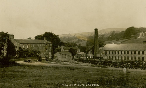 | |
| Postcard collection of Maggie Land Blanck
Holme Mill and Laycock, Keithley | |
|
Ilkley Moor from Skipton Road, Keighley "Ilkla' Moor baht 'at" is the unofficial national anthem of Yorkshire. John Newhill, January 2008 For the words to the song go to Ilkley.org
|
| Postcard collection of Maggie Land Blanck | |
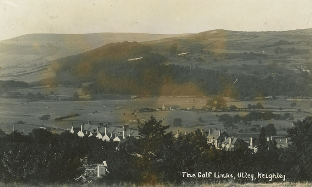 | |
| Postcard collection of Maggie Land Blanck
The Golf Links Utley, Keithley | |
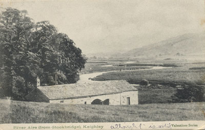
|
River Aire (from Stockbridge) Keighley |
| Postcard collection of Maggie Land Blanck | |
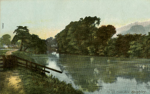 | |
| Postcard collection of Maggie Land Blanck
On the River Aire, Keighley | |
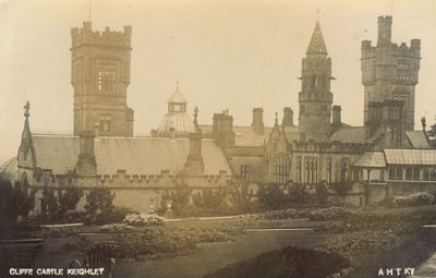
|
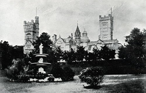
Cliffe Castle, Keighley |
| Postcard collection of Maggie Land Blanck | |

| |
| Postcard collection of Maggie Land Blanck | |
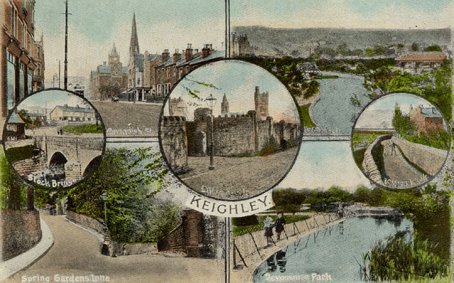
Keighley and District, no date | |
| |
| Postcard collection of Maggie Land Blanck | |
Keighley, no date | |
|
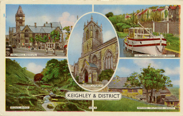
| Postcard collection of Maggie Land Blanck |
Keighley and District, postmarked 1964 |
|
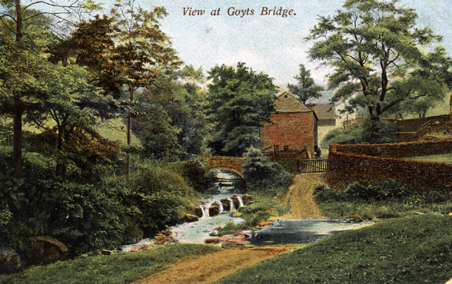
| Postcard collection of Maggie Land Blanck |
View at Goyts Bridge, posted 1906 |
|
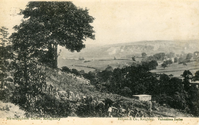
| Postcard collection of Maggie Land Blanck |
Newsolme Dene, Keighley, posted 1905 |
|
| Postcard collection of Maggie Land Blanck |
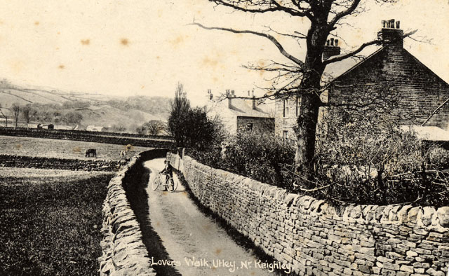
Lover's Walk, Utley Near Keighley |
|
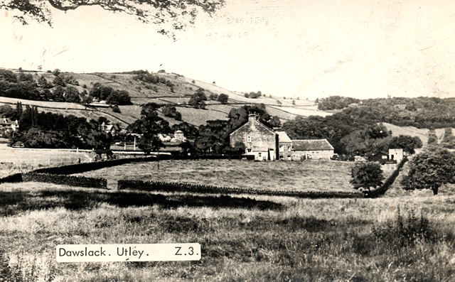
| Image courtesy Richard A Stride February 28, 2012 |
Dawslack, Utley Near Keighley |
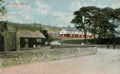 | |
| Postcard collection of Maggie Land Blanck
Posted 1907 In January 2010 IFREAR wrote: "It looks more like the bridge on Swine Lane where it crosses the Leeds Liverpool Canal, looking towards East Morton, rather than nearer Keighley crossing the Aire at Stockbridge. If you check some of the other photos on the website you can see the old Bar House at Stockbridge, at the end of Bar Lane. This, I feel, should be seen on your postcard where the road curves off to the right at the top of the picture. The Bar House is still there."I have seen this images labled "Stock Bridge". | |
 | |
| Postcard collection of Maggie Land Blanck
Crimble Clough, postmarked Keighley 1958 | |
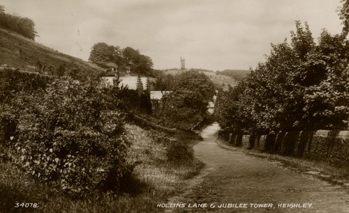 | |
| Postcard collection of Maggie Land Blanck
Hollins Lane & Jubilee Tower, Keighley, not posted | |
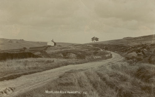 | |
| Postcard collection of Maggie Land Blanck
Moorland Road, Haworth Written on back: "Sep 5, 1910Haworth is south southwest of Keighley. The only access to the area in olden times was paths across the high barren moors. | |
|
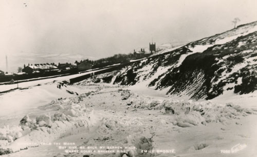
| Postcard collection of Maggie Land Blanck
--worth (maybe Haworth) from the moor "But give me back my barren hills, |
|
30 Views of Keighley and District 30 views of Keighley and District undated, published by T. Johnson, Lithographer and Printer, 16 Cooke Lane, Keighley is a 16 page booklet of images of Keighley and some near-by villages. There is no date and no text. The book must be dated 1904 or later as there is an image of the "Free Library" AKA Carnegie Library which opened in 1904. Impressively there is only one automobile (actually a truck) in the 30 images of Keighley. The image in question is that of North Street. There are very few people on the streets. There are no images that clearly depict women which could help to date the images. |
|
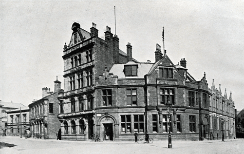
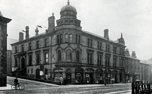
| Town Hall and Post Office, Keighley |
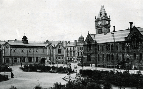
|
| Town Hall Square, Keighley |
|
| Parish Chrurch, Keighley Exterior |
|
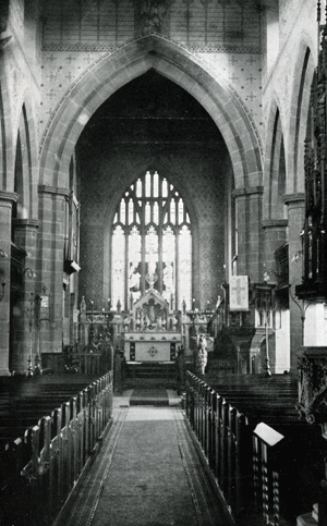
| Parish Church, Keighley, Interior |
|
| Free Library, Keighley |
|
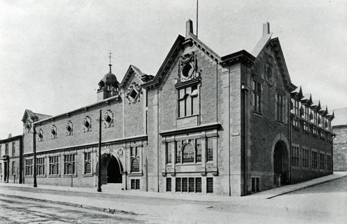
| The Technical Institute, Keighley |
|
| The Temperance Institute, Keighley
The Temperance Institute of Keighley was built in 1896. It is now the home of the Livery Rooms, a Wetherspoon pub. Try the alternative": the built heritage of the temperance movement", Andrew Davison, 2006 |
|
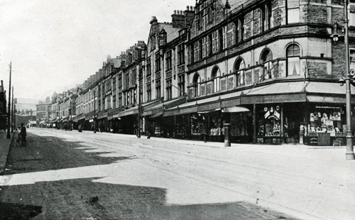
| Cavendish Street, Keighley |
|
| North Street, Keighley The name on the store on the extreme left reads Waddington.
|
|
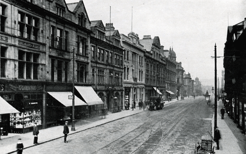
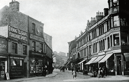
| Low Street, Keighley
The second store from the left was H. Driver, watchmaker and jeweler. Henry Driver clock and watchmaker age 64 was listed on Queen street Keighley in the 1881 census. In the 1871 the same Henry Driver was listed on Low Street. He was also listed in 1851. He does not appear to have had children. Henry Driver died in 1882. The sign on the store on the right says "M. Blakey" cannot read next word "Wallpaper" The third store in on the right has a sign reading "P Ward"
|
|
| Hollins and Bar House Lane, Keighley |
|
| Cliffe Castle, Keighley
The history behind Cliffe Castle Park
|
|
| The Jubilee Tower, near Keighley The Jubilee tower was built in 1897. |
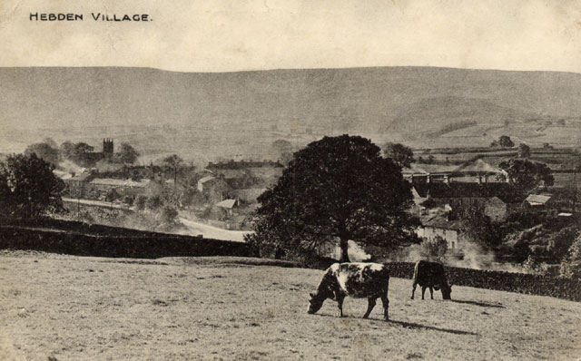 | |
| Postcard image courtesy of Tracy Foulds
In January 2006 Tracey Foulds graciously shared this fabulous postcard of Hebden Village which is located on the moors north of Keighley. Tracy writes: I cannot see the date on the stamp mark but it would have been posted before 1932ish. Because of the wording on the back you can tell she is talking to a little girl. My Grandmother was born 1922 and that is who it was posted to.
In January 2018 Colin Kirkham wrote: "Hebden is a mile or so north of Burnsall." Burnsall is a village and civil parish in the Craven district of North Yorkshire, England, about 20 miles north of Keighley.
| |
Thanks Thanks to:
|
| Stell Connection Page |
| The Stells of Fell Lane (Fellane) Going Back to John Stell Born Circa 1541
For more information on the the early records of Stells in Keighley, click on the photo of Goyts Bridge. |  |
| John Stell (1690)
For more information on John Stell, click on the photo of Fell Lane, Keighley Parish |  |
| Joseph Stell (1721)
For more information on Joseph Stell, the son of John Stell and the father of George Stell, click on the picture of Newsolme Dene |  |
| George Stell (1752-1809), son of Joseph
For more information on George Stell, click on the picture of old Keighley |  |
| Independent Congregation, Keighley
For more information on the Independent Congregation in Keighley, click on the photo of Fellane. |  |
| Keighley and Fell Lane
For more information on the parish of Keighley and the village of Fell Lane, click on the photo of Fell Lane. | 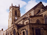 |
| Dinsdale for information on the Dinsdales, click on the photo of Newsolme Dean |
|
| Keighley History and Old Photos at Vale and Dale | |
| If you have any suggestions, corrections, information, copies of documents, or photos that you would like to share with this page, please contact me at maggie@maggieblanck.com |
| RETURN TO TOP OF PAGE |
|
Please feel free to link to this web page. You may use images on this web page provided that you give proper acknowledgement to this web page and include the same acknowledgments that I have made to the provenance of the image. Please be judicious. Please don't use all the images. You may quote up to seventy five words of my original text from this web page and use any cited quotes on this web page provided you give proper acknowledgement to this web page and include the same acknowledgments that I have made to the provenance of the information. Please do not cut and paste the whole page. You may NOT make use any of the images or information on this web page for your personal profit. You may NOT claim any content of this web page as your original idea. Thanks, Maggie |
| ©Maggie Land Blanck - Page created 2004 - Latest update, April 2018 |