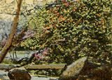
To view photos of Fell Lane and Keighley, click on the photo of the Newholme Dean.
| Keighley Parish |
| HOME - Land Introduction - Stell Connection Page - Dinsdale - Mitchel - John Land |
|
Keighley, 1842 Directory Leeds
"Its parish had no dependent townships though it is about six miles long and four broad, and comprises 10,160 acres of land (including a peaty moor of about 2,00 acres) and a population which amounted, in the year 1801, to 5,745."Fell lane was listed as one of the "hamlets" outside the town.
The Meaning of the Name, Keighley
Professor Ekwall's theory is now universally accepted -"Cyhha's clearing or farm". The Norman clerks compiling William the Conqueror's Doomsday Book in 1086 listed, "In Cichhelai (Keighley), Ulchel, and Thole, and Ravensuar, and William had six carucates to be taxed." (A carucates was traditionally the amount of land that could be cultivated with one plough and eight oxen in one year, about 120 acres). According to Dewhirst some of the various ways the name was spelt over the centuries include: Kichalaie, Kychelay, Kykelei, Kyhele, Kyhelay, Kikhele, Kyghelay, Kithelai, Kygeley and Keghelay The excepted modern spelling is "Keighley" and the pronunciation is "Keathley".
Topography The town of Keighley is near the junction of the Worth River and the North Beck (A beck is a small stream with a stoney bed) about a mile above their junction with the Aire River. Keighley parish is surrounded by high barren moors. According to William Keighley's history the hills around Keighley, "though high, do not attain the character of mountains, unless Rumbles Moor be allowed that distinction, whose height is 1,322 feet above sea level and the elevation in the extreme west of the parish, which spurs off from Boulsworth, whose summit rises 1,698 feet."According to William Keighley, "The Parish averages about seven miles in length, by two and a quarter in breath, and contains 10,160 acres and 14 hamlets: there is no dependent township." History Bronze and Iron Age Remains have been found in the area that date to the Bronze and Iron ages. Celtic There were Celtic stone circle two miles south of Keighley. Romans There are remnants of Roman roads in the area. William The Conqueror and The Doomsday Book Both William Keighley and Ian Dewhirst say that William the Conqueror "devastated" the Keighley area. Every book I have read on Yorkshire uses the word "devastated" to describe what William the Conqueror did to Yorkshire. William Keighley says, " When William the Conqueror devastated Yorkshire and Durham by fire and sword, he issued a decree forbidding any Englishman, on pain of death, to burn a light in his dwelling after the bell had told the curfew, or cover-fire. Until 1857 we kept up the memory of the tyrannical law, by tolling the curfew-bell at eight o'clock in the evening."According to Keighley and Dewhirst's histories of the area, the Doomsday Book (A list of taxable lands compiled in 1086) listed the following taxable properties in the area:
Dewhirst includes:
The Church The first parish church of Keighley was founded in the twelfth century and there has been a church on Church Green since the 12th century. The Parish Registers started in 1562. According to Dewhirst, two records from the 1571 listed the death of "clothiers" indicating that the was a "modest woolen industry" in the area. Population in 1379 There were 109 people in Keighley in 1379. Market Fair William Keighley says that Henry Keighley was granted a charter in 1305 to hold a "Market Fair". Five years after the date of this charter the market prices were the following: "wheat, 6s. a quarter; oats, 3s.; eggs, ¸ d. a dozen; ale, ¸ d. a gallon, a cow, 12s. 6d.; a sheep 1s. 2d.; a fat pig, 3s. 4d.; a fat goose, 2¸d.; a pair of shoes, 4.; a labour's wage, 1¸ d. a day, in harvest time, 2d.; a journeyman carpenter, 2d. a day; a riding horse, 13s 4d.; an English slave and his family sold for 13s. 4d*; a bible, 33 pounds 6s. 8d. The old fair was held on the 27 of October, was later changed to the 8th of November and by 1879 was held on the 8th of May. The Market, after having been held on the Church-Green for more than five centuries was removed to its present site in the month of November, 1833." * my italics This means that the market was held in this one site for at least 500 years. George Stell moved from Keighley to Gomersal at least fifty years before the market moved. According to Ian Dewhirst the fair lasted into the 1920's. The War Against James IV of Scotland In 1513 James IV of Scotland was defeated and killed at the Battle of Flodden. Among the followers of Lord Clifford, who fought in the battle under the standard of the Earl of Surrey, were:
Keighley in 1630 About 1630 Barnaby Harrington, the "Rhyming Vagrant" or "Drunken Barnaby" as he was variously known published a work called "Travels to the North" in which he included a verse about Keighley, "Thence to Kighley, where are mountainsAccording to William Keighley, "The Bowling Green was situated on the west side of and parallel with Church-Green, now the site of the New Bridge Street; and an old house by the Beck-side was called Bowl Alley."Bowling was a popular sport in the area for many years. The Civil War (1642-1649) Concerning the civil was in the area in the 1640s, William Keighley quotes Vicars and Whitelock: " early in the month of February, 1645, a party of about 150 horse from Skipton, taking advantage of the absence of Col. Brandling, who commanded, fell suddenly upon the Parliamentary quarters at Keighley, where they surprise the guards, got into the town and took near a hundred prisoners, sixty horse and other booty. Col. Lambert and his party, however, who happened to be quartered in the neighborhood, having heard the alarm, came to their relief, and preformed their part so gallantly that they recovered all the parliamentary prisoners and most o the booty which the enemy had taken, killed fifteen of them on the spot, took about twenty prisoner, wounded and took the commander---a Captain Hughes--- killed his Lieutenant also, and pursued the rest to the gates of Skipton. On Mr. Lambert's side were lost in this service, Captain Salmon, on of his best officers, and eight dragoons."The army was in the area for several years. The parish records reflect several burials of "souldiers" including:
The war brought additional devastation to the area. A notation at the end of the month of October 1645, which included eight deaths, states, " All ye dyed this month of October was of the Plague". Plaque in 1675 In 1675 the parish was hit by a fatal epidemic called "The Jolly Rant". The number of deaths recorded in the parish registers for 1675 were 105, whereas the normal death rate per year was 40. The Cloth Industry There were two "becks" (streams) in the area, the Sun Beck and the North Beck. William Keighley gives a great impression of the area and the becks both physically and economically with the following paragraph. " The early introduction of spinning machinery, and the subsequent prosperity of this town, are due to the two becks or rivulets which mingle their waters at Calepit and discharge their joint contents into the river Aire about a mile below. Hence the two stream, with their sparkling feeders trickling down the side of the adjacent hills like tears of the Naiads shed in view of the unrural office which await them, are entitled to our consideration as the principal sources of wealth, not only to the mill-owners on their banks, but to the tradesmen and landed properties of the surrounding district."Partly as a result of this water supply, the area became a center for the manufacture of cloth. William Keighley says that during the reign of George I (1714 to 1717) combers and weavers were being mentioned in the parish registers. The first mention of Stells as weavers were:
The first mention of a Stells as a comber was:
Among the other odd bits included by William Keighley is the following, "As the center of a district, Keighley continued for some time to keep up its grand septennial procession in commemoration of Bishop Blaise, the reputed patron of wool-combers; but these gaudy spectacles are now discontinued, being considered extravagant and foolish."William Keighley says that there were shalloon weavers in the area as early as 1724. Shalloon is a lightweight, twilled, woolen or worsted fabric used mainly as a lining for coats and uniforms. William Keighley say that Keighley was for along time dependent on Halifax as its market for selling woolen and worsted. Cotton manufacturing was replacing woolens and worsted in the area in the late 1700s. A large cotton mill was opened in 1780. By 1805 there were ten cotton factories in or near Keighley. Enclosures For centuries pasture land had been communal. Enclosures (or the fencing off of separate areas) occurred in Keighley from 1771 to 1788. Road Improvements Road improvements occurred throughout the mid to late 1700s. Population
Rev. Miles Gale, the rector in Keighley from 1680 to 1720, wrote a history of the parish, which was published in 1733. I have not been able to find a copy, but Mr. Gales is quoted both by William Keighley and Ian Dewhirst, "In the year 1695, when an account was required to be taken of all inhabitants, there appeared to be in the parish 1704, whereof 112 are freeholders, which catalogue is kept in the vestry."and "The town of Keighley contains 100 houses, and is pleasantly situated in a low valley surrounded with hills."and further " A traveler through this parish shall not meet with half a mile of level ground, only at the east end of the town is a field of plain earth, containing 114ą days work round which a horse races are sometime made." Fell Lane (Fellane) The Stell branch that are the Land ancestors lived in the hamlet of Fellane or Fell Lane. Fell Land was a hamlet situated on the south side of the North Beck about a mile west of the town of Keighley. In his book on the area William Keighley gives descriptions of the various hamlets that comprised the township of Keighley. He has very little of interest to say about Fell Lane. He lists it as two words Fell Lane (in the early records it was listed as one word). He says that "fell" could be used to denote a hill or mountain, but he feels it doesn't come from this source. He feels that the name came from the surname of people who lived in the area. He says, "In the year 1628 Ellen Fell was married to Edward Beanlands, and there are a few old persons still living who can remember a 'Maister and Dame Bellands' living there, and employing the main part of the inhabitants of the village in combing, spinning and dying of stocking worsted."William's book was published in 1879. How old were the "old persons" who were reporting this information? A bigger question is why it was called Fell Lane instead of Beanlands Lane? Fell Lane is much more likely to mean his original suggestion of "hill" because Fell Lane, in fact, is a road that runs up a hill from the town of Keighley to "Stell Hill". The Stells of Fellane were listed with occupations like weaver and comber in the mid 1700's. Note: Margaret Stell married Edward Beanelands on October 29, 1587 in Keighley Parish. Their son Edward was baptized in 1591.
Odd Bits Periodically I come across an item that has nothing to do with the families that I am researching but that I find interesting. While looking at some papers from Keighley I came across the following. "June 27, 1701 Sources for the Topography and History of The Parish of Keighley I have found several histories of Keighley Parish:
|
|
| |
| Photos of Fell Lane in Keighley Parish To view photos of Fell Lane and Keighley, click on the photo of the Newholme Dean. |
|
| Keighley History and Old Photos at Vale and Dale | |
| If you have any suggestions, corrections, information, copies of documents, or photos that you would like to share with this page, please contact me at maggie@maggieblanck.com |
| RETURN TO TOP OF PAGE |
| Please feel free to link to this web page. You may use images on this web page provided that you give proper acknowledgement to this web page and include the same acknowledgments that I have made to the provenance of the image. Please be judicious. Please don't use all the images. You may quote up to seventy five words of my original text from this web page and use any cited quotes on this web page provided you give proper acknowledgement to this web page and include the same acknowledgments that I have made to the provenance of the information. Please do not cut and paste the whole page. You may NOT make use any of the images or information on this web page for your personal profit. You may NOT claim any content of this web page as your original idea. Thanks, Maggie |
| ©Maggie Land Blanck - Page created 2004 - Latest update, January 2012 |