|
|
| The Bowers Walk Along The Robe River |
| WALSH/LANGAN INTRODUCTION - HOME - OLD PHOTOS OF BALLINROBE |
| Ballinrobe and Its Townlands Ireland is divided into counties. The counties are further divided into parishes. The parishes are a civil unit, although they frequently coincide with the ecclesiastical parishes. The civil parishes are subdivided into townlands. Many Parishes contain a town with the same name as the parish; the town of Ballinrobe is in the Parish of Ballinrobe. The Parish of Ballinrobe is comprised of several townlands the boarders of which are in the town itself. For instance, people who live on the north side of Glebe Street, Ballinrobe live in the townland of Friarsquarter West and people on the south side of Glebe Street live in the townland of Carnaroya. Civil records, including the Griffith Tax Valuation, make a distinction between Carnaroya and Carnaroya, Town of Ballinrobe. The problem is determining the town limits. Obviously everyone in Ballinrobe knew the difference, but I am having trouble with the concept in trying to determine exactly where John Walsh and family lived. I keep trying to find a map that makes all the distinctions.
| |
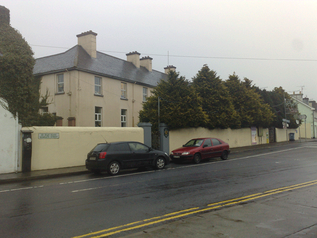
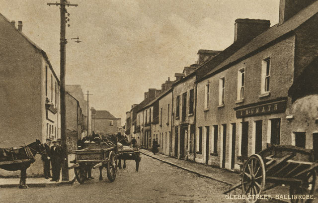
| Bowgate Street
| |
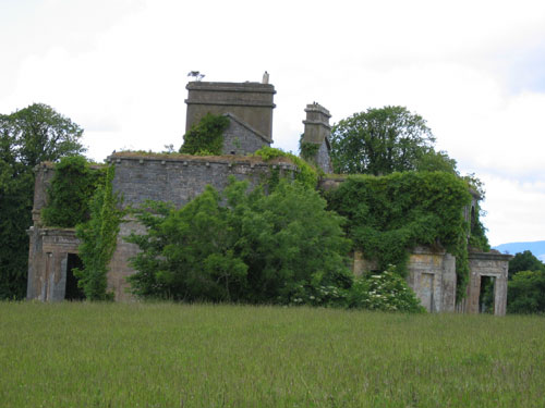 |
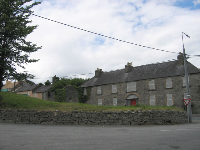
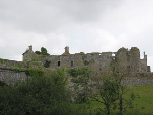
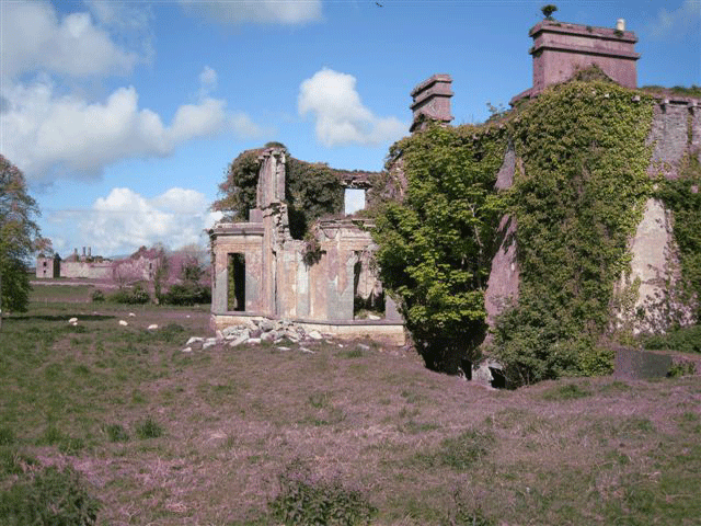
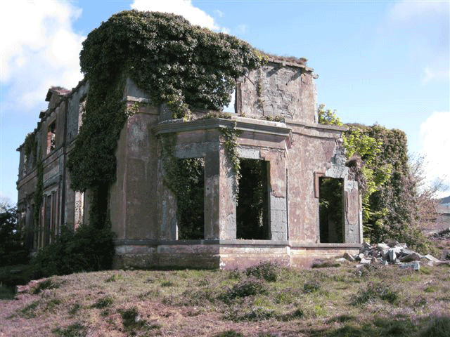
Cranmore House in Ruins
Ballinrobe, 2004 |
| Photo collection of Maggie Land Blanck, 2004 | |
| On Bowgate Street (the southern end of Main Street) stand the ruins of Cranmore
House. Build in 1838 by Alexander Lambert on property of Colonel C. N. Knox, a local landlord, the house was occupied
until the late forties or fifties when the taxes become too high. For more images of Cranmore house and for information on and comments about same go to the photos shared by Kevin McDarby at the bottom of the page. | |
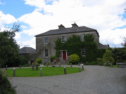 |
Glebe House Main Street Ballinrobe, 2004 |
| Photo collection of Maggie Land Blanck, 2004 | |
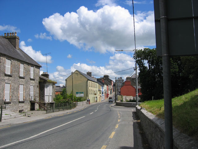
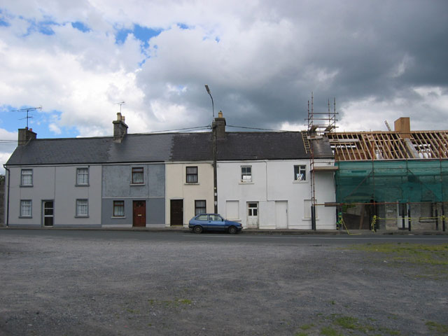
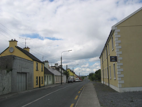
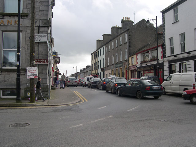
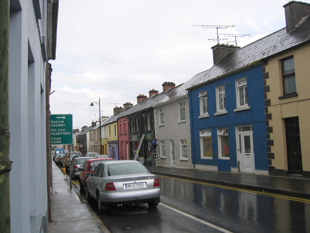
| Bowgate Street turns into Main Street just near the old Post Office. Main Street
was once known as Market Street.
In March 2007 Donal Buckley emailed that he was trying to locate the RIC (Royal Irish constabulary) barracks in Ballinrobe which he believes was adjoining the old post office. Donal says that The Police Barracks have: "been demolished. Gannon's Hotel was used to billet some of forces during the War of Independence. These MAY have been Black and Tans, Auxilliaries or indeed maybe Old RIC who were withdrawn from more rural police barracks/stations. One of your Old Ballinrobe photos shows these buildings and maybe there is a policeman in the doorway." April 7, 2007 The Glebe House was erected in the early 1800s and was the residence of the rector of the Church of Ireland (Anglican Church) | |
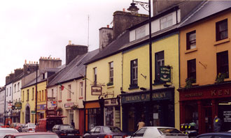
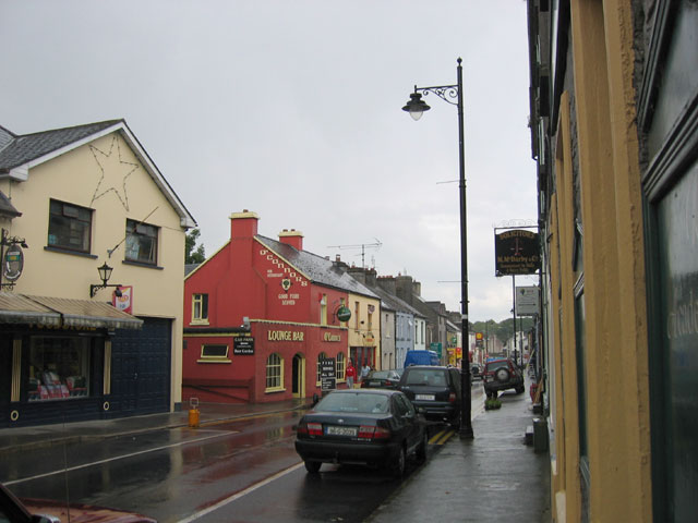
| Main Street
| |
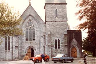 |
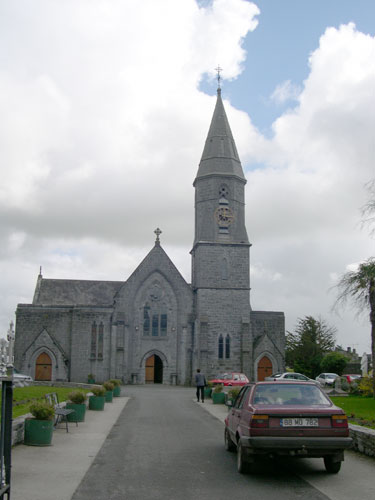
Saint Mary's Roman Catholic Church, Main Street Ballinrobe |
| Photo courtesy of Cathie McEneney, a granddaughter of Joseph Walsh and Maggie Langan. | |
| Construction on St Mary's Church started in 1853 and finished in 1863. All of the children of John Walsh and Fanny Feeney were baptized in St Mary's. Three of the children of Mathias Langan and Penelope Byrne were baptized in St Mary's.
| |
 |
St Mary's Catholic Church, Ballinrobe |
| Photo Ed Land, great grandson of Joseph Walsh and Maggie Langan | |
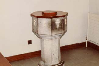 |
The Baptismal Font, St Mary's Catholic Church, Ballinrobe |
| Photo courtesy of Cathie McEneney, a granddaughter of Joseph Walsh and Maggie Langan | |
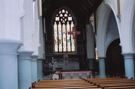 |
| Photo collection of Mike and Kathey McEneney | Inside of St Mary's Chruch Ballinrobe |
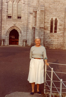 |
Agnes Goehle Land, the granddaughter of Joseph Walsh and Maggie Langan, in front of St Mary's Roman Catholic Church, Ballinrobe, 1980 |
| Photo taken in 1980 by Bud Land | |
 |
Main Street, Ballinrobe, 2005 |
| Photo Ed Land, March 2005 |
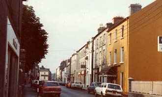 |
Main Street, Ballinrobe, 1980 |
| Photo taken in 1980 by Bud Land and Agnes Goehle Land |
 |
Agnes Goehle Land, Main Street, Ballinrobe,
1980
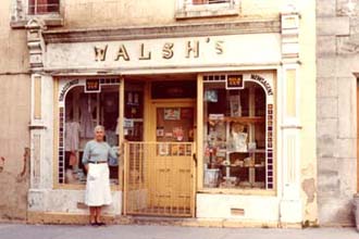
Walsh was one of the most common names in the area. |
| Photo taken in 1980 by Bud Land and Agnes Goehle Land | |
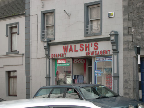 |
Walsh's Ballinrobe, 2005 |
| Photo Ed Land, March 2005 |
 |
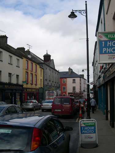
Main Street, Ballinrobe, 2000 |
| Photo taken by Maggie Land Blanck, the daughter of Agnes Goehle Land and the great-granddaughter of Joseph Walsh and Maggie Langan. | |
 |
| Photo Maggie Land Blanck, 2005 | Main Street |
| Unknown, Town of Ballinrobe
| |
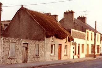 |
A Thatched Cottage in Ballinrobe Most of the houses on Glebe Street had thatched roofs. This cottage may have been similar to the cottages that the Walshes and Langans lived in Ballinrobe in the the mid to late 1800s. |
| Photo taken in 1980 by Bud Land and Agnes Goehle Land. | |
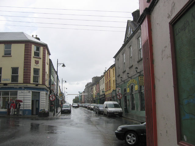
| Bridge Street
|
 |
| Photo collection of Maggie Land Blanck, 2004 | Bridge Street, Ballinrobe, looking west from the intersection of
Main, Abbey and Glebe Streets. Bridge Street runs from the intersection of Main Street, Abbey Street, and Glebe Street to the Robe River Bridge where the name changes to High Street. The white and black truck at the lowest part of the road is just about where the name changes from Bridge Street to High Street. |
| The River Robe
|
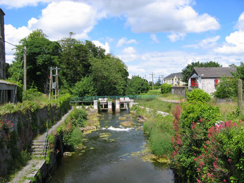 |
| Photo collection of Maggie Land Blanck, 2004 | The River Robe from the Bridge A view of the River Robe, June 2004, from the Bridge that separates Bridge Street from High Street. |
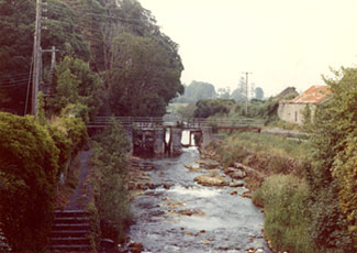 |
Same View 1980
|
| Photo taken in 1980 by Bud Land and Agnes Goehle Land | |
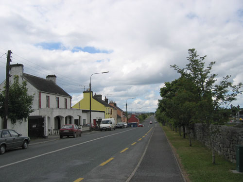
| High Street, Townland of Knocknatish, Town of Ballinrobe High Street is a continuation of Bridge Street as far as the intersections of Creagh Road, Chapel Road and an unnamed road that goes north to Ballyglass. The north side of High Street is in the townland of Knockanotish. Pat Langan was listed as a resident of High Street at his death in 1888. Note: This may have been a clerical error, as the Griffith Tax Valuation show Pat Langan on Creagh Road for a number of years.
John Walsh and his family lived in Knockanotish from at least 1869 to 1882. During that time he was listed as: farmer, gardener, and steward. The boundaries for the townland of Knockanotish are the Robe River, the north side of High Street and the unnamed road that lies east of the graveyard and runs north to Ballyglass. The only buildings shown in the townland of Knockanotish in the 1900 Ordnance Survey are along the north side of High Street and on the corner of the unnamed road to Ballyglass as shown in the following photos.
|
 |
| Photo collection of Maggie Land Blanck, 2004 |
|
The Robe River goes under the road and separates Bridge Street from High Street
just about
where the green and white sign is. The yellowish building is on Bridge Street, Friarsquater West.
The grey buildings are on High Street, Knockanotish. All are in the town of Ballinrobe.
|
| High Street, Townland of
Knockanotish, Town of Ballinrobe
A 1980's view of High Street, Knockanotish showing most of the buildings facing High Street. The large building on the right, the Robe Villa, was the home of the Kenny family, and is the same as the one on the left in the above photo. |
| Photo taken in 1980 by Bud Land and Agnes Goehle Land | |
 |
| Photo collection of Maggie Land Blanck, 2004 | A view of the buildings on High Street from the entrance to the river walk
The large building is the Robe Villa. The dash of bright green on the extreme left of the photo is scaffolding covering on the building on the corner of High Street and the unnamed road to Ballyglass. There is an opening between the Robe Villa and the vine covered ruin to the left of it that goes into the property behind. See photos below.
|
 |
| Photo collection of Maggie Land Blanck, 2004 | Knockanotish houses facing the unnamed road to Balleyglass.
The green scaffolding covering on the front of the building on the right continues around the corner to that visible in the previous picture. |
| Where did the Walshes Live in Knockanotish?
The four photos above show all the areas where houses were indicated in the 1900 Ordnance Survey Map. The Griffith Tax Valuations Ledger that covered the years 1869 to 1882 (the same years that John Walsh and family were listed in Knockanotish) listed:
There are just enough buildings on High Street and the unnamed road to Ballyglass to account for the dwellings listed in the Griffith (1869-1882). The records for John Walsh list him in Knockanotish, not Knockanotish, town of Ballinrobe. His occupations, as listed, would be in keeping with someone who lived in the caretakers house and took care of the 280 acres of land. Where was the caretakers cottage? Since it is listed in Knocknatosh but not the town of Ballinrobe, it must have been off the roads and perhaps in the yard behind the main house. Irish landlords liked to have their employees close to their work. According to Bridie Mulloy in Itchy Feet and Thirsty Work, most of the workers at the Kenny flour mill lived on High Street. Why was Stanhope Kenny listed twice? With the help of Gerry Ryder who did some research in the Castlebar library in 2008, I have determined that John Walsh was a steward/gardner for the Kenny Family. Confirmed dates are 1859 and 1860. |
 |
| Photo collection of Maggie Land Blanck, 2004 | Entrance to the Property off High Street
This driveway leads to to the property off High Street and the building, including the mill, which lie behind.
|
 |
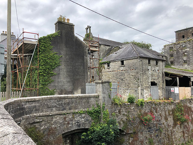
| Photo collection of Maggie Land Blanck, 2004 | The Robe Villa and the Kennys The Kennys were major landholders in the Ballinrobe area. The Robe Villa was build by the Kenny family around 1740. Griffith with dates from the mid 1880s to the mid 1890s lists Stanhope Kenny on High Street with house, land and offices and as landlord of the flour mill. I do not know the function of this very unusual looking building which sits opposite the mill behind the villa.
|
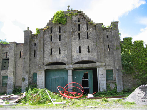
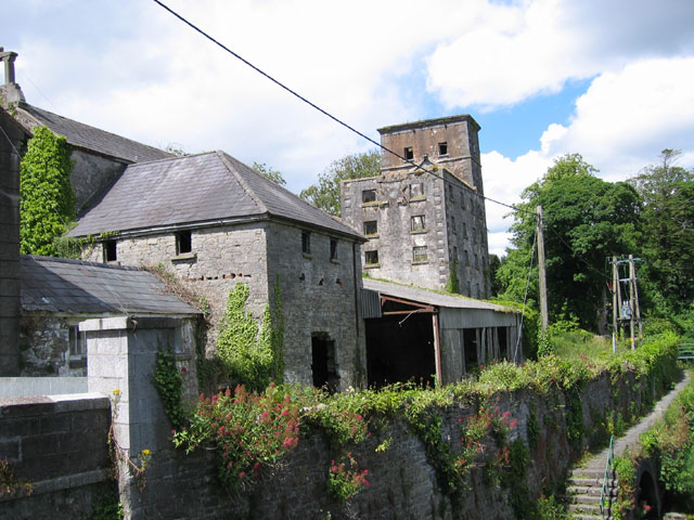 |
| Photo collection of Maggie Land Blanck, 2004 | The Ruins of the Flour Mill, June 2004, As Seen
From the Bridge at the end of Bridge Street.
The seven story mill was powered by the Robe River and was used for grinding flour. The Griffith Valuation Ledger from the mid to late 1880s listed William Livingston as the tenant of the mill with Stanhope Kenny as the landlord. A notation with the dates 1884 and 1887 says: "Mill had ceased working. Mills very old and not now half worked. An annually (can't read word) expenses for repairs."In WW II mill water was used to operate and electric generator.
|
 |
| Courtesy of Paul Herdman, July 2019 | Old Kenny Property - High Street Ballinrobe
|
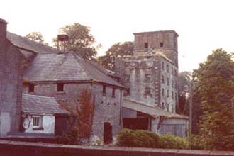 |
Ruins of the Kenny Mill, 1980 Online information shows plans to convert the mill into 21 condos.
|
| Photo taken in 1980 by Bud Land and Agnes Goehle Land | |
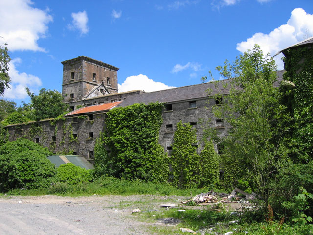 |
| Photo collection of Maggie Land Blanck, 2004 | The Ruins of the Flour Mill, June 2004, As Seen
From inside the yard behind High Street.
|
|
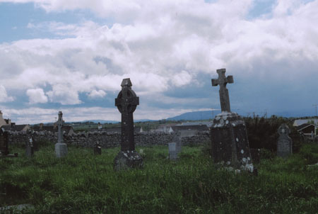
The Carrownalecka Graveyard With The Church Ruins In The Background The graveyard lies between Chaple Road, which goes to Partry, and the unnamed road to Ballyglass. We did not find a tombstone for John and/or Fanny Walsh or Mathias, Margaret and/or Pat Langan during either the visit in 2000 or the visit in 2004. However, both times there were a number of stones we could not reach and/or read. |
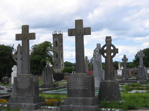 |
| Photo collection of Maggie Land Blanck, 2004 |
|
 |
| Photo collection of Maggie Land Blanck, 2004 | Graveyard and Chapel Road
|
 |
| Photo collection of Mike and Kathey McEneney | Another View of the Graveyard
|
 |
| Photo collection of Mike and Kathy McEneney | Graveyard
View of the graveyard with the old Chapel on Chapel Road in the background. |
|
Chapel Road, The Townland of Carrownalecka, Town of Ballinrobe
|
 |
| Photo collection of Maggie Land Blanck, 2004 | Chapel Road With The Carrownalecka Graveyard On The Right
Carrownalecka's boarders are not completely clear to me. However, the townland appears to be triangular in shape: bordered on the east side by the unnamed road to Ballyglass and on the west by Chapel Road. The northern boundary is not clear. There are several houses on Creagh Road listed in the Griffith under Carrownalecka. There are a number of Walsh listings. However I do not have enough information at this point to determine if any of them are related to John Walsh.
|
 |
| Photo collection of Maggie Land Blanck, 2004 | Chapel Road With The Graveyard Behind The Yellow Building
On The Right
|
| The North Side of Creagh Road,
Townland of Carrownalecka, Town of Ballinrobe
|
 |
| Photo collection of Maggie Land Blanck, 2004 | The north side of this part of Creagh Road was/is in the townland of Carrownalecka, Town of Ballinrobe.
The Griffith Tax Valuations and the civil records show the following for Langan at #10 Creagh
Road, Township of Carrownalecka, Town of Ballinrobe:
I do not know how the numbering system worked for the Griffith Valuation. It is not consistent with the Censuses. Therefore, I do not know which was the house listed as #10. However, it must have been one of the houses show in this photo even if it is one way down at the end. |
 |
| Photo collection of Maggie Land Blanck, 2004 | The South Side of Creagh Road, Townland of Rathkelly, Town of Ballinrobe
|
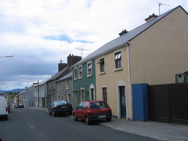
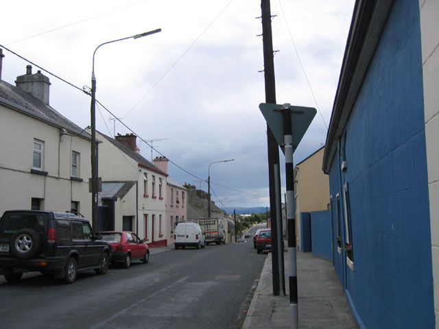
| Abbey Street, Townland of Friarsquarters West, Town of
Ballinrobe The Walshes were living on Abbey Street from at least 1892 to 1894. |
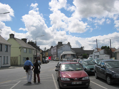 |
| Photo collection of Maggie Land Blanck, 2004 | Abbey Street looking south towards the intersection of
Main, Abbey, Bridge and Glebe Streets. Abbey Street, which lies in the townland of Friarsquarters West runs north south from the intersection on Main, Bridge and Glebe Street, then veers to the right towards Hollymount and Claremorris. The red "x" marks the intersection.
|
 |
| Photo collection of Maggie Land Blanck, 2004 | Abbey Street Houses on the right hand side of the road going north from the town center. In this photo the town center is on the right side of the picture.
|
 |
| Photo collection of Maggie Land Blanck, 2004 | Abbey Street Houses on the left hand side of the road going north. These houses mark the end of the town going northeast in 1901.
|
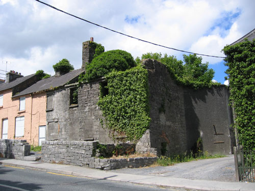
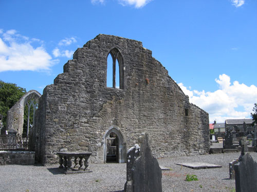
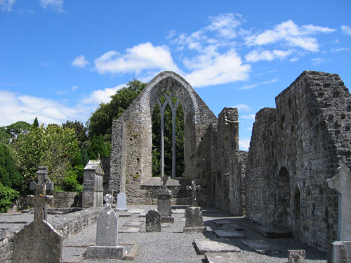
| The Abbey The Augustinian Friary, founded c. 1312, gives name to both Abbey Street and the townlands of Friarsquarters East and Friarsquarters West. The ruins are surrounded by a graveyard. We did not find tombstones for any Walshes, Langans or related families. |
 |
| Photo collection of Maggie Land Blanck, 2004 |
|
 |
| Photo collection of Maggie Land Blanck, 2004 |
|
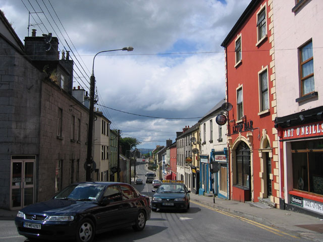
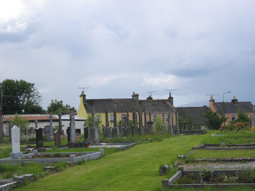
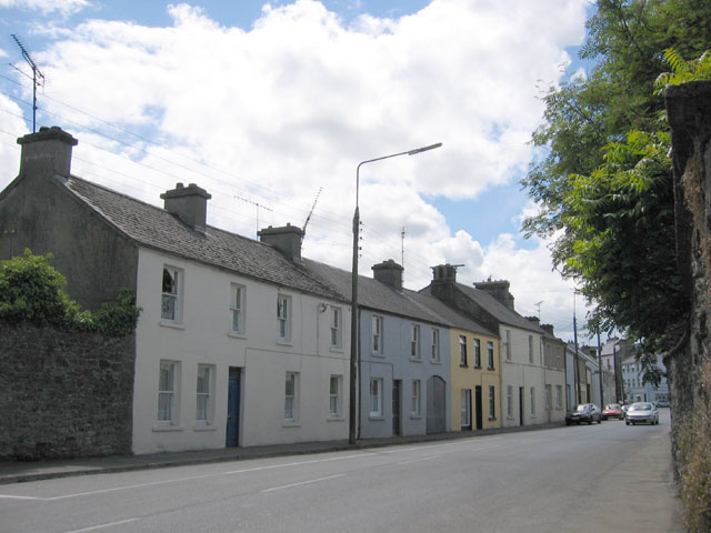
| Glebe Street The glebe was property belonging to the Church of Ireland. Glebe Street runs east west from the intersection of Bridge, Main, and Abbey Streets. Matthew Langan was listed on Glebe Street at the birth of his son, James, in 1877. He was also listed at 27c Friarsquarters in the Griffith Tax Valuation that covers that year. The tax listing indicates that they were living on the north side of the street. Ellen Moughan, the wife of Martin Langan, and her daughters, Martha and Helen, were listed in the 1911 Census on Glebe Street.
|
 |
| Photo Ed Land, March 2005 | Glebe Street Looking East
Mathias and family lived on the left side of the street as seen in this photo. |
 |
| Photo collection of Maggie Land Blanck, 2004 | North Side of Glebe Street From Near Main Street
|
 |
| Photo collection of Maggie Land Blanck, 2004 | North Side of Glebe Street Looking Towards Main Street
|
 |
| Photo collection of Maggie Land Blanck, 2004 |
| South Side of Glebe Street From Near Main Street
|
| The Army Barracks
|
 |
| Photo collection of Maggie Land Blanck, 2004 |
| The Ruins of the Army Barracks
Ballinrobe was a garrison town for many years. The armed forces stationed in Ballinrobe gave an important monetary boost to the town until their withdrawal in 1926. |
| The Town of Ballinrobe from the 1900 Ordnance Survey Map
|
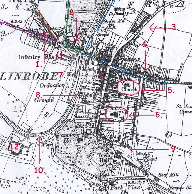 |
| The blue line indicates the boundary of the townland of Friar's Quarters.
This townland includes Abbey Street (3) and Glebe Street (4). To the left of the townland of Friar's Quarters between the blue and green lines is the townland of Knockanotish (2). Still further left, between the green and orange lines is the townland of Carrownalecka (1). The townland between the orange and purple is Rathkelly. The Walshes and Langans lived in Carrownalecka, Knockanotish and Friar's Quarters. Number 11 was the Infantry barracks. Number 12 was the cavalry barracks now in ruins. Number 7 is Main Street. 5 was the old Church of Ireland Church, now the library. 6 is the Roman Catholic church. 8 was the Glebe house. 9 is the Market Square. 10 is the River Robe.
|
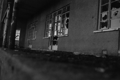
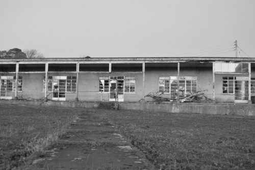
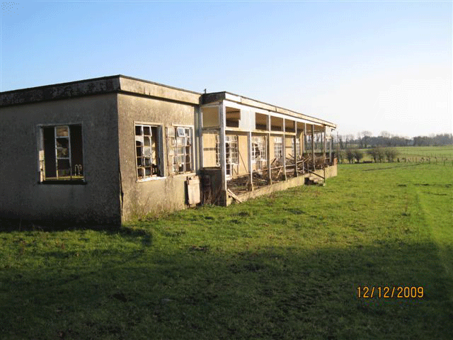
| Tuberculosis Hospital Ballinrobe In January 2009 Brendan Nutley sent the following pictures of the TB hospital which he says was located a few miles out of the town of Ballinrobe. These images show the current condition of the hospital. Brendan is looking for older images of the hospital. |
 |
|
 |
|
| Ballinrobe Photos From Kevin McDarby In December 2009 Kevin McDarby sent the following images of Ballinrobe. |
| |
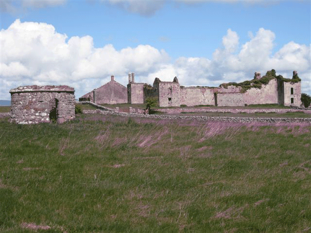
| Photos collection of Kevin McDarby, December 2009
Sentry post is on the left in the middle of the field. You are looking at the old British cavalry barricks - originally Ballinrobe castle. The wall on the right was constructed in 1959 when the property was divided. The red gate seen was the original access to the barricks. Later a bridge was constructed across the river Robe onto the green.........football pitches to day. Kevin McDarby, December 2009
The castle barracks was once the residence of Lord Tyrawley who sold it to the War office in 1821. In 1837 the accommodation of the barracks was; 8 officers; 106 non commissioned officers and privates with stabling for 84 horses and a hospital for 20 patients. Access to the barracks was via the gates at the southern end of Main Street and this accounts for the round stone sentry post in the middle of Cran More. See photo. Later however a bridge (Barracks Bridge) was constructed across the river Robe and this allowed access to the barracks via Bridge street and easier access to the army barracks on the site of the present Garda barracks. Kevin McDarby, January 2010
| |
| |
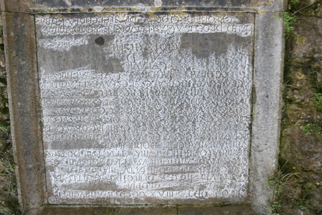
| Photo collection of Kevin McDarby, December 2009
This is the stone plaque on an inner wall of the castle/baracks - impossible to photograph without some special equipment. Kevin McDarby, December 2009 Ballinrobe castle was the home of the "MacWilliams" and the inscribed stone on an inner wall reads in Latin. "with the blessing of the great and good God on the undertaking this castle was begun completed and dwelt in by the elected chieftain of the deBurgo clan in the County of Mayo, called the title of the Mac William."This stone bears the date 1752. Kevin McDarby, January 2010 | |
| |
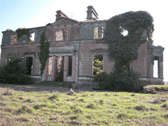
| Photo collection of Kevin McDarby, December 2009
This is the front of Cranmore house which was surrounded by a dry moate. Access to the basement was via a courtyard at the rear of the house.................. down a flight of stone steps. Kevin McDarby, December 2009
| |
| |
| Photo collection of Kevin McDarby, December 2009
Relationship of Cranmore house to barracks. Kevin McDarby | |
| |
| Photo collection of Kevin McDarby, December 2009
Window on the right hand side of this photograph had a set of granite steps leading up to double doors. This allowed access from the house to the tennis court outside. Kevin McDarby | |
| |
| Photo collection of Kevin McDarby, December 2009
With my back to the barracks - the gate is not the original access. The houses on the right of the photo are all built in the original (kitchen) garden of the house. Kevin McDarby, December 2009 Cranmore house: Knox for what ever reason expelled the nuns from working in the workhouse. He also donated the land for its site. | |
| |
| Photo collection of Kevin McDarby, December 2009
This is/was the sanitorium in Creagh outside of Ballinrobe. It was a single story building. Building on the left was kitchens staff accommodation, etc., also a small chapel. Kevin McDarby The Sanatorium in Creagh was located 2 and three quarters miles outside of town. Single story building. A CBS Brother Conway started to visit a young girl by the name of Kathleen Kilbane whose family came from Achill island (where she is buried) but she arrived via Scotland as an orphan aged 11 years in 1946 ...... she was dying of TB a beautiful story of this written by Br Conway is called No More Tears in My Eyes the story of Kathleen Kilbane In our youth we assisted the local priest at the altar i.e. serving at Mass. On our Sunday "on" 2 of us would take off with the priest for the sanatorium where mass was said and communion given our to the patients there. Following this we alter boys (2) would be fed in the kitchen in the large house to the left of the sanatorium (photo), while the priest would be looked after in the dining room. Also at Christmas time we (a choir) visited the sanatorium to sing Christmas carols to the patients there. I do not know when the sanatorium closed but it had to be mid 1950�s when it was taken over by the Government as a research station into the breading of sheep, etc. and many of the lads I went to school with ended up working there. The lands, etc. now are in private hands Kevin McDarby, January 2010
| |
| |
| Photo collection of Kevin McDarby, December 2009
Balcony was to give access to the patients to fresh air and evening sun. Kevin McDarby | |
| More Information From Kevin McDarby Kevin McDarby's parents Maureen and Dr. Mac: "lived in the town since the late 1930's, thus my father was a GP there for almost 60 years." In the photograph of Glebe street ...... to the right of that photo is a house/shop, Mc Graths. I can remember buying sweets from that woman on my way to or from the convent school ..... late 1940's/early 50's. They were related to my mother who was born and lived in the house on the corner to the left of that photograph. To day that property is Stauntons. In my mothers time it went on fire in ..... And having attempted to continue with the business my grandmother (my mother's family) moved to Galway as this gave access to schools, etc. (Her dad died in I think 1929 and it was after this that the fire and move to Galway.) The Convent ..... on heading out the road to Tuam, via Kilmaine the convent will be on your left and not on your right as mentioned. It closed I think last year ....2008/07 when the remaining nuns moved to Castlebar and the property was put on the open market.
|
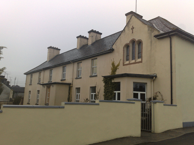
| Christian Brothers School, Ballinrobe | |
| |
| Photo collection of Siobhan Sexton, February 2010
| |
| |
| Photo collection of Siobhan Sexton, February 2010
Siobhan emailed in February to share these two images of the Christian Brothers School in Ballinrobe: I am a Conservation Architect working on a Conservation Report for the Old Christian Brothers School in Ballinrobe. I came across your excellent web page with all the old photos of Ballinrobe. If you have any information or old photos of the Christian Brothers School they would be much appreciated. I attach a current photo although I think the end bays were later additions to the original smaller structure. | |
| To see old images of Ballinrobe click on or the image of Glebe Street |
 |
| If you have any suggestions, corrections, information, copies of documents, or photos that you would like to share with this page, please contact me at maggie@maggieblanck.com |
| Please feel free to link to this web page. You may use images on this web page provided that you give proper acknowledgement to this web page and include the same acknowledgments that I have made to the provenance of the image. Please be judicious. Please don't use all the images. Please do not cut and paste the whole page. You may NOT make use any of the images or information on this web page for your personal profit. You may NOT claim any content of this web page as your original idea. Thanks, Maggie |
| ©Maggie Land Blanck - Page created 2004 - Latest update September 2019 |