|
| HOME - Land/Sykes Introduction - Benjamin Law - Connection To All Sheard Related Pages - Connection to All Sykes Related Pages |
| Birstall
Several of my ancestors, including Benjamin Law (1773-1837) and John Sykes (1797-1874) were born in Birstall Parish. Benjamin Law was born in the village of Gomersal. John Sykes was born in the village of Adwalton. Another Ancestor, Michael Sheard, lived in Gomersal, Birstall Parish from at least 1713 until his death in 1789.
|
| |
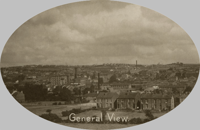
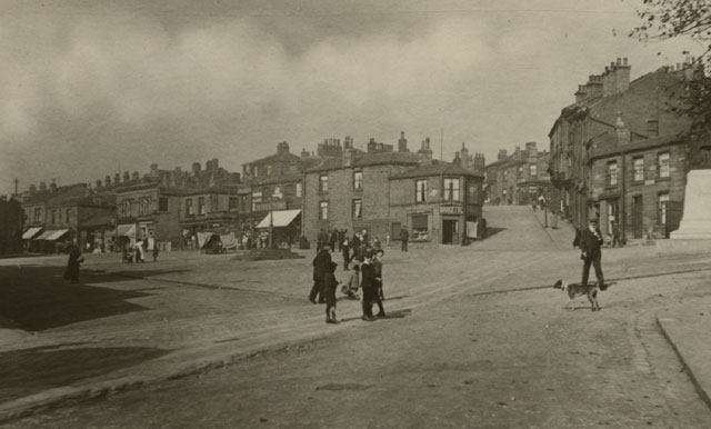
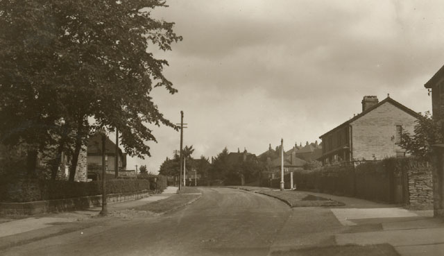
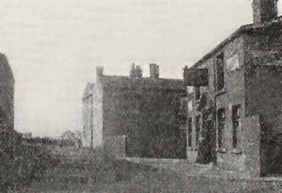
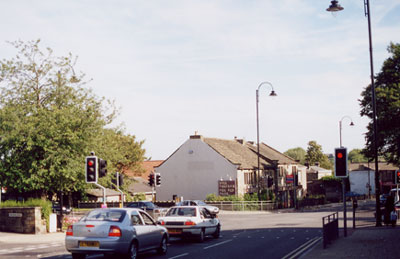
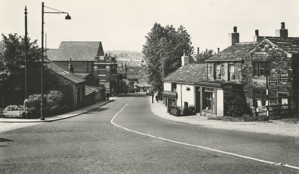
| Postcard collection of Maggie Land Blanck
General View of Birstall Not posted | |
| | |
|
The Parish of Birstall The ancient parish of Birstall comprised the eight townships of Cleckheaton, Drighlington, Gomersal, Heckmondwike, Hunsworth, Liversedge, Tong and Wike. Although Tong was officially part of the parish its records were kept separately. In addition to the townships there were several villages or hamlets including, Adwalton, Birstall, Great and Little Gomersal, Stubley, Littletown, Robertown, Long Liversedge, Heaton, Okenshay, Moore Lawe, Doghouse, Scholes, and Berkonshay. While the village of Birstall gave its name to the parish, it was actually a part of the township of Gomersal. The main church, St Peter's was situated on the eastern boundary of the parish close to Batley. The parish records started in 1558, the first year of the reign of Elizabeth. However, they are sparse and contain many gaps until the 1700s. Based on a comparison of the numbers of baptisms, marriages and burials in the parish around 1650 the population of the parish is estimated to have been 2500 people. At the time of the Archbishop's visit to Birstall parish in 1743, there were 9000 people in the parish. It is believed that the increase in the population was partly due to an influx from other parishes.
|
| |
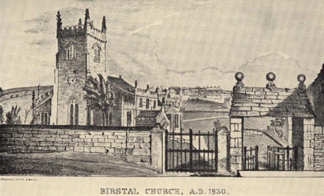
| A History of the Ancient Parish of Birstall, H.C.
Cradock, M.A. (1933)
Birstall church A.D. 1830 | |
| | |
| |
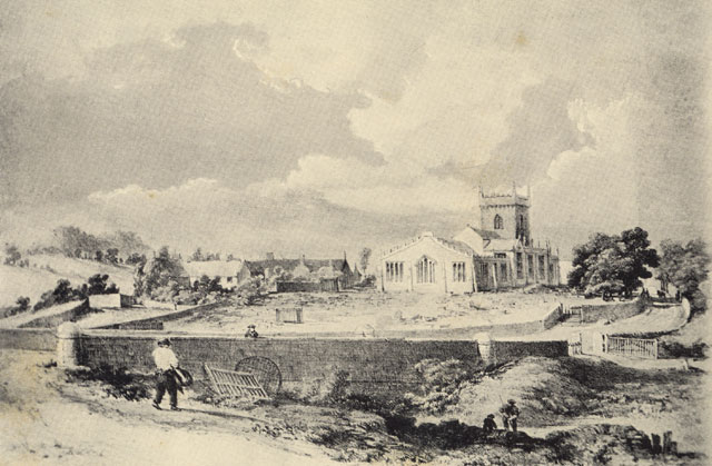
| A History of the Ancient Parish of Birstall, H.C.
Cradock, M.A. (1933)
Birstall church A.D. before 1865 | |
| | |
| |
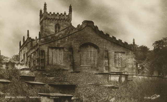
| Postcard collection of Maggie Land Blanck
Birstall church A.D. before 1865 Not posted Compare this photo with that of the print above and the postcard following. Notice the changes in the center window of the church. | |
| | |
| |
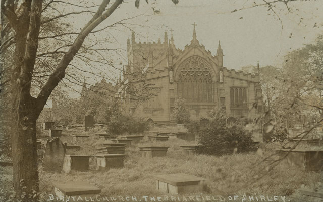
| Postcard collection of Maggie Land Blanck
Birstall Church after 1865 Posted 1906
| |
| | |
 |
|
| Postcard collection of Maggie Land Blanck
The old church was repaired in 1851. In 1865 the need arose to enlarge the church. "But a careful examination proved that the whole structure was too dilapidated for restoration. The fabric was unsafe. The ground had been shaken by the falling in of old coal workings; the pillars has sunk partly owing to the weight of the galleries, partly by the sinking of old burial vaults, with which the floor was honey-combed."The new church was re-consecrated on 29 April 1870 by the Bishop of Ripon. This postcard was posted in 1908 | |
| | |
| |
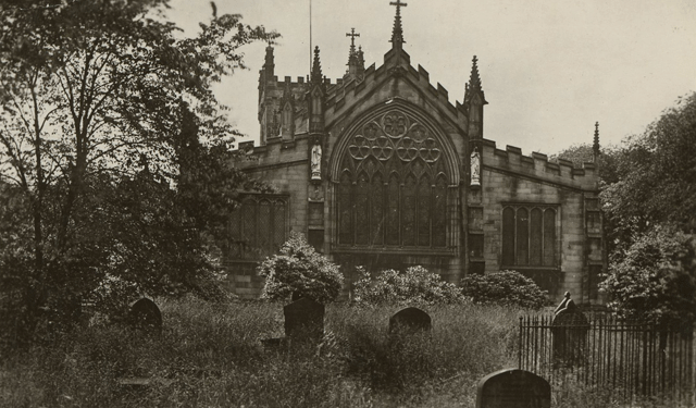
| Postcard collection of Maggie Land Blanck Parish Chruch Birstall Not posted. | |
| | |
| |
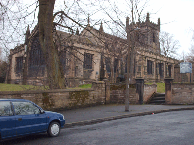
| Photo by David C. Beaumont, August 2008 The Church in August 2008 as photographed by David C. Beaumont | |
| | |
| |
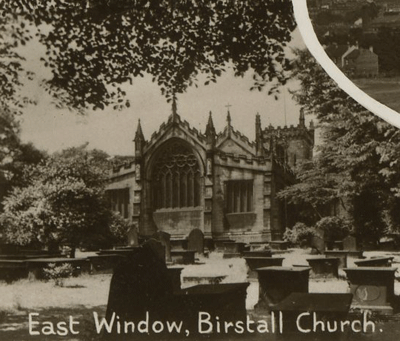
| Postcard collection of Maggie Land Blanck East Window, Birstall Church Not posted. | |
| | |
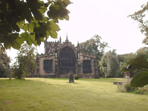
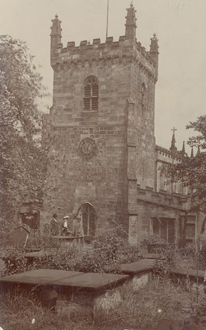
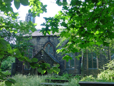
|
The East Side of St Peter's,
the Birstall Parish Church,
2002 The entrance is to the right of this photo. Several of the Land/Sykes ancestors were baptized in the old church in Birstall Parish. Notice that most of the tombstones visible in the 1928 photo are now missing. They were removed to the graveyard across the street. There were a few still remaining including the one in the foreground. |
| Photo by Tom Blanck, 2002 | |
| | |
| The West Side St Peter's,
Birstall Parish Church,
The church was closed when we visited in June 2002. |
| Postcard collection of Maggie Land Blanck
| |
| | |
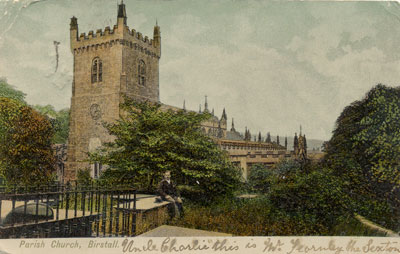
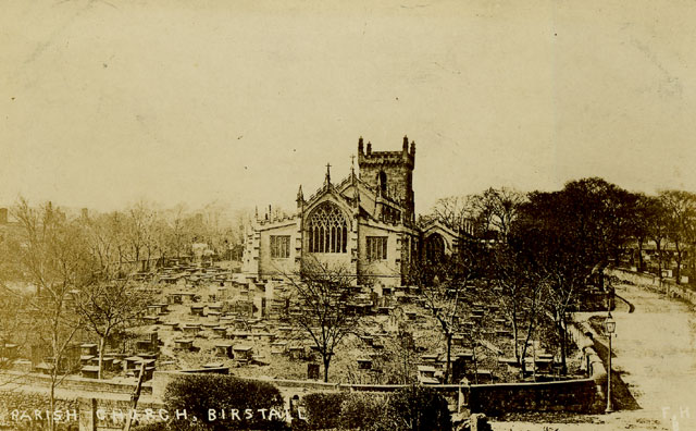
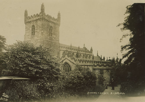
|
Parish Church, Birstall Postmarked 1905 |
| Post card collection of Maggie Land Blanck | |
| | |
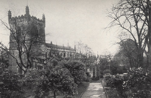
|
Parish Church, Birstall 1932 |
| A History of the Ancient Parish of Birstall, H.C. Cradock, M.A. (1933) | |
| | |
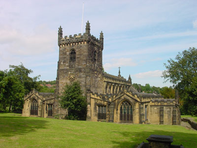
|
Parish Church, Birstall Compare with the next picture taken in 2002. The graves on this side of the church have also been moved. No date |
| Post card collection of Maggie Land Blanck | |
| | |
| |
| Photo by Tom Blanck, 2002 | |
| | |
| |
| Photo by David C Beaumont, 2008 Parish Chruch Birstall, April 2008
| |
| | |
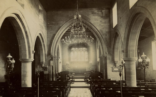
| 
|
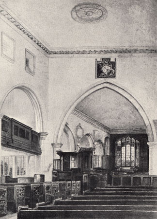
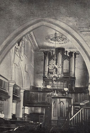
| A History of the Ancient Parish of Birstall, H.C. Cradock, M.A. (1933) | |
| Birstall Parish Church Interior, Looking East, 1865 (From a painting by the late Mr. T. P. Frost) | Birstall Parish Church Interior, Looking West, 1865 |
| | |
 |
|
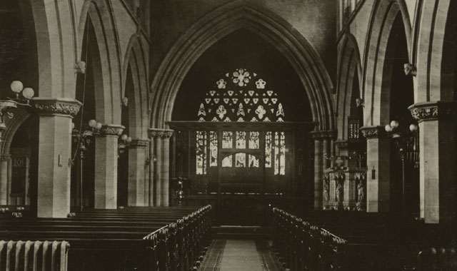
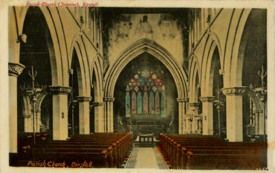
| Postcard collection of Maggie Land Blanck Interior of the parish church, Birstall. Not posted | |
| | |
 |
|
| Postcard collection of Maggie Land Blanck Interior of the parish church, Birstall. Posted in Gomersal 1909 | |
| | |
 |
|
| Postcard collection of Maggie Land Blanck Interior of the parish church, Birstall. Not posted | |
| | |
| |
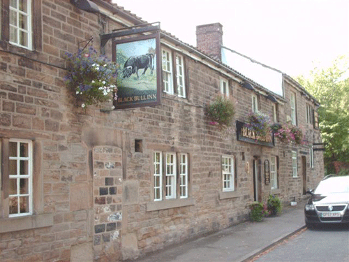
| Photo by David C. Beaumont, August 2008 The Black Bull Inn, August 2008 as photographed by David C. Beaumont. The Blanck Bull Inn is on Kirkgate across from the church. | |
| | |

| |
| Photo David C Beaumont, April 2008 A grave marker from: "The church yard on the left side of the church looking uphill to the Public House." | |
| | |
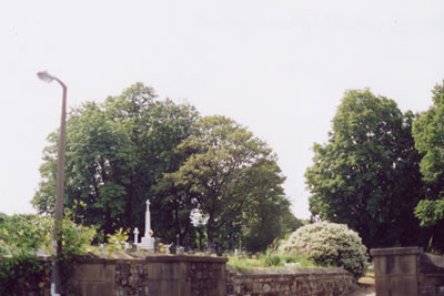
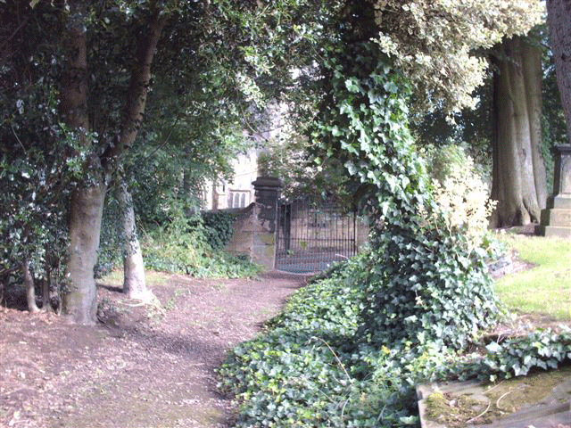
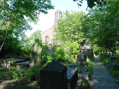
|
A view of the graveyard from the west lawn of the parish church, 2002. |
| Photo by Maggie Blanck, 2002 | |
| | |
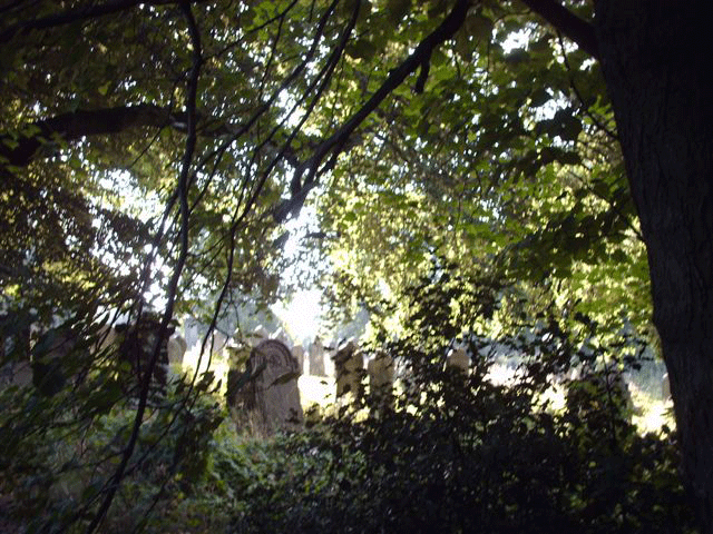
|
The Birstall Parish Graveyard
2002 The church tower is in the background. In the foreground are some of the stones that were moved from the east side of the church. The stone closest to the bottom of the photo is the memorial stone of George Stell Sykes, his wife, Sarah Walker Sykes, and three of their children. To see a close-up of the stone go to The Sykes Memorial Stone |
| Photo by Maggie Blanck, 2002 | |
| | |
| |
| Photo by David C. Beaumont, August 2008 The old gate entrance to Birstall Cemetery. | |
| | |
| |
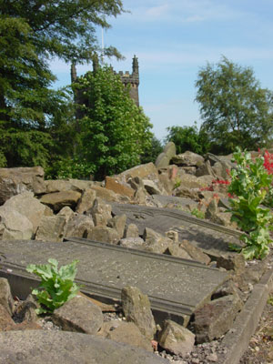
| Photo by David C. Beaumont, August 2008 The 1800' Cemetery Yard.
"This photo is was taken in late July 2008 from the old cemetery main path near the old gate enterance oposite the Birstall parish church. The older gate enterance is just below the entrance that is currently used. As one walks the path from the gate enterance you can visualize the old quality of those long forgotton days. Too the right of the path is where the locals say the old churchyard gravestones are buried. (Others say the old stones were sold.)"
| |
| | |
| The Village of Birstall |
| The parish church is just outside the village. |
 |
|
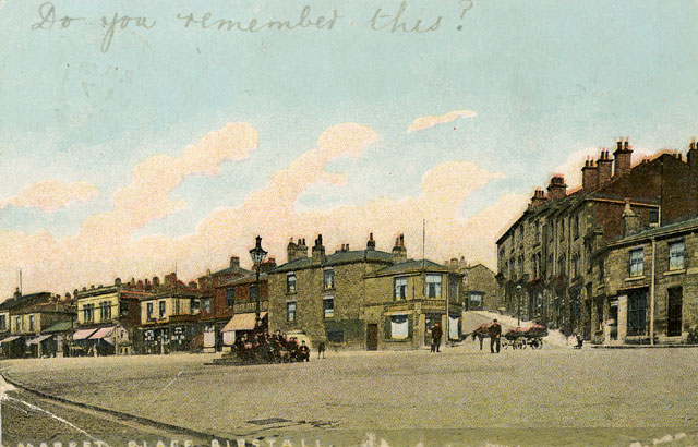
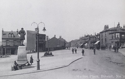
| Postcard collection of Maggie Land Blanck Market Place Birstall. Posted 1907 Birstall. | |
| | |
| |
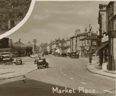
| Postcard collection Maggie Land Blanck The Market Place, Village of Birstall, circa 1920
| |
| | |
| |
| Postcard collection Maggie Land Blanck The Market Place, Village of Birstall, not dated
| |
| | |
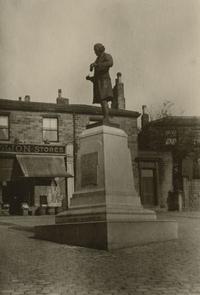
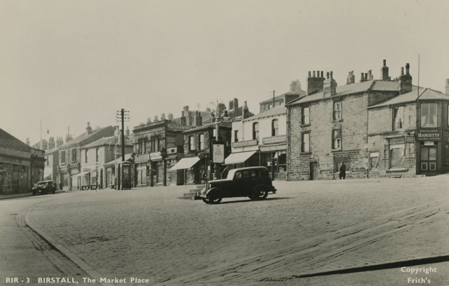
|
The Market Place, Village of Birstall
The statue of Joseph Priestley was erected in 1912. Joseph Priestley was a scientist and clergyman who discovered oxygen and invented soda water. Priestley, born in Birstall parish on March 13, 1733, was the eldest of six children of a local cloth dresser. |
| Postcard collection of Maggie Land Blanck | |
| | |
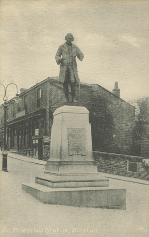
| Dr. Priestly Statue, Birstall |
| Postcard collection of Maggie Land Blanck, June 2011 | |
| | |
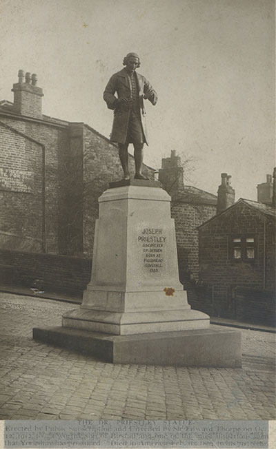 |
|
| Graciously shared by Carol Lodge, October, 2014 | |
| 'THE DR. PRIESTLY STATUE Erected by Public Subscription and Unveiled by Sir Edward Thorpe on Oct 12, 1912 to "a worthy son of Birstall and one of the most illustrious men that Yorkshire has produced." Died in America Feb 06, 1804 in his 71st year.' | |
| | |
 |
|
| Graciously shared by Carol Lodge, October, 2014 | |
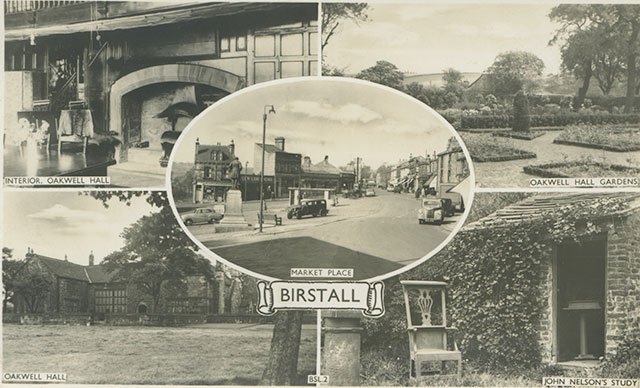
| Birstall Multiview Market Place. Interior Oakwell Hall, Oakwell Hall, Oakwell Hall Gardens and John Nelson's Study.Posted September 25, 1959. | |
| | |
|
The Market Place, Village of Birstall, circa 1920
|
| Postcard collection of Maggie Land Blanck | |
| | |
|
Birstall Market Place
|
| Postcard collection of Maggie Land Blanck | |
| | |
|
The Market Place, Village of Birstall, 2002
This photo was taken at the corner of the Market Place in village of Birstall looking in the same direction as the 1920 photo above. |
| Photo by Tom Blanck, 2002 | |
| | |
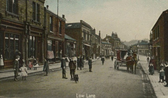
|
| Postcard collection of Maggie Land Blanck Low Lane, Birstall Posted 1910
|
| |

|
Low Lane, Village of Birstall circa 1920
Low Lane goes off to the left and Middlegate (in the center of the photo) heads towards the township of Drighlington and the village of Adwalton. |
| The Archives Photographs Series AROUND BATLEY compiled by Norman Ellis | |
| | |
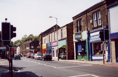
|
Low Lane, Village of Birstall, 2002
Middlegate is to the extreme left of the photo. |
| Photo by Tom Blanck | |
| | |
|
Low Lane, Village of Birstall, 2002
Low Lane continues from the village of Birstall across Bradford Road to Kirkgate, where the Birstall Parish church stands. |
| Photo by Maggie Blanck | |
| | |
 |
|
| Postcard collection of Maggie Land Blanck Cambridge Road, Birstall. Not posted Cambridge Road does not appear on the 1908 Ordnance Survey map of Birstall. It is shown on a contemporary map of Birstall off Bradford Road Just west of Kirkgate. | |
| | |
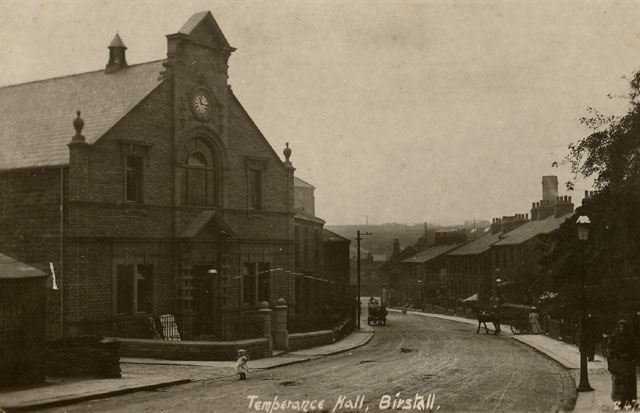 |
|
| Postcard collection of Maggie Land Blanck Temperance Hall, Birstall A & J Graham in Birstall Where they Ka Quite identifies this image as "looking towards Smithies from Temperance Chapel". "Smithes" she says was at the the intersection of Bradford Road and Huddersfield Road and is now commonly called "Birstall Crossroads". "where they ka quite" means where they keep quite according to A & J Graham | |
| | |
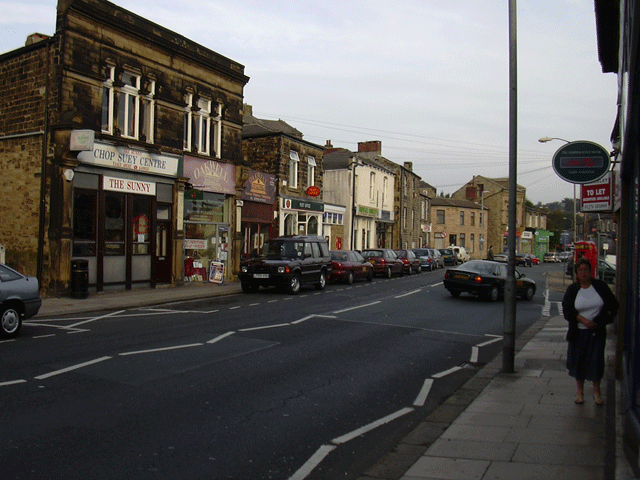 |
|
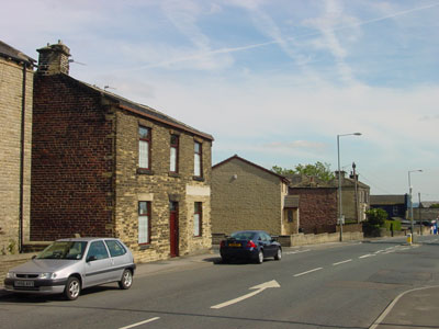
| Photo by Andy Graham, 2008 - Copyright Andrew Graham To see more photos by Andy Graham go to THEURBANGLOW
| |
| | |
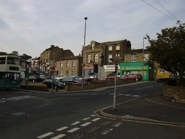 |
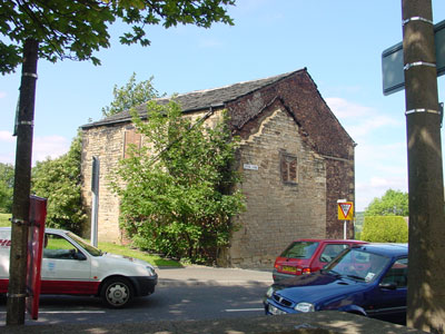
|
| Photo by Andy Graham, 2008 - Copyright Andrew Graham
| |
| | |
 |
|
| Photo courtesy of David Beaumont, August 2008 Bristall Methodist Church
| |
| | |
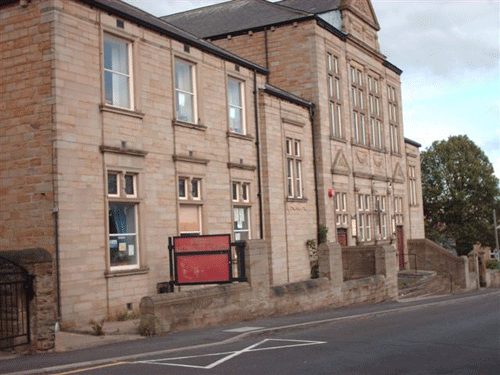
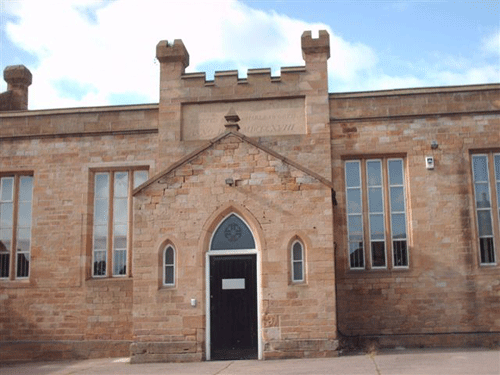 |
|
| Photo courtesy of David Beaumont, August 2008
"This is the old nation school (not sure on date, will relook next visit. Think it is 1868). It is now used as an industrial store and its end wall is knock out.:
| |
| | |
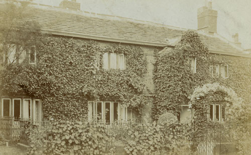 |
|
| Postcard collection of Maggie Land Blanck Unknown House Addressed to Mrs J Jubb, 69 Church Street, Birstall, but not posted.
| |
| | |
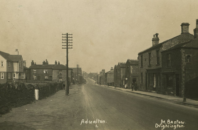
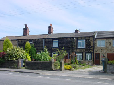
| Township of Drighlington and the Villages of Adwalton and Gildersome Street |
| Land Ancestors in Adwalton The family of James Law and Susannah Crossley, the great-grandparents of Benjamin Law, lived in the village of Adwalton from 1693 to 1721. Sykes ancestors were in Adwalton as far back as 1797. The censuses indicate that the Sykes lived on "Wakefield Turnpike Road" in an area "comprising all the Houses and cottages on both sides of the Turnpike leading from Adwalton to Gildersome Street". The Walkers were in Adwalton by 1841, when their son, Jem, was baptized in the Birstall Parish Church. The census also indicate that they lived very near the Sykes also on the "Wakefield Turnpike Road" in an area "comprising all the Houses and cottages on both sides of the Turnpike leading from Adwalton to Gildersome Street". |
Drighlington in the Doomsday Book Drighlington was mentioned in the Doomsday book (1086) as Drelintone. The villages of Adwalton and Drighlington date to Saxon times. |
| |
| Postcard collection of Maggie Land Blanck
Adwalton Not posted | |
| | |
|
Hodgson Lane, Adwalton
|
| Illustrated History From Hipperholme to Tong, James Parker (1904) | |
| | |
|
Wakefield Road, Village of Adwalton, 2002
A few miles north of the village of Birstall in the the township of Drighlington is the village of Adwalton.
|
| Photo by Tom Blanck | |
| | |
|
Wakefield Road, Village of Adwalton, 2002
As with everywhere else in the area, most of the house were new. There were, however, a few older looking places along Wakefield Road. |
| Photo by Tom Blanck | |
| | |
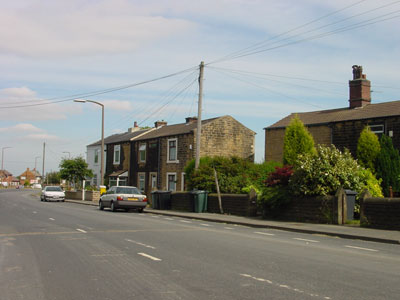
|
A mile or less east of the village of Adwalton along the Wakefield Road lies the village of
Gildersome Street. There was a sparse but continuous number of older looking houses along the way. | |
| | |
|
Wakefield Road from the Village of Adwalton
to the Village of Gildersome Street The next three photos were all taken on a stretch of the Wakefield Road that has become a dead-end. The road used to continue on to Wakefield. This is the point where the old road from Bradford to Wakefield crossed the old road from Huddersfield to Leeds. Today there is a Junction of the M62 Motorway. |
| Photo by Tom Blanck | |
| | |
|
Wakefield Road from the Village of Adwalton
to the Village of Gildersome Street This short section of the old Wakefield Road is now labeled "Bradford Road" on the map. Less than a mile back up the Wakefield Road is the village of Adwalton. On the other side of the junction of M62 is the the village of Gildersome Street. |
| Photo by Tom Blanck | |
| | |
|
Wakefield Road from the Village of Adwalton
to the Village of Gildersome Street Since this group of houses are clearly older than most in the area and they lie exactly as described in the censuses, this could be the area of Adwalton where the Sykes and Walkers lived. |
| Photo by Tom Blanck | |
| | |
|
Battle of Adwalton Moor 1643 Adwalton Moor was site of a famous battle of the English Civil War on June 30th 1643. Fairs Adwalton was granted a charter to hold sheep and cattle fairs in Elizabethan times. The Adwalton cattle fairs were among the most important in Yorkshire until sometime after 1815 when the Wakefield Cattle Fair became more prominent. The fairs were originally held on 26th February, Thursdays in Easter and Whitsun weeks, and every alternate Thursday from then until September 29th. Later they were held on February 6, March 9, November 5, and December 23. Note: Whitsunday is Pentecost (The seventh Sunday after Easter) National Gazetteer 1868
"DRIGHLINGTON, a township or chapelry in the parish of Birstall, wapentake of Morley, in the West Riding of the county of York, 5 miles S.E. of Bradford, and 6 S.W. of Leeds, its post town. It contains the hamlet of Adwalton. The Leeds, Bradford, and Halifax Junction railway has stations both at Drighlington and Adwalton. The village is pleasantly situated on elevated ground, near the junction of the Leeds and Wakefield roads. There are malting, worsted, spinning, and cloth manufactories. The land is chiefly in pasture, and there are several collieries. The living is a perpetual curacy in the diocese of Ripon, value �84, in the patronage of J. Hague, Esq. The charities consist of an endowment of �60 per annum to the free school, founded by Archbishop Margetson, in 1678, who was a native of this place. The Wesleyans, Primitive Methodists, and New Connexion Methodists have each a chapel. John Hague, Esq., is lord of the manor. Fairs at Adwalton are held on the 6th February, 9th March, 5th November, 23rd December, and on the Thursday in Easter and Whitsun weeks, mostly for cattle."Mills According to James Parker in Illustrated History from Hipperholme to Tong, 1904 there were two mills in Drighlington: Moorland Mill and New Mill both "cloth manufacturers". When did they open? Julia Vaughn wrote in October 2005 to say that the 1894 Ordnance Survey map listed
Adwalton For information on the village of Adwalton go to Adwalton , now or at the bottom of the page.
|
 |
|
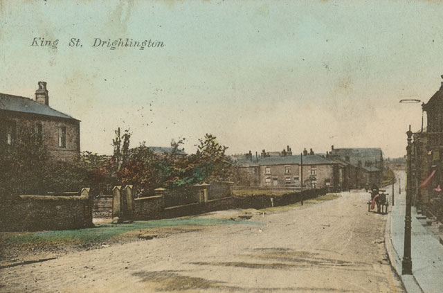
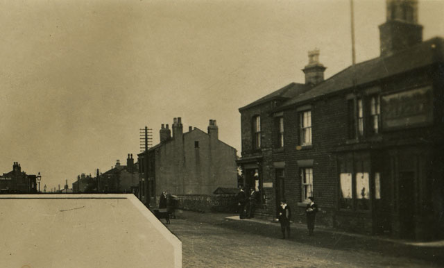
| Postcard collection of Maggie Land Blanck King Street Drighlington. Posted 1907 | |
| | |
 |
|
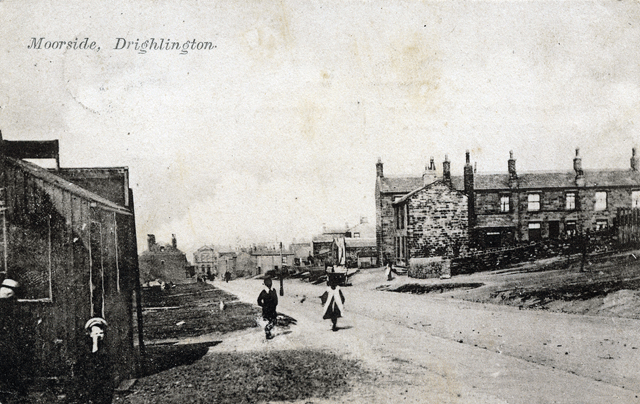
| Postcard collection of Maggie Land Blanck Moorside, Drighlington. Posted 1905 | |
| | |
 |
|
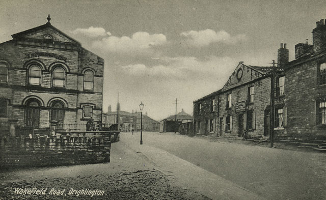
| Postcard collection of Maggie Land Blanck Wakefield Road, Drighlington. Not posted | |
| | |
 |
|
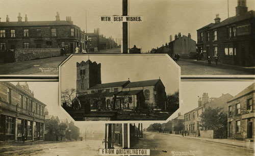
| Postcard collection of Maggie Land Blanck Multi view post card Drighlington | |
| | |
 |
|
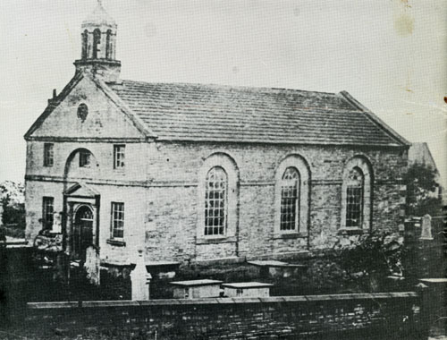
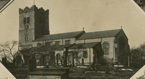
| From St Paul's Drighlington Centenary 1878-1978
Book collection of Maggie Land Blanck Bell Chapel The Bell Chapel or Chapel of Ease was located just south of the present parish church: "James Sykes, the Lord of the manor, provided the first place of worship in Drighlington. The village, being a district within the Parish of Birstall, St. Peter, was served by the Incumbent of Birstall and his assistant, but there was no chapel of ease. From 1742 the Moravians had had a centre at Adwalton, and in 1783 the aforementioned James Sykes built a chapel for them which was used as a preaching place by the Moravians from Fulneck. It does not seemed to have prospered, as later, it was used by Baptists from Gildersome. Eventually, however, James Sykes became a churchman and he handed the chapel over to the Church of England in 1813 on condition that the advowson was vested in him and his heirs."Note: Advowson is the right to nominate a person who will hold a church office in a parish. The chapel had one aisle, a nave and chancel and one bell.
The population was 2,740; acreage 1,130; chief landowner John Hague. The principal trades were shoemaking, worsted spinning, brickmaking, brass-refining, machine card making, matting and coal-mining..... There was no Sunday School.Drighlington became a separate parish 1875.
| |
| | |
 |
|
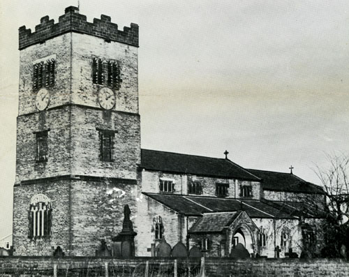
| From St Paul's Drighlington Centenary 1878-1978
Book collection of Maggie Land Blanck Drighlington Church from Whitehall Road Consecrated Friday April 26, 1878. | |
| | |
 |
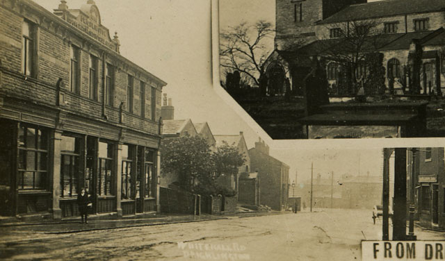
|
| Postcard collection of Maggie Land Blanck St Paul's Church of England, Drighlington Church from the multi view post card Drighlington. St Pauls is located on Back Lane just off Whitehall Road. | |
| | |
 |
|
| Postcard collection of Maggie Land Blanck From the multi view post card Drighlington | |
| | |
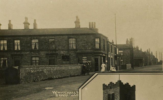
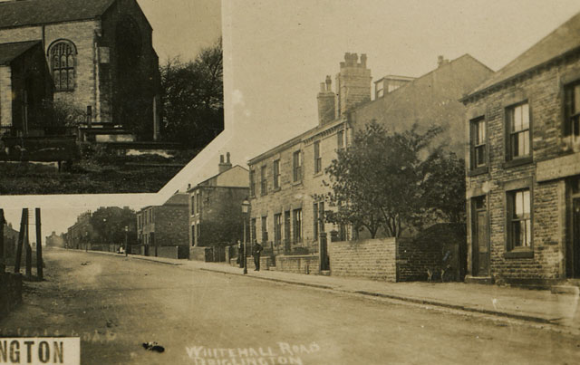 |
|
| Postcard collection of Maggie Land Blanck Whitehall Road, Drighlington - from the multi view post card Drighlington | |
| | |
 |
|
| Postcard collection of Maggie Land Blanck Whitehall Raod - from the multi view post card Drighlington | |
| | |
 |
|
| Postcard collection of Maggie Land Blanck Whitehall Road - from the multi view post card. | |
| | |
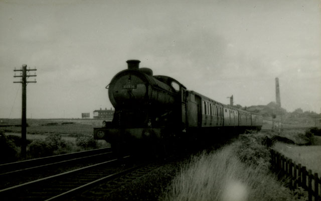 |
|
| Photo collection of Maggie Land Blanck Adwalton Junction. | |
| | |
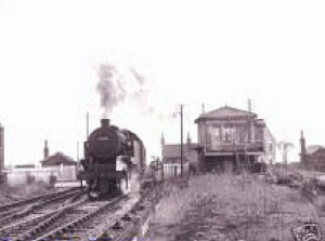 |
Adwalton Junction about 1959. See Lost Railways of West Yorkshire for more images of trains and for the routes of the various lines in West Yorkshire. |
| Photo courtesy Melvyn Aveyard, February 2006 | |
| |
|
| The Village of Gomersall |
| The Laws and Sheards in Gomersall Gomersall was a township that included several hamlets or villages. The parish records list the following sections for Gomersall: Gomersall, Little Gomersall, Gomersall Hill Top, and Popeley. Gomersall Hill Top is a village located in the parish of Birstall about a mile west (Up Church Lane) from the parish church in the village of Birstall and about a mile and a half from the town of Batley. Popeley, a farm, lies on the slope between the Birstall parish church and Gomersall Hill Top. The village of "Gomersall" is down the hill just north of Gomersall Hill Top. Gomersall, as listed by the parish clerk, could also have stood for someone living in the "township" of Gomersall versus someone living in the townships of Cleckheaton, Drighlington, Gomersal, Heckmondwike, Hunsworth, Liversedge, and Wike "Little Gomersall" - "Little Gomersal, which is only divided from its neighbour by the Leeds and Elland Road, is equally favoured with respect to situation, but is not so richly clothed with vegetation. It overlooks the basin in which Heckmondwike is situated, and commands extensive views of Mirfield, Hanging Heaton, and the "shoddy" country around Batley. Little Gomersal promises, however, to be the most populous portion of the district, owing to land being more available for building purposes. In the old part of the village the houses are of brick, and mean in construction, but those of more modern erection are generally built of stone." The Laws were in the parish of Birstall from at least 1665. James Law and Alice Rawse were listed in "Gomersall" between 1665 and 1707. Their son James and his wife, Susannah Crossley lived in the village of Adwalton between 1693 and 1721. Their son William and his wife, Hannah Raynor, lived in "Great Gomersall" between 1730 and 1746. Their son, George and his wife, Mary Wilby, were listed between 1763 and 1788 in "Great Gomersall", "Gomersall", "Gomersall Hill Top" and "Popeley". George Law of Popeley died in 1788. Shortly after that his son, Benjamin Law, moved to Batley. The Sheards were in the parish of Birstall from at least 1713. Michael Sheard and his wife, Abigail Healy, lived in "Gomersall" between 1713 and 1725. Their son, Jonas, and his wife, Dinah Kirk, lived in "Great Gomersall" from 1740 to 1748. Their son, Michael, and his wife, Sarah Barber, lived in "Great Gomersall" from 1768 to 1772. Michael and Sarah were in Batley by 1777. Jonas Sheard also moved to Batley where he died in 1789. Gomersal was an ancient village and was mentioned in the Doomsday Book: In Gomersall, Dunstan and Gamel had four carucates of land to be taxed, where there may be six ploughs. Ilbert (de Lacy) has it, and it is waste. Value in King Edward's time, forty shillings. Weaving was known in the area from at least 1284: "As early as the year 1284, it may be presumed, the weaving of cloth constituted one of the arts of life practised in this locality, as in the Hundred Rolls of that period mention is made of one Evam, a weaver of Gomersal, being confined in the prison of Bradford, apparently for debt.In the late 1700s the Knowles family were the leaders of the cloth trade in Gomersal. They had large contracts with the government to supply army cloth. "Many of the small clothermakers were dependent upon them for orders." By 1876 the cloth trade was waning in Gomersal; "The old staple trade of Gomersal - the manufacture and merchanting of army cloth - has almost left the village, only one firm being now engaged in it. In the early part of the century the merchants were Joshua Taylor, Lionel Knowles, Joseph and Edward Swaine (the latter manufacturers also), all of Great Gomersal; and Henry Rhodes, of Little Gomersal. The manufacturers, carrying on their business chiefly at their own houses, or on premises adjacent, were Benjamin Fearnley, John, Thomas, and Joseph Crowther, the three brothers Sigston, S. Scott, Samuel Scholefield, Thomas Pearson, W. Hammond, and John Blackburn. These clothiers attended the Leeds White Cloth Market twice a week, selling their cloth in the "balk," or raw state, the merchants dyeing and finishing the same. The trades now carried on are various, consisting of the manufacture of worsted yarns (which is of some standing in Gomersal), army cloth, blankets, cotton, woollen machinery, chemicals, cards, and felting. The coal measures have long been worked in the neighbourhood, but much of this mineral still remains to be got." |
|
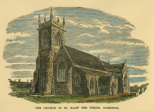
The Church of St Mary the Virgin, Spen Lane, Gomersal.
|
| Postcard collection Maggie Land Blanck
Situated on the Spen Road between Gomersal Hill Top and Cleckheaton St Mary the Virgin church was erected in 1851. It was a subdivision of Birstal Parish and included Great and Little Gomersal. "The church is an excellent example of the Flowing Decorated Style, wherein solidity and decoration have been happily blended. Its appearance, however, would have been improved if the tower had terminated in a spire. In 1864 a new transept and vestry were built, and an organ added, the illumination of the latter being executed by a London artist at the expense of Mr. Mann, of Spen Bank. The stained work of the east window, which is in five compartments, is by Ward & Hughes, of London. The west window is also filled with stained glass, the gift of the "artisans, teachers, and scholars of the school." A window in the south aisle was filled in with the same material in 1869, and dedicated by Sir Charles Henry Firth, of Flush, Heckmondwike, "in humble submission to the will of God, and in memory of Ada, Lady Firth," who unfortunately perished in the month of May, in the river Wharfe, near Bolton Abbey, at the early age of twenty-five. The cost of the edifice was about, £4000. The value of the living is, £185, and the presentation is vested alternately in the Crown and the Bishop of Ripori."Almost directly across the road stood "Gomersal Mills": "Gomersal Mills are situate on the crest of the hill opposite the church. The premises are often called the Cloth Hall, owing to the circumstance that they were built in the anticipation of a cloth market being established at Gomersal many years ago. Tradition has it that a cloth mart did in fact exist at Gomersal before Leeds could boast of possessing one. Gomersal Cloth Hall was built on Sir James Ibbetson's property, by the subscriptions of clothiers and others, it being stipulated that if it ceased to be used as a cloth market, it should revert to the Ibbetsons. This it did, and Mr. Carr, their agent, took a long lease, and converted one wing of it into a cotton mill. | |
| | |
 |
|
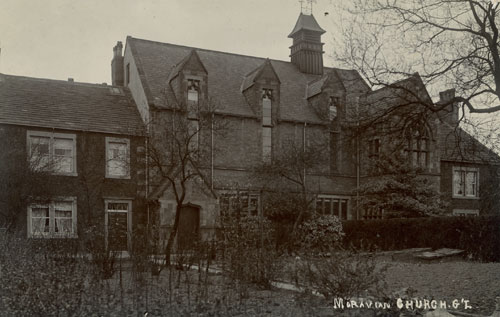
| Postcard collection of Maggie Land Blanck Moravian Church Gomersall Birstall Parish. Posted 1905. The Moravian Chapel at Little Gomersal was erected in 1751. It was enlarged several times. | |
| | |
 |
|
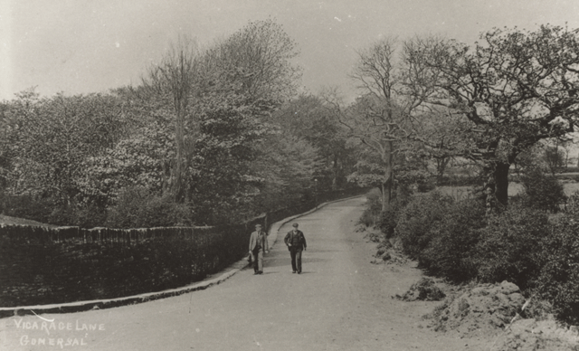
| Collection of Maggie Land Blanck, June 2011, reproduction of
original photo The image is labeled "Vicarage Lane Gomersal" but I cannot find "Vicarage Lane" in Gomersal. In May 2014 Julia Wood wrote that she thought "Vicarage Lane" is now called "Fusden Lane." It was where the vicarage once stood.
| |
| | |
 |
|
| Collection of Maggie Land Blanck, June 2011, reproduction of
original photo Post Office Gomersal | |
| | |
|
"I believe that this picture is of the post office at the top of Spen Lane (looking down)
Gomersal with Hill Top behind the camera."
Sue Newton, January 2008 |
| Photo by Tom Blanck | |
| | |
|
Oxford Road, Gomersall Hill Top, 2002
Gomersall Hill Top is at the crossroads of Oxford Road (North/South) and Church Lane (East), which turns into Spen Lane (West) on the west side of Oxford Road. |
| Photo by Tom Blanck | |
| | |
|
Oxford Road, Gomersall Hill Top, 2002
The oldest looking section of the "hill top" is right at the crossroads. There is a relative short stretch of buildings, (see the above photo), going south on Oxford Road. then the buildings thin out. |
| Photo by Tom Blanck | |
| | |
|
Oxford Road and Spen Road, Gomersall Hill Top, 2002
This building is on the northwest corner of the intersection. Except for the buildings in these photos, all of the buildings on the "hill top" are "new". |
| Photo by Tom Blanck | |
| | |
|
Red House Museum, Oxford Road, Gomersall
Down the hill to the north is Red House, the home of Charlotte Bronte's friends, the Taylors. This house appears as "Briarmains" in her novel "Shirley". This overly romantic novel is set during the Luddite uprisings. The house dates to 1830. |
| From the Kirklees Metropolitan Council Museum Brochure | |
| | |
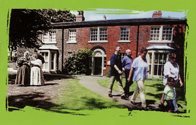
|
Oakwell Hall, Birstall
"Fieldhead " in the novel Shirley by Charlotte Bronte |
| Postcard collection of Maggie Land Blanck | |
| | |
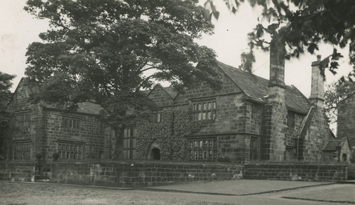
|
Oakwell Hall, Birstall
|
| Postcard collection of Maggie Land Blanck | |
| | |
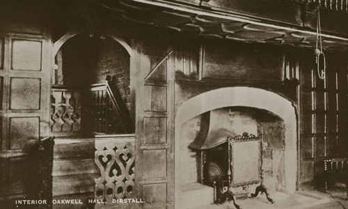
|
Oakwell Hall Interior, Birstall
|
| Postcard collection of Maggie Land Blanck | |
| | |
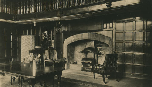
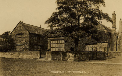
|
Interior Oakwell Hall, Birstall
(Fieldhead of "Shirley" by Charlotte Bronte) |
| Postcard collection of Maggie Land Blanck | |
| | |
|
Oxford Road, Gomersall
Going north from Red House along Oxford Road were a few more buildings that looked older than most. There was no place to park on the narrow road so I just took two quick shots in either direction. Looking north. |
| Photo by Maggie Blanck | |
| | |
|
Oxford Road, Gomersall
Looking south.
|
| Photo by Maggie Blanck | |
| | |
| |
| Collection of Maggie Blanck | |
| | |
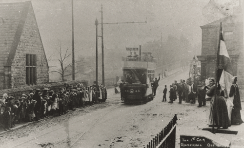 |
|
| Collection of Maggie Land Blanck, June 2011, reproduction of
original photo The 1st Car, Gomersal October 2, 1903 | |
| | |
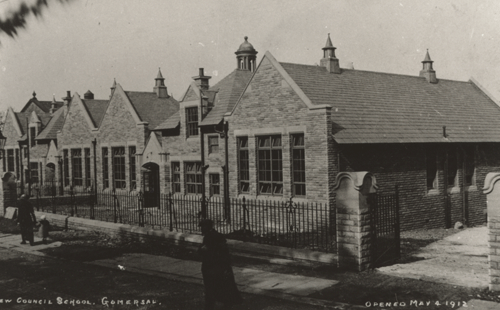 |
|
| Collection of Maggie Land Blanck, June 2011, reproduction of
original photo New Council School, Gomersal, opened May 4, 1912
| |
| | |
| For additional images of Gomersal shared by Barry Riding go to
Barry Riding
| |
| | |
| The Village of Cleckheaton and the
White Chapel
According to a 1379 poll tax list Cleckheatone has an estimated population of 59 persons above the age of 16. | |
|
|
|
Cleckheaton is a village a mile or so from Gomersall
Hill Top taking Spen Lane to the west. The photo shows the intersection of Spen Land, West Gate, and Bradford Roads. Bradford Road going southeast leads to Batley.
|
| Photo by Maggie Blanck | |
| | |
|
White Chapel, Cleckheaton
Very few of the church graveyards are intact. Everywhere we went we saw the gravestones used as pavers. The graveyard at the White Chapel shows how the graves with there markers were set up. |
| Photo by Tom Blanck | |
| | |
|
White Chapel, Cleckheaton
Most parishes did not record a cause of death with the records. The White Chapel in Cleckheaton recorded causes of deaths from 1793 to 1813. These records give an indication of the fatal illnesses in the area for that time period. For more information on the causes of death in Cleckheaton go to Causes of Death |
| Photo by Tom Blanck | |
| | |
 |
|
| Postcard collection of Maggie Land Blanck Interior of the Cleckheaton Church. Not posted. | |
| | |
| Liversedge
Liversedge was historically a township in Birstall Parish. Liversedge was mentioned in the Doomsday Book (1086) with two manors and "four carucates" (about 500 acres of ploughed land). According to a 1379 poll tax list Liversedge has an estimated population of 51 persons above the age of 16. | |
|
|
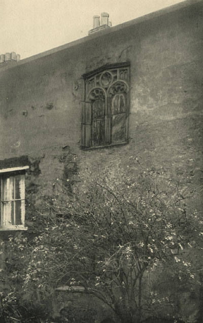
|
Ancient Window, Liversedge's Hall
|
| A History of the Ancient Parish of Birstall , Cradock, 1933 | |
| | |
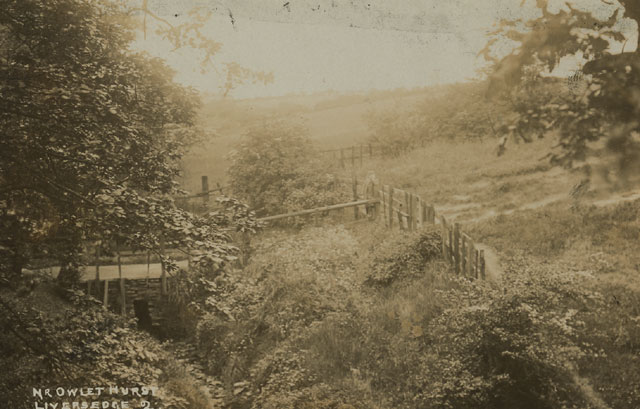 |
|
| Postcard collection of Maggie Land Blanck
Owlet Hurst, Liversedge. Posted 1927 | |
| | |
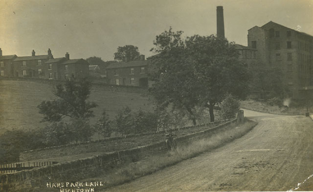 |
|
| Postcard collection of Maggie Land Blanck
Hare Park Lane, Hightown, Liversedge | |
| | |
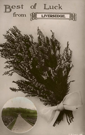 |
|
| Postcard collection of Maggie Land Blanck Best of Luck from Liversedge. Not posted. | |
| | |
|
Heckmondwike
Heckmondwike was historically a township and chapelry in the Birstall Parish. According to the 1379 poll tax list Heckmondwike has an estimated population of 21 persons above the age of 16.
In 1837 William White wrote of Heckmondwike: HECKMONDWIKE is one of the many places in the clothing district of Yorkshire, which, under the influence of manufacturing industry, have become populous and wealthy. It is now rather a town than a village, and ranks next Dewsbury as a principal seat of the blanket and carpet manufactures, for the former of which it has a market, held every Monday and Thursday from 1 till 1/4 past 2 o'clock, in the "Blanket Hall" which adjoins the George Inn, and is very conveniently fitted up with stalls for the use of the numerous manufacturers of the town and populous surrounding villages. Heckmondwike is a township in the parish of Birstal, and in the wapentake of Mortey, seated in the vale of a small rivulet, 2 miles N.W. of Dewsbury, 9 miles S.W. by S. of Leeds, 9 miles E. of Halifax, 7 miles N.E. of Huddersfield, and 7 miles S.S.E. of Bradford. Its population amounted in 1801 to only 1,742 souls, but in 1831, the township was found to contain 680 acres of land, 6O0 bouses, and 2,793 inhabitants, exclusive of the adjoining village of Mill Bridge, which is in Liversedge township, and swells the population of Heckmondwike and its suburbs to upwards of 4,000. Though not a handsome town, it presents an interesting scene of activity and industry; for in addition to its numerous blanket and carpet manufactories, it has several lirge mills and factories engaged in the fabrication of woollen cloth. The Church, dedicated to St. James, was erected by Government, at the cost of £2,574 10s., in 1830, - the first stone being laid on March 3rd in that year, ft is a small but neat Gothic edifice with a spire and about 700 sittings, of which nearly 300 are free. The curacy has been endowed with £400 of Queen Anne's bounty. The vicar of Birstal is the partron, and the Rev. Wm. Battersby the incumbent. The other places of worship in the town are, - a Meiliodist Chapel built in 1812, and two Independent Chapels, one at Hill-top built in 1763 near the site of one erected in 1701; and the other in the lower part of the town, built in 1784. The Independent ministers are the Rev. Robert Martin, of the Lower,and the Rev. Henry Beanof the Upper Chapel. The Independent or Calvanistic congrcgationalists had a small soriety here as early as 1621, and on the Wednesday after the second Sunday is June they hold an annual religious festival here, called the lecture, which is attended by a great number of their ministers and people from the surrounding parishes; the objects being the arrangement of certain matters relative to the ministry, and the promotion of vital religion. On April 12th, 1829, a fatal accident happened in the Methodist chapel, where, during the time Mr. Dawson was preaching to a crowded congregation for the benefit of the Sunday School, the noise occasioned by the falling of a stove pipe created such an alarm, that the people fearing the gallery was falling, made a simultaneous rush towards the doors, and in an instant, such a scene of consternation and confusion ensued as no pen can describe. Those who first gained the narrow passages leading from the galleries, were thrown down by those behind, who, in their turn, were overturned by those rushing from the body of the chapel. In vain did the preacher attempt to calm the tumult, for his voice was drowned in the shrieks of the terrified and the groans of the dying. When the alarm had subsided, the most appalling spectacle presented itself; - two heaps of persons unable to rise were piled up at the doors to the height of four or five feet, and five persons were taken out dead; six or seven were removed apparently in a lifeless state, and twenty others were injured. Besides a commodious National School erected in 1833, here is another large school for boys and girls, built by subscription in 1822, and having about 150 scholars, who each pay a small sum per week. In thee latter is deposited a Subscription Library, established in 1820, and now comprising upwards of 370 complete works, and supported by 24 subscribers of 21s. per annum. The Post Office is at Mrs Hannah Seniors, where letters arrive from Leeds, etc. at 1/2 past 7 morning and 1/2 past 6 evening, and are despatched at 5 and j past 11 morning. | |
| | |
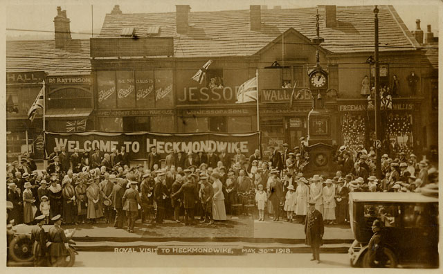 | |
| Postcard collection of Maggie Land Blanck | |
| Heckmondwike, May 30, 1918 In April 2010 Alan Jackson wrote to tell me about a newsreel of the visit of King George V and Queen Mary to Heckmondwike. Go to British Pathe | |
| | |
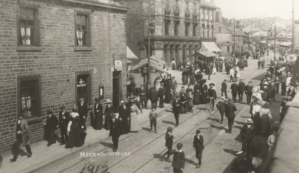 |
|
| Collection of Maggie Land Blanck, June 2011, reproduction of
original photo Heckmondwike 1912 | |
| | |
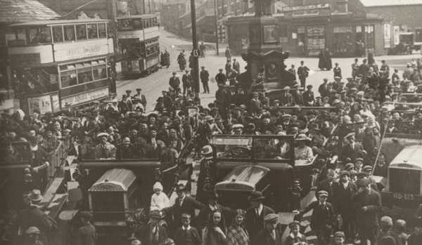 |
|
| Collection of Maggie Land Blanck, June 2011, reproduction of
original photo Heckmondwike | |
| | |
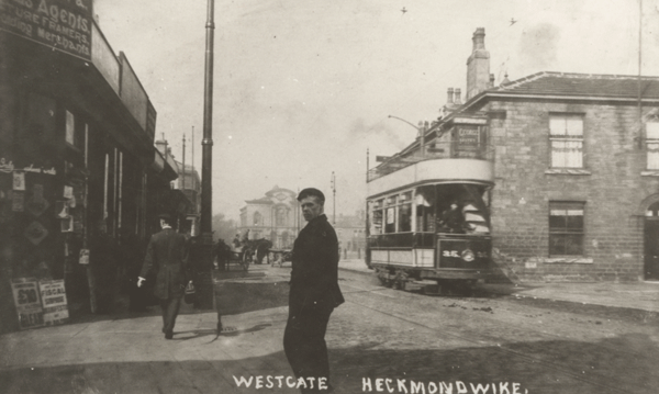 |
|
| Collection of Maggie Land Blanck, June 2011, reproduction of
original photo Westgate, Heckmondwike | |
| | |
 |
|
| Postcard collection of Maggie Land Blanck
High Street Heckmondwike, not posted | |
| | |
| Birstall Faces | |
|
|
| |
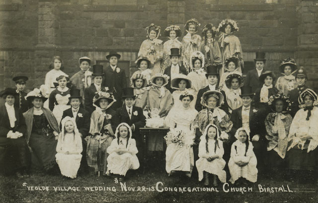
| Photo collection of Maggie Land Blanck | |
| "Ye Olde Wedding Nov 22-13 Congregational Church Birstall | |
| | |
| |
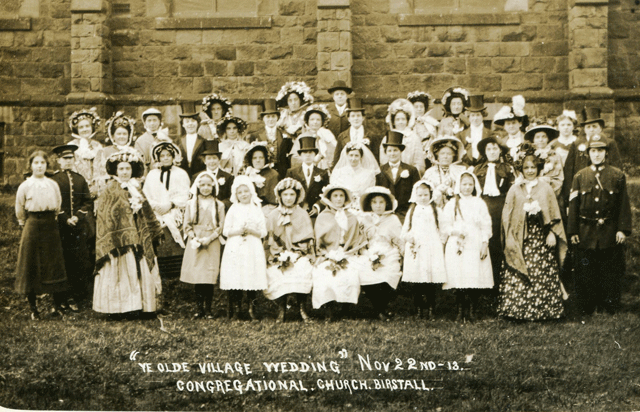
| Photo courtesy Mike Gammon February 2011 | |
|
"Ye Olde Wedding Nov 22-13 Congregational Church Birstall According to Around Batley by Norman Ellis this "imaginary" event was some sort of a fund raiser. | |
| | |
| Birstall Information
Adwalton Information The Laws The Sheards The Sykes The Siddles |
| Old Photos from the Birstal, Gomersal, Scholes area
shared by Barry Riding Click on the photo of Gomersal Hill Top |
 |
|
| |
| Outside Links
Kirklees Image Archive IMAGES OF BATLEY
Fred Marriott Batley Reporter 29th December 1888 Terrific Mill Fire at Birstal
|
| If you have any suggestions, corrections, information, copies of documents, or photos that you would like to share with this page, please contact me at maggie@maggieblanck.com |
| RETURN TO TOP OF PAGE |
| Please feel free to link to this web page. You may use images on this web page provided that you give proper acknowledgement to this web page and include the same acknowledgments that I have made to the provenance of the image. Please be judicious. Please don't use all the images. You may quote up to seventy five words of my original text from this web page and use any cited quotes on this web page provided you give proper acknowledgement to this web page and include the same acknowledgments that I have made to the provenance of the information. Please do not cut and paste the whole page. You may NOT make use any of the images or information on this web page for your personal profit. You may NOT claim any content of this web page as your original idea. Thanks, Maggie |
| ©Maggie Land Blanck - Page created 2004 - Latest update, May 2014 |