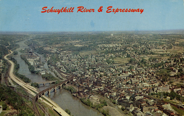
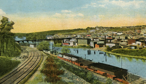
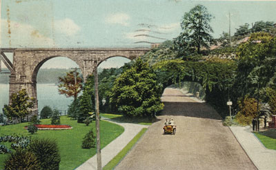
Schuylkill River and Expressway
A view of the Manayunk, Roxborough/Wissahicken area of Philadelphia.
| Roxborough/Manayunk/Wissahickon Section of Philadelphia, Pennsylvania |
| HOME - Land Introduction - John Land - Samuel Land and Mary Ann Law Land and Their Children - Lydia Law Land and Her Children - Shoddy |
| The Roxborough/Manayunk/Wissahickon
Section of Philadelphia The following members of my family lived in the Roxborough/Manayunk/Wissahickon section of Philadelphia in the the late 1800s and early 1900s.
Textile mills were located in Manayunk since the 1820 and 30s. There was at least one shoddy mill in Manayunk. The Schofield family who were originally from England founded Economy Mills. It was built in 1857 near Rector Street (formerly Robeson Street) between Main Street and the Schuylkill River. The Dobson family, also from Yorkshire, married into the Shofield family. The Dobsons also founded mills in Manayunk. This area of Philadelphia is/was made up of several neighborhoods including Manayunk, Roxborough (Roxboro), and Wissahickon. The area is roughly triangular in shape. It is bordered by the Schuylkill River on the south and southwest and Wissahickon Park on the north and northeast. The land slopes downhill on both sides of Ridge Road. The Schuylkill River side is a rather steep incline. Roxborough is above Manayunk Avenue. Roxborough was the neighborhood where many of the mill owners and company executives lived and where St Timothy's Church is located. Samuel Land and his family are buried in St. Timothy's Church yard. Lydia Land lived for a number of years on Pechin Street near Shurs Lane in Roxborough. A large old mill stands on the corner of Shurs Lane and Pechin Streets. I have several Manayunk/Roxborough addresses for the Lands. With the exception of 176 Lauriston Street, I believe that all of the building the family lived in are gone - mostly replaced by newer buildings. Manayunk is below Manayunk Avenue. The shopping area was/is in Manayunk along Main Street at the bottom of the hill and near the river. The area along the river contained many mills and warehouses. Wissahickon is a small section in the southeast. Vassar and Kalos Streets (where Samuel Land and Lydia Law Land lived for some period of time) are both in the Wissahickon section. In October 2007 Regina Wakefield emailed some reminiscence of Manayunk/Roxborough, As I looked at your postcards I remembered the "ageold" discussion about where Manayunk began and ended. I grew up in the 200 block of Rector St. Above Terrace St. and a few houses below Manayunk Ave. We would fight to the last breath to say we lived in Roxborough even though we were below Manayunk Ave. We were above the cliff, our phone exchange was Roxborough 8 and our post office address was Roxborough 28. Manayunk was 7 and 27! Of course, now it is very chic to live in Manayunk but believe me, in the 40's it was not. In fact, to a child of that time, Manayunk was scary. Just thought you might like to read my "looking back" thoughts! For more information on shoddy go to Shoddy. For more information on Lydia Law Land go to Lydia Law Land. City of Philadelphia describes the three neighborhoods as follows:
|
| Postcard Captions by Harry Garforth Harry Garforth, a local Manayunk-Roxborough historian, has graciously shared some of his research on the area. |
|
|
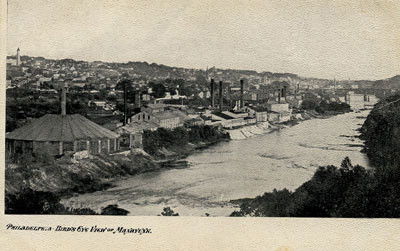
| Postcard in the collection of Maggie Land Blanck Schuylkill River and Expressway A view of the Manayunk, Roxborough/Wissahicken area of Philadelphia. | |
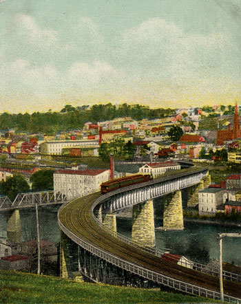 |
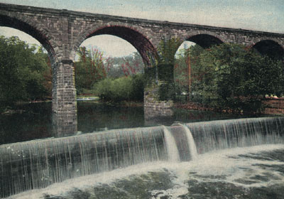
The S Bridge over the Schuylkill River
at Manayunk, Philadelphia, Pa, built in 1884.
No postmark
|
| Postcard in the collection of Maggie Land Blanck | |
 | |
| Postcard in the collection of Maggie Land Blanck | |
| Philadelphia Pennsylvania R.R. Bridge, Manayunk
Not posted
| |
 |
Pennsylvania R. R. Bridge, Manayunk, Philadelphia, Pa.
Posted 1921
|
| Postcard in the collection of Maggie Land Blanck | |
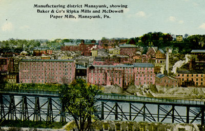 |
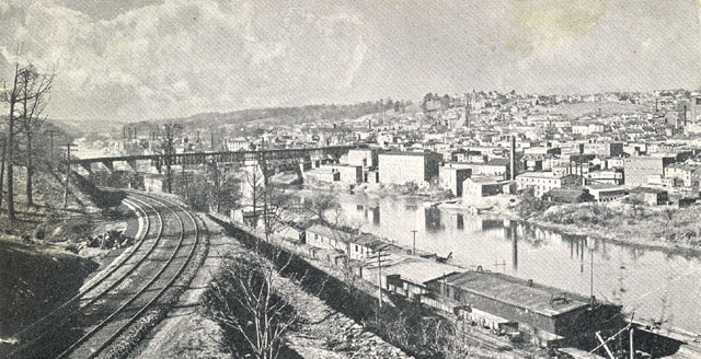
Manufacturing district Manayunk, showing Baker & Co's Ripka Mills
and McDowell Paper Mills, Manayunk, Pa.
No postmark
|
| Postcard in the collection of Maggie Land Blanck
The trestle in the foreground belongs to the Pennsylvania Railroad (PRR). The trestle allowed the PRR to descend from the "S" bridge, high above the Schuylkill River down to the Pencoyd Steel Mill on the west bank of the river. This trestle crossed over the Philadelphia and Reading Railroad tracks and used a switchback to achieve the change in elevation. | |
 |
|
| Postcard in the collection of Maggie Land Blanck
| |
 |
|
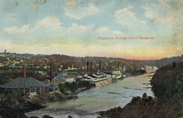
| Postcard in the collection of Maggie Land Blanck The large church in the center of the picture is St John the Baptist Roman Catholic, 146 Rector Street, Manayunk. Part, if not all, of the buildings visible in this image are the Economy Mills owned by by the Schofield family. These mills manufactured blankets for the Union army during the civil war. | |
 |
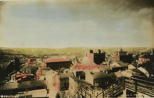
Philadelphia a Bird's Eye View of Manayunk.
No postmark
|
| Postcard in the collection of Maggie Land Blanck
| |
 | |
| Postcard in the collection of Maggie Land Blanck | |
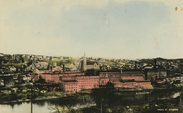
| Manayunk
No postmark In November 2010 Faith L Smith identified the round building at the left of this images as part of the Manayunk Wood Pulp Mill. At Faith Smith's suggestion see The Jessup and Moore Paper Company The Free Library of Philadelphia online map collection includes several volumes of Hexamer General Surveys (some dated, some not). Volume 9 (1873) indicates that the large round building was the "Evaporating Building & Furnaces" for Manayunk Pulp Works. The small building immediately to the right is the "Filter House". The large white building with the light grey roof housed the "Boiling House", "Bleach House" and " Wood Chopping & Beating Engine House". These buildings are somewhat different in appearance in the 1874 schematic than in the above image. MANUFACTURE: Wood Pulp only — No paper manufactured on the premise. 140 hands (136 men 4 boys). Lessees: Jessup & Moore and Martin Nixon The mill was located between the Schuylkill and the Manayunk Canal north of Flat Rock Paper Mill. The next series of lighter buildings with darker roofs belonged to the Flat Rock Paper Mills owned by Martin Nixon.
| |
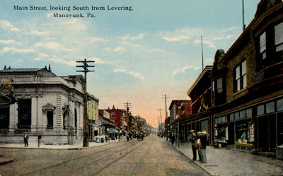 |
Main Street, looking South from Levering, Manayunk, Pa. No postmark
|
| Postcard in the collection of Maggie Land Blanck
The trolley tracks in Main Street belong to the Philadelphia Traction Company's Route 61. The service began as a horse car line but was later electrified on August 30, 1894. The trackage extended to Green Lane and Main Street. The route was further extended to Leverington Avenue and Main Street on October 25, 1909. Designation of this service as Route 61 occurred September 13, 1914. Trolley service continued until1941, when buses ran for a short period to allow reconfiguration of the overhead wire system for trolleybus operation. Trolley buses ran until March 13, 1961 when the line was converted to bus. | |
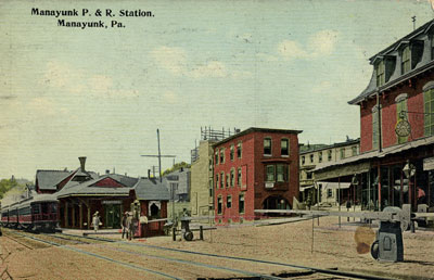 |
Manayunk P. & R. Station, Manayunk, Pa Sent in 1911. Manayunk Reading Railroad Station at the intersection of Cresson and Gay Streets. Harry Garforth, April 2006
|
| Postcard in the collection of Maggie Land Blanck | |
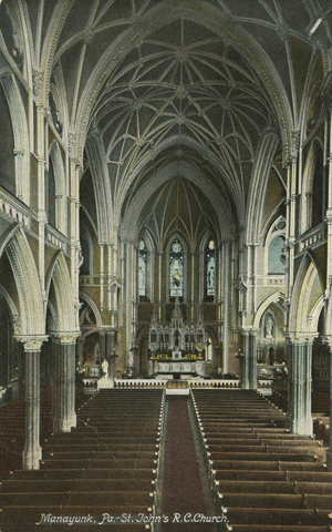 |
Interior St. John's R. C. Chutch, Manayunk, Pa. Not posted St John the Baptism Manayunk — since 1831 |
| Postcard in the collection of Maggie Land Blanck
| |
 |
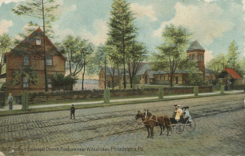
|
| Postcard collection of Maggie Land Blanck Posted 1911 | |
 |
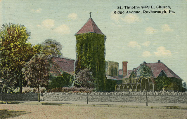
St. Timothy's Episcopal Church, Roxboro near Wissahicken, Philadelphia, Pa. Not posted |
| Postcard collection of Maggie Land Blanck | |
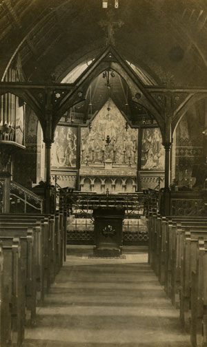 |
Interior St Timothy, Roxborough Philadelphia, Pa.
Posted 1909
|
| Postcard in the collection of Maggie Land Blanck | |
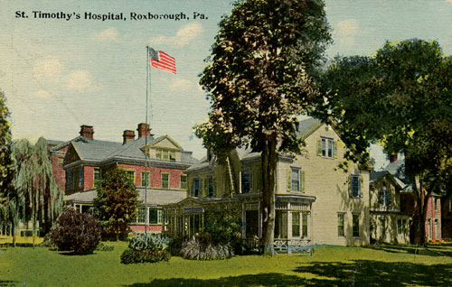 |
St. Timothy's Hospital, Roxborough, Pa.
Not posted St. Timothy's Hospital in now The Roxborough Memorial Hospital Don Duffy, April 2006
|
| Postcard in the collection of Maggie Land Blanck | |
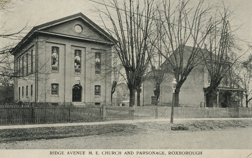 |
Ridge Avenue Methodist Episcopal Chruch and Parsonage
Roxborough
Not posted This may now be the Ridge Avenue United Methodist at 7805 Ridge Ave. at Shawmont Ave., Roxborough |
| Postcard in the collection of Maggie Land Blanck | |
 |
|
| Postcard in the collection of Maggie Land Blanck Leverington Presbyterian Church corner of Leverington and Ridge Avenues (1880-1928). No longer standing. | |
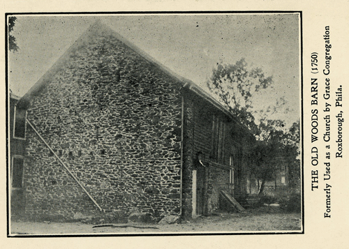 |
The Old Woods Barn (1750)
Formerly Used as a Church by Grace Congregation, Roxborough, Phila. Not posted
|
| Postcard in the collection of Maggie Land Blanck | |
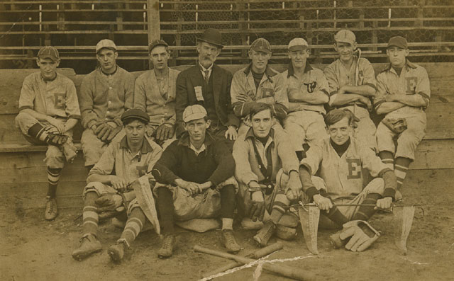 | |
| Postcard in the collection of Maggie Land Blanck Eden Baseball Roxborough Team Manayunk, not dated | |
 |
| Print in the collection of Maggie Land Blanck |
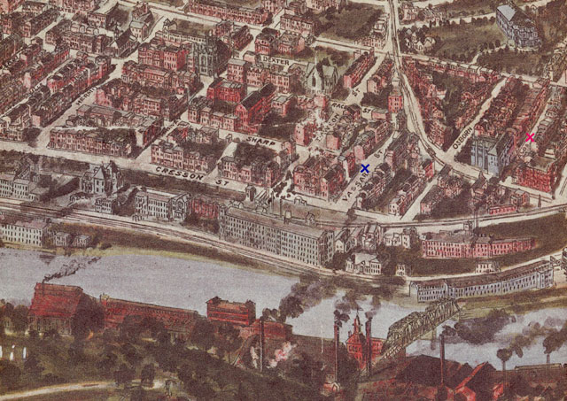
| The Manayunk section of Philly 1907
The blue "x" shows the 1880 address of Samuel Land and Mary Ann Law Land. The red "x" shows the 1920 addresses of:
|
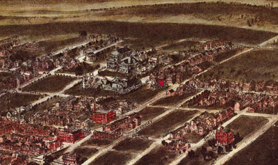 |
The Manayunk section of Philly 1907 The red "x" shows the location of St Timothy's Church where the family of Samuel Land and Mary Ann Law Land and several of their children are buried.
|
| Print in the collection of Maggie Land Blanck | |
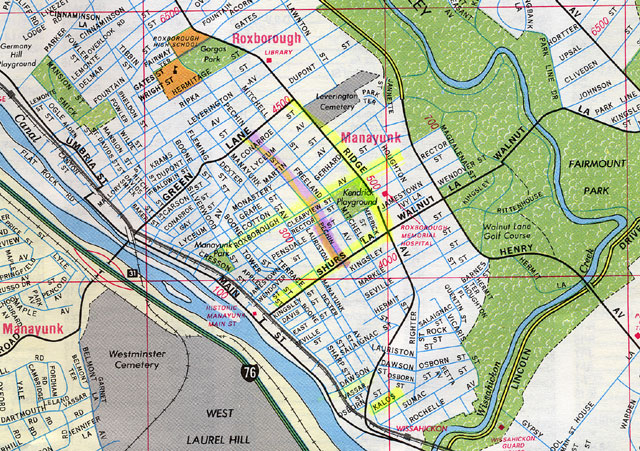 |
| The Manayunk/Roxborough/Wissahickon section of Philly
I believe that "MANAYUNK" is in the wrong place. It should be below Manayunk Avenue.
|
|
Some Facts About Manayunk Development A wool processing mill was built in Manayunk circa 1870 and by the late 1890s Manayunk had become a world class textile center. The Pennsylvania Railroad came to Manayunk in 1884. In 1898 there were ads for the train to Atlantic City. A trolly line to center City was completed in 1894. In 1895 electric trains began replacing horse drawn carts. Electric lights were available in 1898 from the Wissahickon Electric Light Company.
|
| Fires in Some Mills in Manayunk
Fire was an ever present danger in most mills. Lists of fires in Philadelphia include the following mills:
In 1883 Economy Mill was listed as a shoddy manufacturer and maker of wool blankets and clothes. The mill employed 850 hands: 480 men, 40 boys and 330 women and girls. For a history of the mill go to Economy Mills Blantyre Mills
|
| Some Shoddy Mills in Philadelphia
Shoddy was developed in Batley Yorkshire in 1813. See Shoddy W. M Hall, Shoddy Manufacturers and dealers in Shoddy Material Office No 25, North Front Street, Philadelphia, from postcard dated 1884. William Hall and Co was established by T. C. Hall and John H. Hall in 1867 in Landsdown Delaware C.. They were manufacturers of "fine shoddy' and dealers in wool and woolen rages.
|
| Costs of Living in 1896 and 1898 As Indicated in The Local Manayunk Paper
In 1896 a 6 room house near the RR Station rented for $9.00 per month and was for sale for $800. Other rentals in new houses (no location given) were listed at $12 per month, selling for $1,200 to $1,486. In 1898 the following rentals were listed:
Mortgage rates in 1896 were $2.36 per week for $1,000 and $4.78 per week for $2,000. It cost $25 for a new square piano and $14.75 for a solid oak bedroom suite. A plot in west Laurel Hill Cemetery cost from $20 and upwards. There were 14 trains from Manyunk to the cemetery. In the summer of 1898 it cost 15 cents to go round trip on the Fairmont Steamer. The boat made a circle between Riverside-Strawberry, Belmont, Zoo, Gardens.
|
| Atkinson/Abdale/Wetten Families in Manayunk
In April 2011 Thomas Wetten emailed about his Manayunk connections: I am descended from a few families that might have crossed paths with yours in Manayunk: |
| Schofield/Dobson Families in Manayunk
In April 2015 Elizabeth Jeffords wrote about her family Scholfield/Dobson/Snowden who came from Yorkshire, and founded mills in Manayunk. Birth: Joseph Schofield Circa 1801 Marriage: Joseph Schofield, of Chaddlesworth, spinner, 13 May 1823, Rochdale, Lancashire, England, Spouse: Mally Savill, of same place, by banns, they both made their marks. Bishops Transcripts
Children:
1841 English Census: Joseph Schofield and family were listed in the 1841 census in Rochdale, Yorkshire, in the township of Saddleworth on Den Lane: Joseph Schofield 40, cotton spinner, Mally Schofield 39, Sarah Schofield 17, John Schofield 14, Tom Schofield 12, Savill Schofield 9, Charles Schofield 6, Maryan Schofield 1, all were listed as born in Yorkshire. Note: On the boarder between Lancashire and Yorkshire, Saddleworth was historically part of Yorkshire, but was frequently listed under Lancashire. 1850 USA Census: The were listed in the 1850 census in Lower Merion as follows: Joseph Schofield 49, cotton manufacturer, Malley Schofield 47, Sarah Schofield 26, Thomas Schofield 21, manufacturer, Seville Schofield 19, manufacturer, Charles Schofield 16, manufacturer, Mary Ann Schofield 10, Maria Schofield 5, Joseph Schofield 2, all born England, Nesx to them was John Schofield age 24 manufacturer born England and his wife Elizabeth age 21.
Sevill Schofield became a prominent Philadelphia textile manufacture, the owner of Economy Mills in Manayunk. Economy Mills Seville Scholfield obit: "SEVILL SCHOFIELD.*Lees, Oldham is in Greater Manchester. Historically Lees was in Lancashire. Sarah Schofield married John Dobson. John Dobson and his brother, James, were partners in the Falls of Schuylkill woolen mill. They were the owners of one of Philadelphia's largest woolen mills. John Dobson, the founder of the business, came to this country in 1848, from England. A short time thereafter he started in the woolen manufacture on his own account, becoming associated with James Lees in West Manayunk. After several changes the mill was located at the Falls of the Schuylkill, and at the outbreak of the Civil War the manufacture of blankets was undertaken. Upon the invasion of Pennsylvania by the Confederate Army John Dobson organized a company from his mill for the Union Army, and while absent in that service the management of the business was undertaken by his brother, James Dobson, who had become connected with the enterprise. After the war was ended the brothers formed a partnership under the firm name of John & James Dobson. At that time the manufacture of carpets was begun. Later plushes and velvets were added and still later the making of worsted yarns was started. The business has continually expanded until today the company is operating five plants in Philadelphia and making blankets, carpets, rugs, plushes, velvets, cloakings, men's wear, and dress goods, and operating 47 worsted cards, 40 combs, 31,216 spindles, 39 woolen cards, and 1335 looms. It is capitalized at $9,200,000.1903: "In the past few weeks death has been a frequent visitor in the Schofield family, of Manayunk, Pa., where for years its members have been actively identified with manufacturing industries. The latest victim was Charles Schofield, aged 69, the well known cloth manufacturer, who died last week at his home in Scott lane, Falls of Schuylkill. His brother, John Seville Schofield, died in St. Timothy's Hospital of blood poisoning following an operation, on February 22, at the age of 76. With their father, Joseph Schofield, and their brothers, Joseph, Thomas and Siville, the brothers came to this country in 1845, from Lancashire, Eng. The father died in the 50s, and was succeeded by the sons, who continued the business in Minayunk. Later each brother went into business for himself. All five brothers are now dead. Mrs. John Dobson and Mrs. James Dobson are sisters of the Schofields."Obituary of John Dobson born 13 October 1827, Yorkshire, England: John Dobson, a wealthy carpet - velvet and plush - manufacturer of Philadelphia, died at his home Wednesday, June 28, from injuries suffered on Tuesday by falling downstairs. Owing to his advanced age, eightythree years, he had little chance for recovery. He was the head of the carpet and woolen goods factory of John and James Dobson. He was born in Soudle (sic) Town, Yorkshire, England, in 1828. Coming to this country when twenty-two years old, he obtained employment in a woolen mill in Manayunk, Pa., and after working there for little more than a year he invested his savings in a small business of his own. The Dobson mills now constitute the largest individual textile establishment of its class in the United States.James Dobson was married to Sarah Scholfield's sister, Mary Ann. John and James were the sons of William Dobson and Elizabeth. James was born March 6, 1837 according to his death record in 1926.In October 2018 Elizabeth Jeffords wrote: "The Dobson Mills were originally at the junction of the Schuykill and Wissahickon Rivers when they were using water power but then moved down Ridge Avenue to the site of the current Dobson Mills apartment complex when they switched to coal. That site was on the Reading Railroad's coal line to Port Richmond, Philadelphia on the Delaware River. Both Jeffords and Dobsons had railroad sidings to get coal from that line. The Dobson Mills in the Falls of the Schuykill and J.E. Jeffords Pottery at the terminus of the coal line in Port Richmond." |
| James Stafford in Manayunk (1837-1904)
1904: James Stafford, senior member of the manufacturing firm of James Stafford & Sons, Star Woolen Mills, Manayunk, Philadelphia, died from a complication of diseases at his home. He was born in Oldham, England, April 6, 1837. He was engaged as head bookkeeper at the woolen establishment of Seville Schofield for some time, and in 1874 started the Star Woolen Mills. |
| The Work Force
Several of the families who set up mills in Manayunk came for either Lancashire or Yorkshire in England. The mills were built along the same lines as the mill in England. Workers also came from England, with spinners and shearers from Yorkshire and carders and weavers from Greater Manchester. How did people used to the cool damp climate of Yorkshire adjust to hot humid summers in Philadelphia? In 1899 Fibre and Fabric reported a big improvement in the textile business in Manayunk. The main problem was to secure enough workers. Help was "scarce". The piecers were on strike at Richard Hey & sons and at Arcola Mills, demanding higher wages. There pay was $7 a week and they re requesting an one dollar a week raise. Arcola mill work was described as "heavy" requiring strong "boys". Recent labor issues had forced many of the mill workers to seek employment elsewhere resulting in a shortage of available employees. Good weavers were also scarce at the time. The Economy mills under the leadership of Dobson Schofield were doing well as was the spinning mill owed and managed by Clayton G. Rice on Shur's Lane. Weavers from Yorkshire in Manayunk
|
| Health Issues - Work Dangers
1889: July 30, 1889, A double boiler at the Freeland Carpet Yarn mill at the corner of Shur's Land and Freeland ave, Manayunk exploded. The boiler explosion at the three story building owned by Flanagan & Brothers instantly killed Joshua Ambler, age 12 of 177 Levering street. George D. Schofield, age 8, son of the mill engineer, was seriously wounded and died the next day. The Schofields lived at 163 Gay. James Stuart, age 20, was badly cut around the head and face. Several other mill hands were slightly injured from the flying debris. The mill employed over 100 men. The explosion occurred in the boiler house, a free standing building in the mill yard. Engineer Schofield and many of the men were eating their dinner when the explosion occurred. The two young boys were playing in the yard after having brought dinner to family members who worked in the mill. Large pieces of the boiler were spread around the yard. One, weighing about 800 pounds, was blown as far as Freeland ave about 200 yards away. All of the mills windows were shattered. An inquest determined there were defects in the iron, but the engineer and the owner had taken proper precautions. The deaths of Joshua and George were deemed an accident.1889: "On the morning of October 17 a bad accident occurred in a mill in Manayunk Pa., occupied by the Manayunk Paper company. The head of a large cast-iron paper drying cylinder, thirty-six inches in diasmeter and weighing 800 pounds blew out."1892: When a large boiler exploded at the McDowell Paper Mill Manayunk it killed the engineer and completely demolished the boiler house a brick structure separated form the main building. 1893: a duster machine charged with muriatic acid exploded in a mill in West Manayunk on August 31. 1893: "MILL HANDS IDLE OUT IN MANAYUNK" "Starvation Threateatening Many Famlies on the Banks of the Schuylkill River" When "running full" the local Manayunk mills employed 5,228 hands. In October 1894 3,739 were unemployed.
1894: May 21, 1894 Four days of rain had swollen the local crees and many mills were forced to shut down. The Schuylkill had risen to 20 feet above the low water mark. There was a lot of damage in Manayunk and 5,000 mill hands were our of work and 28 families were homeless due to flooding. By mid morning all ground floors of all the mills fronting on the river were under water. Much valuable machinery was ruined and merchandise was lost. "Before the employees of Seville Schofield's lower mills were aware the water had risen so rapidly that the boiler and engine rooms were entered and the fires extinguished. The entire stock of shoddy, valued at several thousand dollars was rendered worthless." The worsted mill of John and James Dobson was flooded. Houses along Main street form Wissahicken to Shurs lane were inundated with about 4 feet of water. |
| Health Issues - Polluted Water
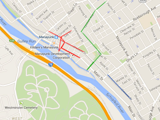
There are several severe water born diseases including Cholera, Typhoid Fever and a variety of intestinal illnesses spread by microbes in polluted water. Before the understanding of microbiology many cities just want to get rid of the stinky stuff. The easiest way was to built sewers and dump the waste in the nearest river. Philadelphia, was afflicted with cholera in 1832, 1849, and 1866. Cholera Philadelphia was frequently effected by typhoid fever outbreaks. Coalition against Typhoid has a graph of the occurrence of typhoid in Philadelphia from 1860 to 1935. Philadelphia introduced water purification by slow sand filtration between 1900 and 1911. Philly H2O In 1886 there were three public sewers in Manayunk, several private sewers and a brook and a stream that were used as sewers. In addition there was a tremendous amount of industrial waste produced by the local mills. The major portion of this refuse was dumped into the Schuylkill River.
In 1886 the Schuylkill river served the city of Philadelphia with drinking water. Several cities and towns above Philadelphia used the river for drinking water and as a sewer. In addition to human and animal waste, mines, factories, mills and other industrial businesses dumped their refuse in the river. Consequently the water was already pretty polluted before it arrived in Manayunk. The biggest danger from the mill pollution was the human waste from the privies. There were three public sewer lines in Manayunk as described in the 1886 Annual Report of the State Board of Health and Vital Statistics Volume 1 Pennsylvania. They are highlighted in red, green and blue on the map. They are not exactly as detailed in the report because some of the street names have changed. The red line ran for approximately 2,600 feet. The green line for about 3,500 feet and the blue line for about 1,330 feet. In addition there was a private line along the course of a natural brook and another along the course of a natural stream. The stream which ran along the upper side of Shurs Lane was used by several mills. In total there were about two miles of sewer which discharged into the Schuylkill river. In the following report the amount of waste dumped in the river by the mills and other businesses was per day.
"These sewers receive not only the street washings and surface drainage from the greater portion of the most densely populated part of this district, but domestic waste water from more than 1,010 houses, (occupied, probably, by 5,000 persons,) either by direct connection or through the street gutters and inlets, (beside many others at such a distance from regular channels that most of the water is absorbed or evaporated,) and water-closet* drainage from about 65 houses, including the city police station, with 25 officers and an average of 7 or 8 lodgers, and many liquor saloons, representing a population of probably over 500 persons who have water-closet drainage into the river through the sewers of Manayunk. (Emphasis mine. MLB)The report goes on to list the businesses in West Manayunk who were dumping in the river.
*A euphemism for the toilet. Note: The mills ran every day including Sunday. |
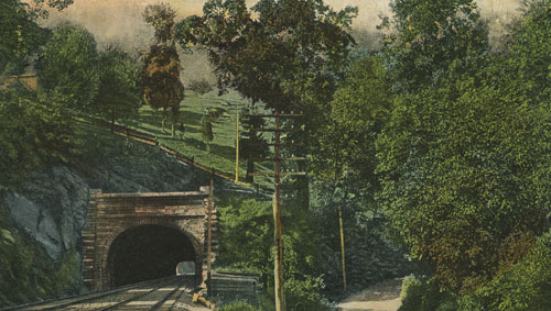 |
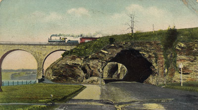
Flat Rock Tunnel Manayunk, Philadelphia
Posted 1911 |
| Postcard in the collection of Maggie Land Blanck
Flat Rock RR tunnel is between exits 337/338 (mileposts) on I-76, the Schuylkill Expressway. Exit 338 is Green Lane/Belmount Avenue, and 337 is Armore. This is very close to the Schuylkill River across from Manayunk section of Philly. On a map, look for RR tracks which disappear across the Schuylkill Expressway. That's the tunnel. | |
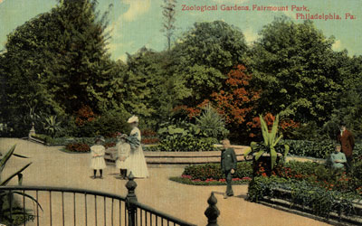 | Zoological Gardens, Fairmont Park, Philadelphia, Pa.
The Philadelphia Zoo opened July 1, 1874. It was the first zoo in America. The zoo was accessible by steamers on the Schuylkill River. Not posted |
| Post Card in the collection of Maggie Land Blanck | |
 |
Henry Avenue Bridge over the Wissahickon Creek,
Philadelphia, Pa. Not dated. Printed on back Henry Avenue Bridge was erected in 1932 at a cost of over $2,000,000. It is of Masonry constrution 915 feet long, 84 feet wide and 185 feet above water level in Wissahickon Creek. One of the most beautiful bridges in the city it connects Roxborough and Germantown. |
| Post Card in the collection of Maggie Land Blanck | |
 |
Henry Avenue Bridge Over Wissahickon
Thanks to Don Duffy, April, 2006 Not posted. |
| Postcard in the collection of Maggie Land Blanck | |
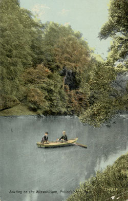 |
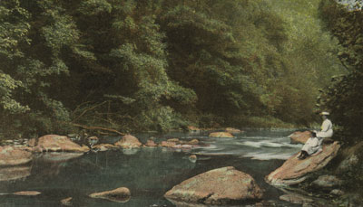
Boating on the Wissahickon, Philadelphia,
Not dated. The Wissahickon River runs along the Wissahickon Valley through Fairmount Park. This area of Fairmount Park formed the northeast boundry of Manayunk/Roxborough. The Wissihickon was popular for boating in the summer and skating in the winter.
|
| Postcard in the collection of Maggie Land Blanck |
 |
Tall Bridge over Wissahickon Creek Philadelphia,
Not posted. Copyright 1905. |
| Postcard in the collection of Maggie Land Blanck | |
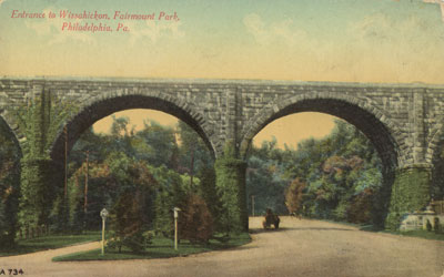 |
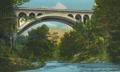
Entrance to Wissahickon, Farimont Park,
Philadelphia, Pa.
Not posted. The bridge is the Reading Railroad Bridge. Don Duffy, April 2006 |
| Postcard in the collection of Maggie Land Blanck | |
 |
Wissahickon Creek, Fairmont Park, Philadelphia
Copyright 1907 by Taylor Art Co. Not posted. |
| Postcard in the collection of Maggie Land Blanck | |
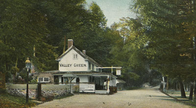 |
Valley Green, Fairmont Park, Philadelphia
Dated October 12, 1906 |
| Postcard in the collection of Maggie Land Blanck | |
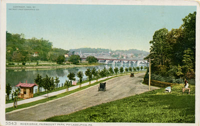 |
River Drive, Fairmount Park, Philadelphia, Pa. No date.
|
| Postcard in the collection of Maggie Land Blanck
September 2008 William Ross wrote: "The road paralleling the river was then called East River Drive, and is now called Kelly Drive. The town in the background at the time was called the Falls of Schuylkill, and is now called East Falls. The intersecting street (on the right) was at the time called Nicetown Lane; it is now called Hunting Park Avenue. Both sides of said street were and are the property of Laurel Hill Cemetery. I biked by there twice today on the Schuylkill River trail, and rowed by there yesterday. It is now much more heavily wooded. ĘWilliam Ross, September 3, 2008" | |
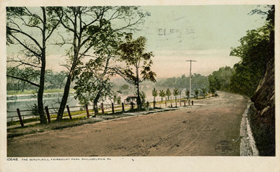 |
The Schuykill, Fairmont Park, Philadelphia, Pa.
Post marked 1911. |
| Postcard in the collection of Maggie Land Blanck |
 |
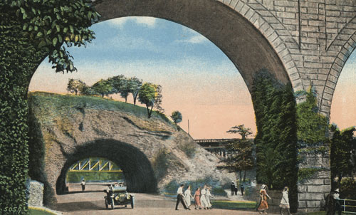
River Drive and Tunnell, Philadelphia, Pa
Posted in 1905 "The intersection shown is East (Kelly) River Drive and Brewery Hill Drive." MarcZ, December 2007 |
| Post Card in the collection of Maggie Land Blanck |
 | |
| Postcard collection of Maggie Land Blanck | |
| East River Drive Fairmont Park Philadelphia Pa. Printed on the back of the card, "Drive in East Fairmont Park, beginning at Girard Avenue and extending north to the Wissahickon, among the most romantic and picturesque scenery."Hand written notes in pencil
"East Side looking South Not posted | |
 |
The Tunnell, River Drive, Fairmont Park, Philadelphia, Pa
No date.
|
| Post Card in the collection of Maggie Land Blanck |
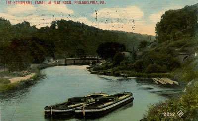 |
The Schuylkill Canal at Flat Rock, Philadelphia, Pa.
Posted 1911
|
| Postcard in the collection of Maggie Land Blanck | |
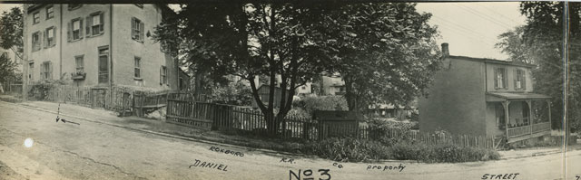
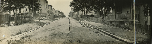
| The Corner of Daniel and Hermit Streets 1923
The following four photos were taken in July 1923 in what appears to be changes planned by the railroad. These photos where attached to the map dated 8-22-23.
| |
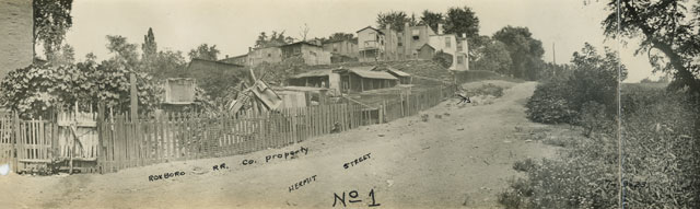 | |
| Photo collection of Maggie Land Blanck | |
| Daniel Street and Hermit Street, July 19, 1923 | |
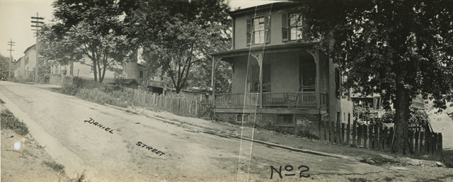 | |
| Photo collection of Maggie Land Blanck | |
| Daniel Street and Hermit Street, July 19, 1923 | |
 | |
| Photo collection of Maggie Land Blanck | |
| Daniel Street and Hermit Street, July 19, 1923 | |
 | |
| Photo collection of Maggie Land Blanck | |
| Daniel Street and Hermit Street, July 19, 1923 | |
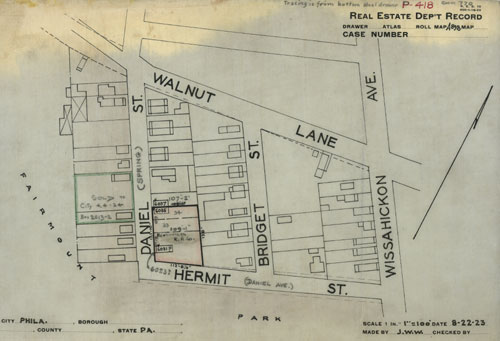 | |
| Map collection of Maggie Land Blanck | |
|
Written in the larger block outlined in green "SOLD TO CITY 4-4-24"
Written in the smaller block outlined in green "Box 2613-12" Written in the largest block outlined in red "ROXBOROUGH R. R. CO."
| |
|
Comments from Harry Garforth, February 21, 2006
Henry H. Houston, who was a Pennsylvania Railroad Company Director from 1881-1895, was instrumental in developing a plan to acquire substantial land holdings in upper Roxborough. The acquisitions were in anticipation of building a new railroad extension into the territory.
| |
 |
|
| Images courtesy of Phebe Morgan, February 2012 | |
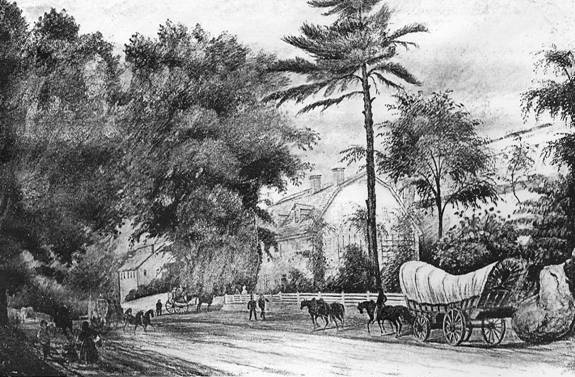
|
The Robeson
home, Shoomac Park (or Roxboro) taken about 1834 . Built possibly 1752 or before. Image shared by Phebe Morgan, Febraury 2012.
See An historical and genealogical account of Andrew Robeson: of Scotland, New ... By Susan Stroud Robeson, Caroline Franciscus Stroud (a google book). |
 |
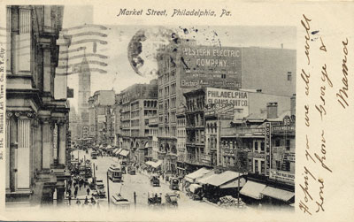
Market Street, Philadelphia, Pa. Post marked 1907. |
| Post Card in the collection of Maggie Land Blanck | |
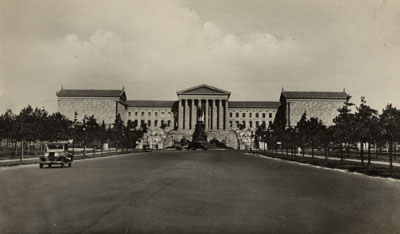 |
Art Museum and Washington Monument, Philadelphia Not posted. Go to Philadelphia Museum of Art for a history of the Philadelphia Museum of Art. |
| Post Card in the collection of Maggie Land Blanck |
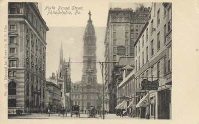 |
North Broad Street, Philadelphia, Pa.
No date. |
| Post Card in the collection of Maggie Land Blanck |
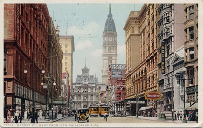 |
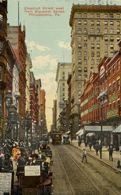
Market Street West From 11th, Philadelphia, Pa.
Post marked 1918. |
| Post Card in the collection of Maggie Land Blanck |
|
Market Street, Philadelphia, Pa. Post marked 1907. |
| Post Card in the collection of Maggie Land Blanck | |
 |
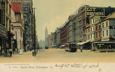
Market Street, Philadelphia, Pa.
Post marked 1904. |
| Post Card in the collection of Maggie Land Blanck | |
 |
Chestnut Street west from Eleventh Street,
Philadelphia, Pa.
Post marked 1913. |
| Post Card in the collection of Maggie Land Blanck | |
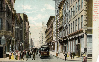 |
2361 Chestnut Street,
West from 8th Street, Philadelphia, Pa. Not dated. |
| Post Card in the collection of Maggie Land Blanck | |
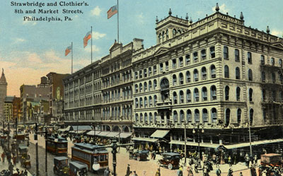 |
Strawbridge and Clothier's 8th and Market Streets Philadelphia, Pa. Not dated. |
| Post Card in the collection of Maggie Land Blanck | |
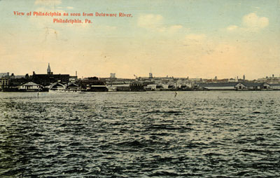 |
View of Philadelphia as seen from Deleware River, Philadelphia, Pa. Not dated. |
| Post Card in the collection of Maggie Land Blanck | |
| Other Sources For Old Philadelphia Photos
Anita McKelvey sent the following helpful email in December 2007:
The best and most comprehensive database of photos is the city-owned website Philly History. Sometimes, accessing the database can be a little tough, trying to find what you're looking for, but it's a treasure trove once you get the hang of it.THANK YOU, ANITA Mike Ettner's Blog contains two lovely paintings of Manayunk in the snow by the artist James Jeffreys. |
| If you have any suggestions, corrections, information, copies of documents, or photos that you would like to share with this page, please contact me at maggie@maggieblanck.com |
| HOME | |
| Land Introduction | |
| John Land | |
| Samuel Land and Mary Ann Law Land and Their Children | |
| Lydia Law Land and Her Children | |
| Shoddy | |
| ©Maggie Land Blanck - page created 2004 - latest update, October 2018 | |