|
|
| HOME - AZARIAN CONNECTIONS |
 |
|
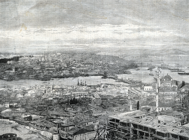
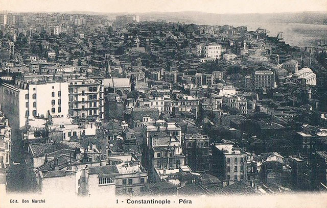
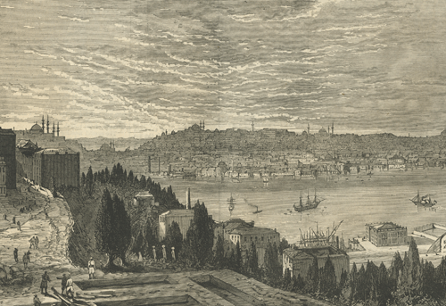
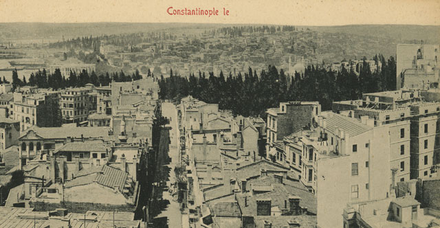
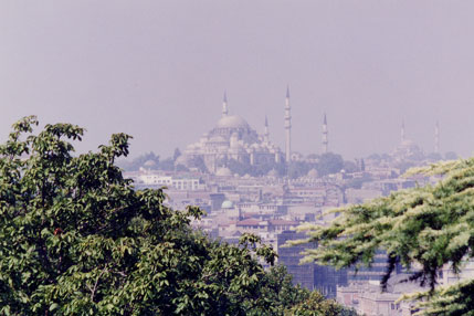
| Collection of Maggie Land Blanck A VIEW OF CONSTANTINOPLE AND PERA - THE GRAPHIC JUNE 15, 1870 | |
 |
|
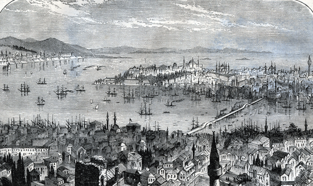
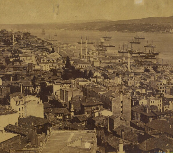
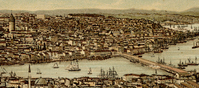
| Collection of Maggie Land Blanck A VIEW OF CONSTANTINOPLE FROM PERA 1881, publication unknown | |
 |
|
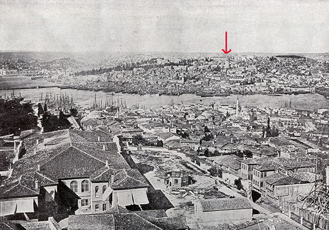
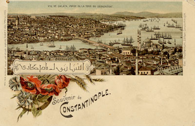
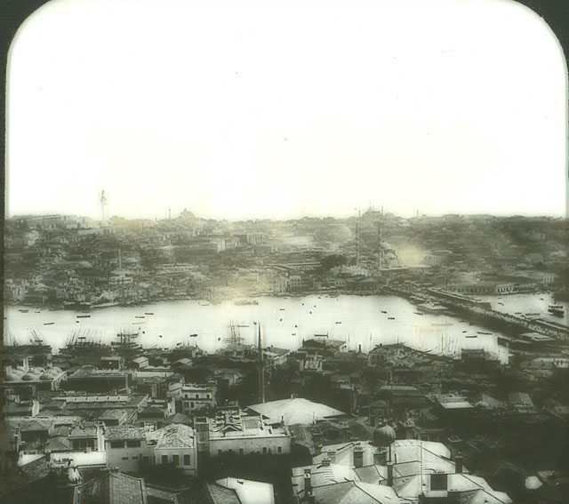
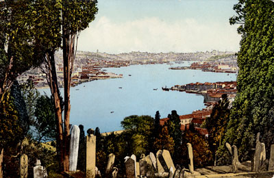
| Collection of Maggie Land Blanck, June 2012, cut from Album of the world's gems:
sunlight pictures from every land, 1893 The city looking towards Galata. The arrow indicates the Galata Tower. For a panoramic view from Galata go to Library of Congress | |
| Constantinople/Istanbul | |
|
Constantinople was founded by the Roman emperor Constantine in 330. From the conquest of the city by Sultan Mehmet II in 1453 it was known as Istanbul; meaning "in the city". Constantinople officially became Istanbul in 1930. It was still referred to as Constantinople until the 1960s. The city is basically divided into three sections. Stambul and Pera on the European side of the Bosporus and Scutari on the Asian side. Historically the European side of Constantinople was divided into a Moslem section and a non-Moslem section. The Golden Horn (Corne d'or) separated the two sections. The Moslem section was known as "Stamboul". The European section was variously known as Galata, Pera, and Beyoglu (Pera was an northern expansion of Galata due to population growth. Beyoglu was what the Ottoman Turks called Pera). The nomenclature of the European section gets a little confusing as the names in many cases were used interchangeably and in other cases more specific designations were given. The embassies, European hotels, and the Armenian Catholic churches were located in the Galata/Pera/Beyoglu section of the city. The family of Abraham and Lucy Azarian lived in Constantinople from at least 1895 to 1921.The Azarians lived in the "European" section of the city. The known Azarian "addresses" were:
Most of the non-Muslim population of Constantinople lived in this part of town.
Note: A major problem with identifying some locations in Constantinople is a reflection of the international status of the city. The names are variously in Turkish, French, German, English, etc. The Galata Bridge and the Old Bridge (Vieux pont) Two bridges, the Galata Bridge and the old bridge, connected the two "cities" of Stambul and Beyoglu (Galata & Pera). The Galata Bridge is the more famous of the two. Originally built in 1845 the Galata Bridge was rebuilt between 1910 and 1912. The present bridge dates to 1992. Climate The summers are frequently very hot and dry. Winters are mild but very wet. "Snow sometimes falls in winter, but the ground rarely freezes, becoming instead a mass of adhesive mud which is rendered still more disagreeable by incessant rain." "Winter in Constantinople is long and disagreeable, not because of its cold, which is rarely severe, but because of its darkness and penetrating dampness...... you cannot count on the sun between October and April. Those six months are really a rainy season."Addresses Streets were unnamed and houses were unnumbered. However, each neighborhood or quarter had a name. To find a given person first you had to find the quarter and then someone in it would know the person being sought. Language Constantinople was an international city. In addition to Turkish people spoke: Arabic, Armenian, English, French, German, Greek, Italian, Persian, Russian and other languages.
"In the polyglot multitude, he who speaks but a couple of languages is considered ignorant and is often helpless. The common handbills and notices are usually printed in four. The sign over a cobbler's shop may be painted in the languages of six different nations, and the cobbler on his stool inside may in his daily talk violate the rules of grammar in a dozen or more. Still the resident who is possessed of four languages will almost always be comfortable and at ease.The official interpreter between two or more people who did not share a common language was the dragoman. It was said there were three misfortunes in Pera: plague, fire and the dragoman. To those who could not speak the language during negotiations the dragoman was essential. Unfortunately, the dragoman was inclined to take bribes. Population A census in 1886 gave the population of Istanbul at 851,494 a 110% increase from forty years before. 129,243 were said to be foreigners. Of the permanent residents of the city 53% were Muslims, 21% were Greek, 21% were Armenians and 3% were Jews.
| |
| Beyoglu (Galata & Pera) — the European Section of the City | |
 |
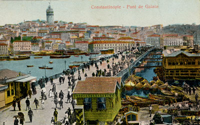
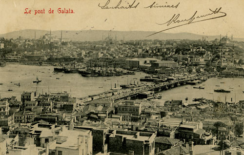
Constantinople, Pont de Galata
Looking from a street in Stambul (the Moslem side of Constantinople) across the Galata Bridge to Galata and the "European" side of the city. The Galata Tower is visible against the sky.
|
| Die Dardanellen book collection of Maggie Land Blanck | |
 |
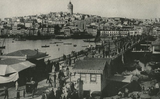
Constantinople, Pont de Galata 1912 Looking across the Galata bridge towards Galata and the Galata Tower from Stamoul.
|
| Postcard collection of Maggie Land Blanck | |
 | |
| National Geographic collection of Maggie Land Blanck | |
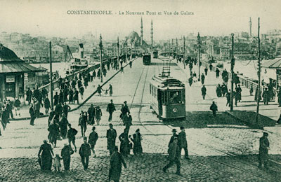
| Constantinople, Pont de Galata (Galata Bridge) and the Golden Horn,
1918 First built in 1845 and originally a pontoon bridge, the Galata Bridge was one of two bridges crossing the Golden Horn. The Golden Horn was for centuries the city's harbor where ships off loaded their cargos into the warehouses that lined its shore. In 1893 it cost "a penny" to cross the bridge on foot. Varying tolls were charged on animals, carriages, etc. The toll was ended in 1930.
| |
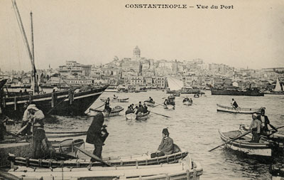 |
Vue du Port No date This "view of the port" (the Golden Horn) looks towards the European section of the city. The Galata Tower is in the center. |
| Postcard collection of Maggie Land Blanck | |
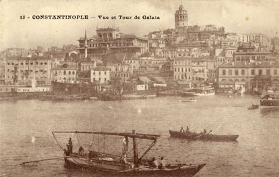 |
Constantinople, Vue et Tour de Galata No date
|
| Postcard collection of Maggie Land Blanck | |
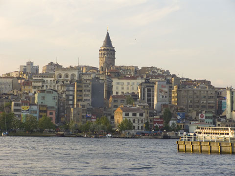 |
Galata and La Tour De Galata, Constantinople, 2005 |
| Photograph Eileen Claveloux, 2005 | |
 |
|
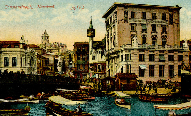
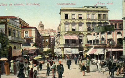
| Postcard collection of Maggie Land Blanck
Karakeui Place de Karakeui (Karakoy Square) is on the European end of the Galata Bridge. Karakoy is the modern name for the old Galata.
| |
 |
Another view of Karakoy Square |
| Collection of Maggie Land Blanck | |
 |
|
| Postcard collection of Maggie Land Blanck
Constantinople Place de Karakeui (Karakoy).
"There is no city in the world where so many different types of humanity meet and jostle each other and the stranger at every turn. Every nation in Europe is represented, and every nation of Asia as well." | |
 |
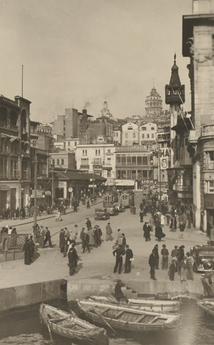
Place de Galata, Karakeuy (Karakoy) No postmark |
| Postcard collection of Maggie Land Blanck | |
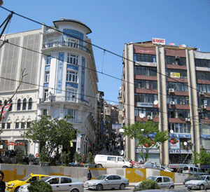 |
Place de Galata, Karakeuy (Karakoy), May 2008 Yusek Caldirim is a steep street that runs from Kayrakoy to Galipdede Street and then on to Istiklal Cadessi. It is the most direct route from the heights of Pera to the Galata Bridge. It can be seen in the background of the Karakoy postcards. From this photo one can get a sense of just how much the Place de Galata has changed. |
| Postcard collection of Maggie Land Blanck | |
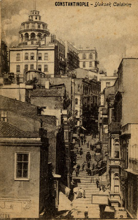 |
Constantinople- Yuksek Caldirim No date Several of the main thoroughfares of Galata are, in fact, staircases. |
| Postcard collection of Maggie Land Blanck | |
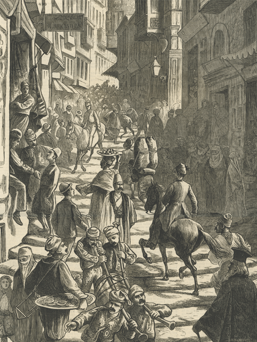 | |
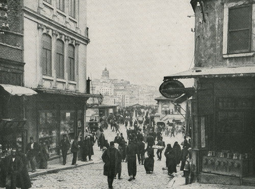
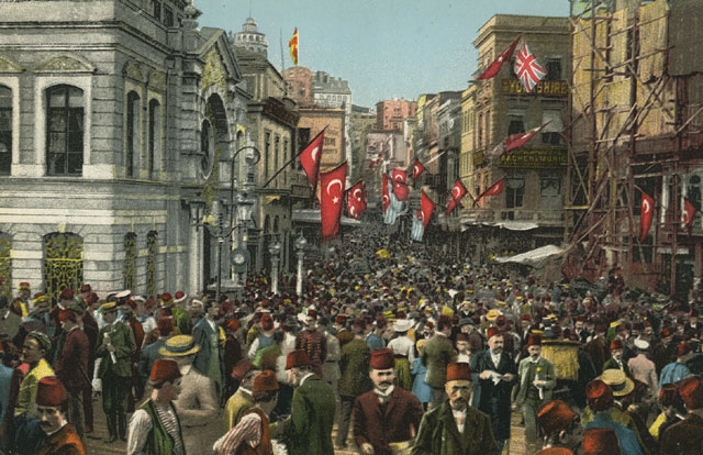
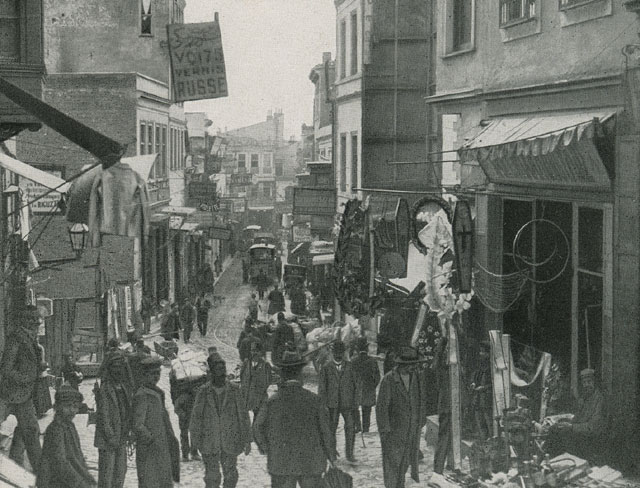
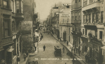
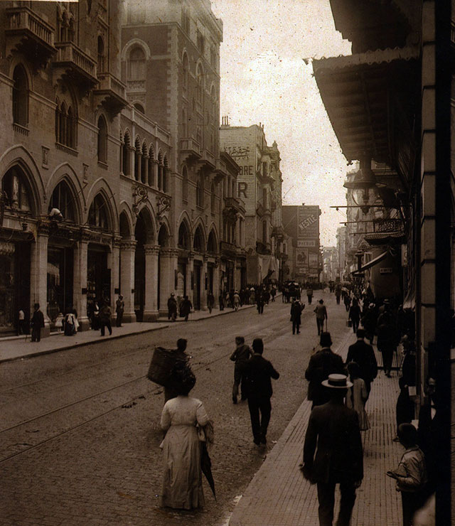
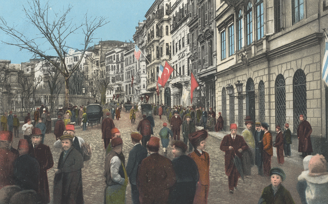
| Print collection of Maggie Land Blanck THE EASTERN QUESTION: THE GRAND RUE DE PERA - THE GRAPHIC MAY 13, 1876 The shop sign in the upper left reads N MELKENSTEIN According to A Guide to Constantinople, 1902, Meleknstein Bros. 517 Grand Rue de Pera, Tunnel Square were jewelers.
| |
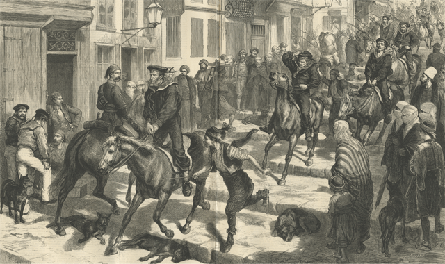 | |
| Print collection of Maggie Land Blanck THE BRITISH FLEET OFF CONSTANTINOPLE - "HORSE MARINES" IN THE STREETS OF PERA The Graphic April 6, 1878 Unfortunately, the text, which may have explained why these British soldiers are charging down the step street of Constantinople, was not included with the image. This image represents the presence of the British in Constantinople in the spring of 1878 as they attempted to bring to a close a war between Russia and Turkey. The Russians and Turks were traditional enemies. The wars between them were numerous. The war between Turkey and Russia from 1877-78 ended with the intervention of the British. England sent a fleet of battleships to Constantinople to keep the Russians from entering the city. Horse Marines were calvary soldiers assigned to a ship. | |
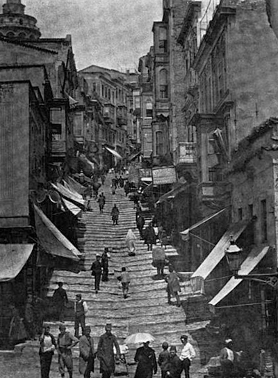 | |
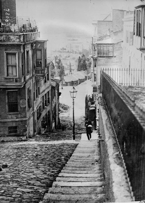
| The Yuksek Kalderin
| |
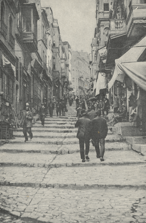 | |
| Print collection of Maggie Land Blanck Publication and date unknown.
"STEEP SHOP-LINED THOROUGHFARE LEADING TO PERA
| |
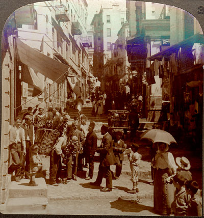 |
Shops and people on narrow up-hill street of steps in Pera, Constantinople |
On back of card
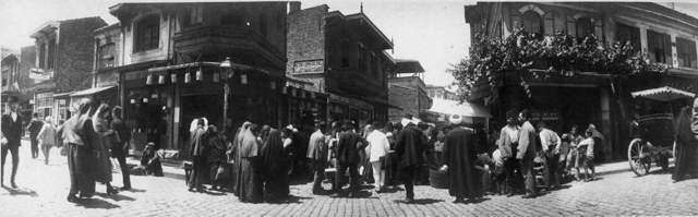
City Life | |
| Postcard collection of Maggie Land Blanck | |
 | |
| Postcard collection of Maggie Land Blanck
| |
 |
 |
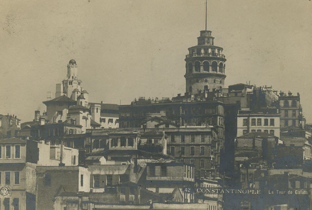
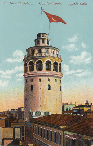
| Postcard collection of Maggie Land Blanck
Galata Tower |
Postcard collection of Maggie Land Blanck |
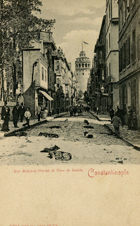
| Constantinople, Rue Boujouk-Hendek et Tour de Galata. No date The above two post cards show different views of Bukuk Kendek Street which runs from the Galata Tower to Yolcusade Iskender Street. Notice the large number of dogs lying in the street in the second picture. | |
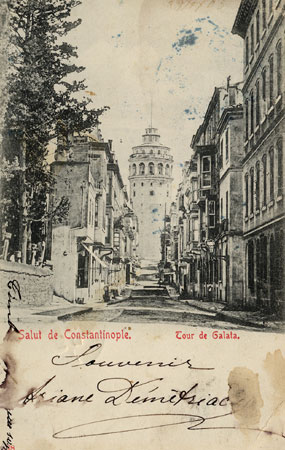
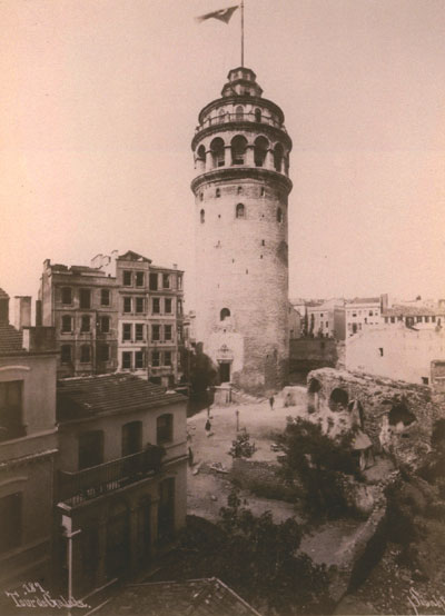
 |
La Tour De Galata, Constantinople |
| Postcard collection of Maggie Land Blanck | |
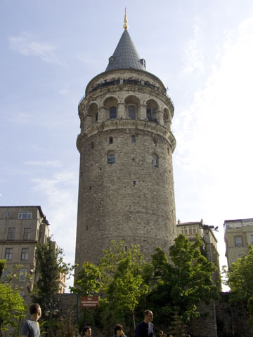
 |
La Tour De Galata, Constantinople |
| Photo collection of Maggie Land Blanck | |
 |
La Tour De Galata, Constantinople, 2005 |
| Photograph Eileen Claveloux, 2005 | |
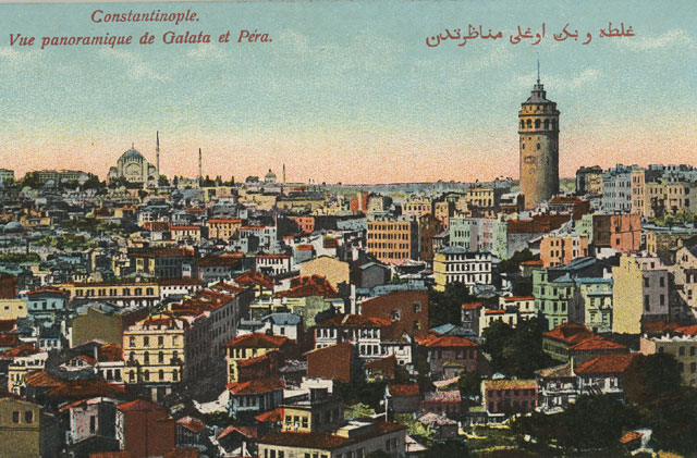 | |
| Postcard collection of Maggie Land Blanck Constantinople, Vue panoramique de Galata et Pera In 1914 the Azarian and Arevian families lived somewhere in the general area pictured in this postcard and the next photograph. See Abram Azarian. | |
 | |
| Postcard collection of Maggie Land Blanck, 2012 Constantinople, Pera In 1914 the Azarian and Arevian families lived somewhere in the general area pictured in this postcard and the next two photos. See Abram Azarian. | |
 | |
| INHA Biblirtheque Institut
national d'historie de'art Constantinople, Vue panoramique de Galata et Pera
| |
 | |
| gallica bibliotheque national de France Une rue pittoresque de Pera (Corne d'or)
| |
 |
|
| Die Dardanellen book collection of Maggie Land Blanck A street in Galata
| |
 |
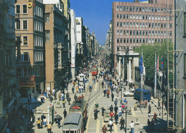
Grande rue de Pera No postmark The Grand Rue de Pera is now known as Istikal Caddesi. |
| Postcard collection of Maggie Land Blanck | |
 |
|
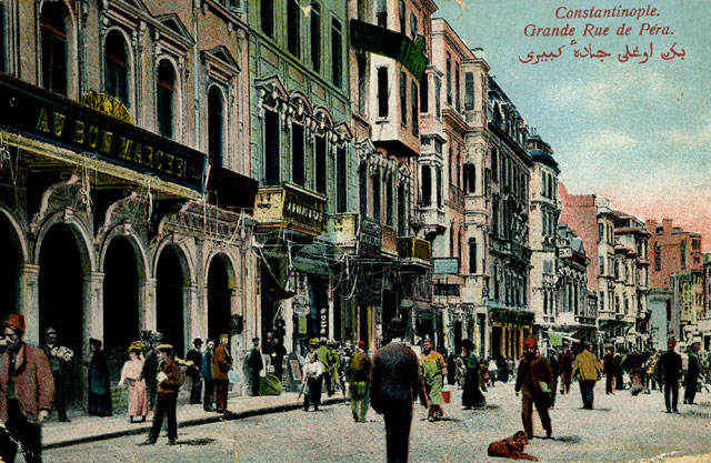
| Postcard collection of Maggie Land Blanck
Grand Rue de Pera Not posted | |
 |
|
| Postcard collection of Maggie Land Blanck
Grand Rue de Pera Not posted | |
 | |
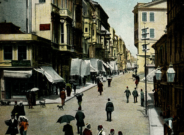
| Postcard collection of Maggie Land Blanck Constantinople, Grande Rue de Pera e Tarcho | |
 | |
| Postcard collection of Maggie Land Blanck, 2012 Constantinople, Grande Rue de Pera | |
 | |
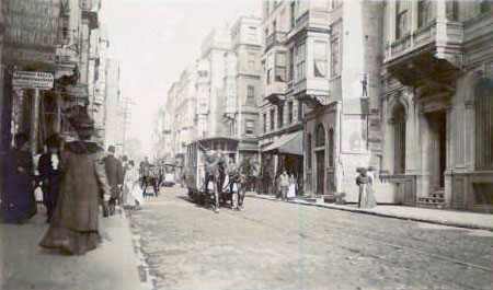
| Collection of Maggie Land Blanck, 2012, modern copy of
old stereo view Title: Grand Rue de Pera, Constantinople Creator(s): Underwood & Underwood, photographer Date Created/Published: c1912 July 26. | |
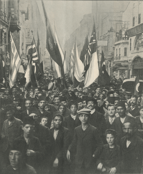 | |
| Print collection of Maggie Land Blanck THE BRIGHT SIDE OF TURKEY'S TROUBLES The Graphic October 17, 1908
"One of the most noteworthy features of the present crisis has been the extraordinary moderation and self-restraint shown by the Turks in the face of the wanton provocation offered the by Austria and Bulgaria........ Crowds, composed of all sorts and conditions of people, paraded the principle streets of Pera - the quarter in Constantinople were the foreign Ambassadors and Minsters reside."My aim is to highlight the city and its people. The history of the Ottoman Empire is complicated and many web sites have excellent pages on the events of 1908 and 1909.
| |
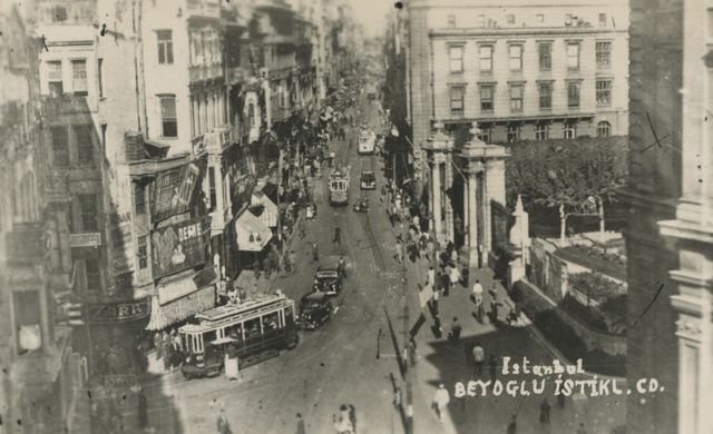 | |
| Print collection of Maggie Land Blanck Istanbul, Beyoglu, Istikl. Cd. Written in blue ink on reverse "Rue principal de Galata" Not dated.
| |
 |
|
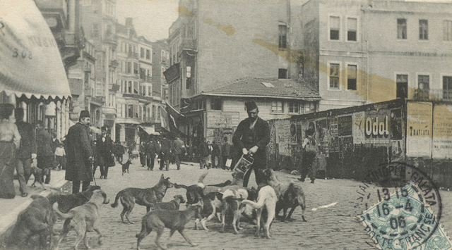
| Groupe de chiens dans la grande rue de Pera. Posted 1906
Collection of Maggie Land Blanck
Much has been written about the dogs of Constantinople. They roamed the streets of the city and lay in large packs interfering with traffic of all sorts. These dogs were without owners and were mongrels who breed, were born, and died on the streets. "With us it is customary for the dogs to withdraw to allow horses and people to pass by. There it is quite different, people, camels, horses, donkeys, and vehicles making sometimes quite a considerable circuit in order not to disturb the dogs: sometimes in one of the most crowded quarters of Stambul four of five of them, curled up fast asleep directly in the middle of the street will make the entire population turn out for half a day. And in Pera and Galata it is nearly as bad, only there it is done less out of respect for the dogs themselves than for their numbers. Were you to attempt to clear the road, you would have to keep up an uninterrupted series of blows and kicks form the moment you set out until your return."The dogs were scavengers who lived off the refuse in the streets. Apparently they spent most of their time sleeping in the middle of the streets where little disturbed them. At night they were known to howl and bark. Reportedly they were less numerous in Pera and Galata because there was less refuse on the streets. | |
 |
|
| Postcard collection of Maggie Land Blanck, 2011
" ISTANBUL TURKIYEThis is the former "Rue de Pera". | |
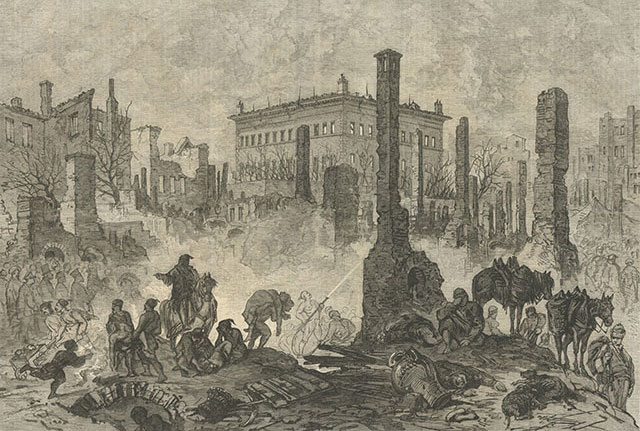 |
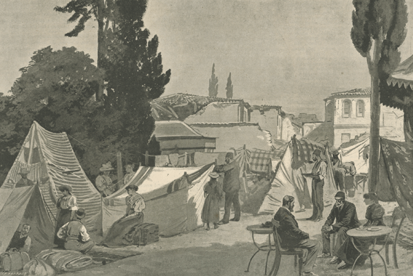
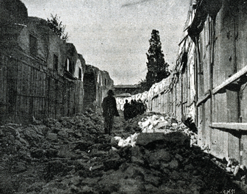
| Print collection of Maggie Land Blanck, June 2012 ILLUSTRATED LONDON NEWS, JULY 2, 1876 VIEW OF THE RUINS AFTER THE GREAT FIRE AT CONSTANTINOPLE A fire near the British Embassy destroyed "nearly the whole of Pera" on Sunday the 5th of June. "More than 3,000 dwellings or shops, occupying a space much exceeding one square mile, and including the residences of many wealthy families were entirely consumed." The number of lives lost was estimated between seven and nine hundred. The fire reported started in the Armenian quarter in Valide Tshesme street when a "little child" spilled a pan of burning charcoal on some stairs. A fierce gale quickly spread the fire among the wooden houses. The "conflagration" quickly spread to Feridje street and both sides of the Grand Rue de Pera. The walls of British Embassy was built of stone and so withstood the flames, although the roof was damaged. Most of the residence were in the country, and nearly all the Armenians had gone to Unkiar Skelessi*, to celebrate a national fete, the tenth anniversary of their civil and religious Constitution.*Hunkar Iskelesi is on the Eastern bank of the Bosporus. |
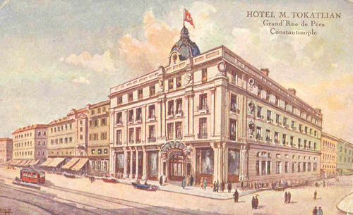 |
| Postcard collection of Maggie Land Blanck
Agatha Christie stayed here on her first trip to Constantinople. She used the hotel in the opening scenes in Murder on the Orient Express. The cliental of this 160 bed luxury hotel was mostly European. The Tokatlians, and Armenian family, owned several hotels and restaurants in Constantinople. |
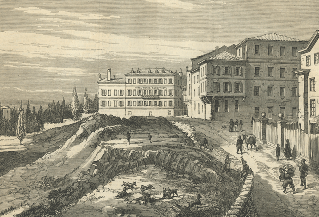 |
| Print collection of Maggie Land Blanck HOTEL AT PERA, OCCUPIED BY LORD SALIBURY AND HIS STAFF, THE CONFERENCE AT CONSTANTINOPLE, THE ILLUSTRATED LONDON NEWS, DEC 25, 1876
|
 |
| Print collection of Maggie Land Blanck VIEW FROM LORD SALISBURY'S HOTEL AT PERA, THE ILLUSTRATED LONDON NEWS, DEC 25, 1876 Frances Elliott born in England in 1820 was a popular travel writer of her day. She wrote several "Diary of and Idle Woman" including Diary of an Idle Woman in Constantinople. She describes her approach to the Hotel Royal by horse back in 1893. "As we approach the summit of the Pera Hill, the beggarly shops die out, and some stone houses and a few graceful villas in gardens, belonging to wealthy Greeks, appear: a dismal casino also owing all to its prospect over the Golden Horn: and a last, a really decently appointed street, the precursor to the Grand Rue di Pera. (I say this relatively, as in comparison to what we have been traversing some half-hour on the steep hill.)Elliott describes the Grand Rue de Pera as "long, irregular, flimsy street, with shops of the most inferior quality. The noise of the crowd, from every European nation is deafening. The aspect vulgar." Mrs. Elliott was clearly a snob and a bigot. But her account of the city is colorful. |
 |
| Postcard collection of Maggie Land Blanck
Constantinople, Le Petits Champs Le Petit Champs was lined with European style hotels that provided great views of the city. The street is now called Mesrutiyet Cd. |
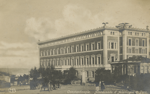 |
| Postcard collection of Maggie Land Blanck
Constantinople Ambassade d'Allemagne a Pera ( The German Embassy at Pera) |
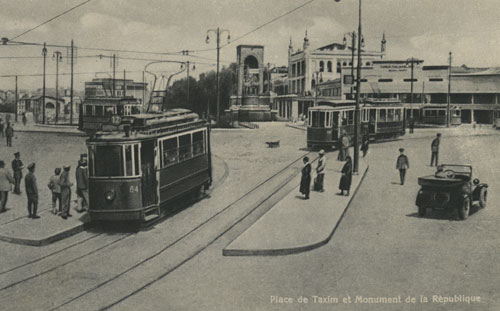 |
Place de Taxim et Monument de la Republique |
| Postcard collection of Maggie Land Blanck | |
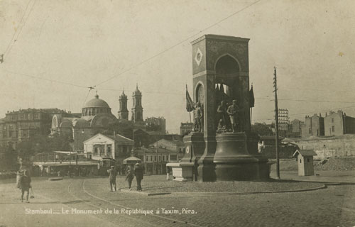 |
Stamboul--- Le Monument de la Republique a Taxim, Pera |
| Postcard collection of Maggie Land Blanck | |
 |
| Postcard collection of Maggie Land Blanck Constantinople A very similar photo was included in an article in Sky Life (Turkish Airlines, May 2005) about Galata. "Büyük Hendek Street, one of those created when the defense wall were demolished". I don't known when the walls were demolished but it was before 1875. |
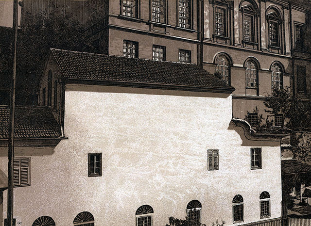 |
| Collection of Maggie Land Blanck, 2012 Constantinople, Hospice of Our Lady of the Seven Sorrows (Hospice de sept douleurs de la S. V. or Chapelle Notre-Dame des Sept-Douleurs). The hospice and its chapel are located in Pera. In the year 1548 the Sacred Guardianship erected a house for the purpose of keeping there a person to look after the affairs of the Holy Land at the Port*. The house was twice burned and twice rebuilt.*The Sublime Porte - the Ottoman court.
|
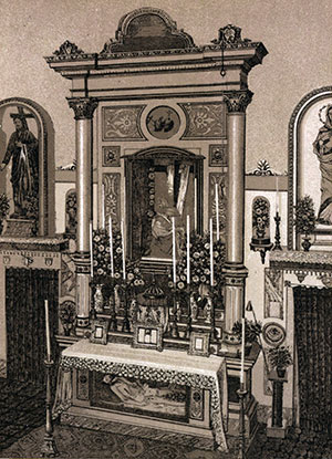 |
| Collection of Maggie Land Blanck, 2012 Constantinople, Interior of the Chapelle at the Hospice of Our Lady of the Seven Sorrows. This was the private chapel of the Sacred Guardianship and was considered a auxiliary to the Latin mission of Constantinople. |
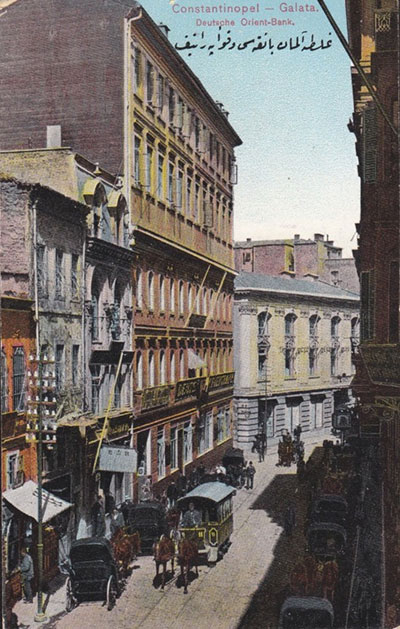 |
Deutche Orient Bank, Rue Voyvoda (now Bankalar Cd) |
| 2012 | |
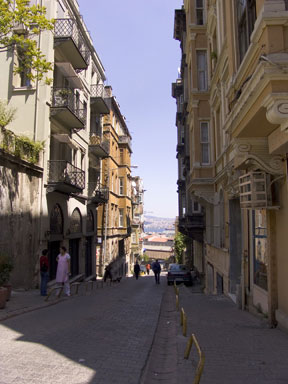 |
Constantinople A street in Galata, 2005 |
| Photograph Eileen Claveloux, 2005 | |
|
Tophane Tophane is a section of Beyoglu along the coast of the Bosporus in Istanbul | |
 | |
| Courtesy Lyndon Comstock, June 2014
| |
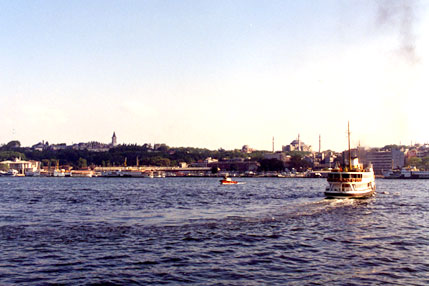
| The Golden Horn and the Waterfront | |
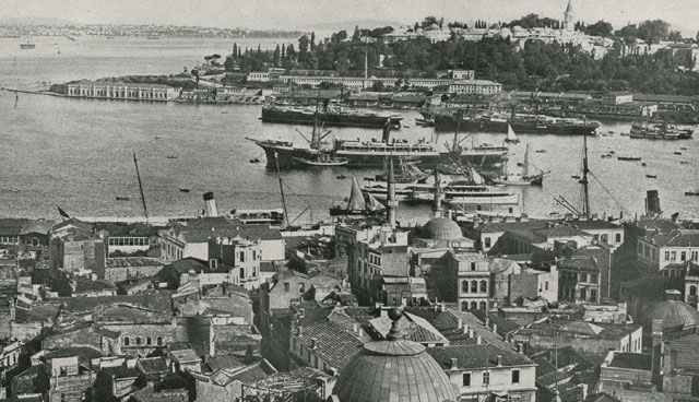 | |
| Died Dardanellen book collection of Maggie Land Blanck Constantinople A view of the entrance from the Bosporus to the Golden Horn. Beyoglu is at the bottom of the picture. The Seragio Point and the Topkapi Palace are at the top right.
| |
 |
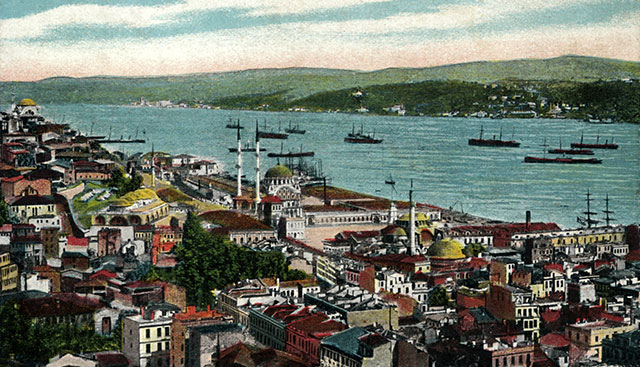
Constantinople. Vue de Galata No date. |
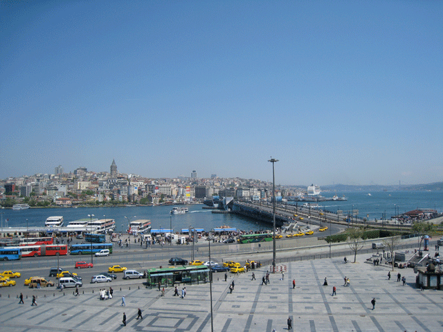
| Postcard collection of Maggie Land Blanck This overview shows part of the Moslem section on the bottom of the picture. In the middle are the Galata Bridge and the Golden Horn, with the Galata Tower on the left. To the right is the Bosporus. | |
 | |
| Close up of above post card focusing on the Galata/Pera/Beyoglu section of the city. While the Galata Bridge appears a barrier it could open to let large ships into the area between the Galata Bridge and the Old Bridge further up the Golden Horn. | |
 |
|
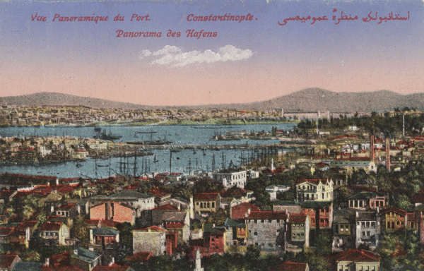
| Postcard collection of Maggie Land Blanck
Vue Panoramique du Port - Constantinople I do not know from what vantage point this picture was taken. | |
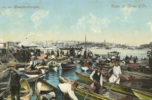 |
|
| Postcard collection of Maggie Land Blanck
Dans la Corne d'Or. No date. This view is towards the Galata bridge. Notice the Galata Tower in the distance on the right. | |
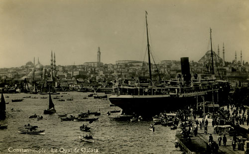 |
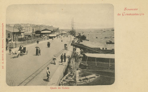
Quai de Galata No date
|
| Postcard collection of Maggie Land Blanck | |
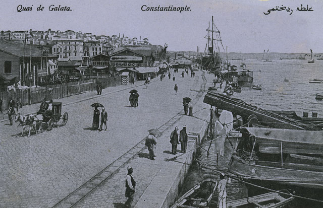
 |
Quai de Galata No date
|
| Postcard collection of Maggie Land Blanck | |
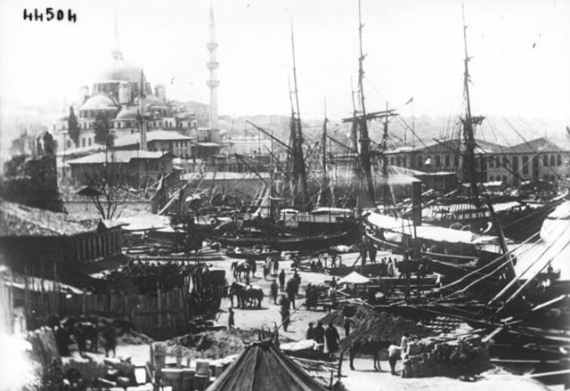
 |
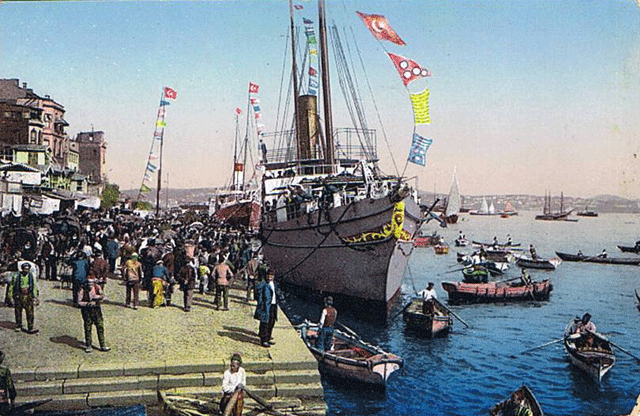
The docks Galata |
| Die Dardanellen book collection of Maggie Land Blanck Family history says that Abraham Azarian was a "purchaser for the French Lines" in Constantinople. Surely he spent time on the docks of the city. The Galata docks (Quai de Galata) were at the foot of the Galata hill on the Outer Harbor (Bosporus side of the Galata Bridge). | |
 |
Pascal Juven shared this postcard in June 2010.
He wrote:
"My county La Drôme is the region of France which has the biggest Armenian community in France, in the cities of Romans and Valence." |
 | |
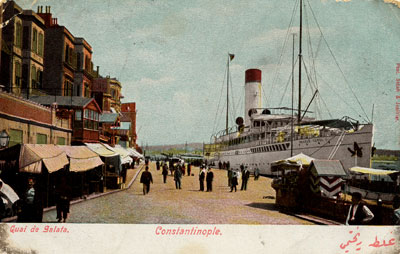
| Postcard collection of Maggie Land Blanck Constantinople, Quais de Galata | |
 | |
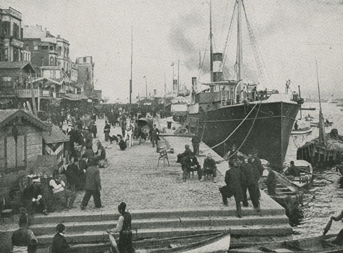
| Postcard collection of Maggie Land Blanck Constantinople,Quai de Galata
| |
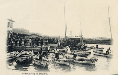 |
Constantinople. Landungssteg in Stambul. Post marked 1909 |
| Postcard collection of Maggie Land Blanck | |
 |
Vue de la Donana de Stamboul (View of the Customs House) No date
|
| Photo collection of Maggie Land Blanck | |
 |
|
| gallica bibliotheque national de France | |
 | |
| Photo collection of Maggie Land Blanck The Golden Horn, Constantinople
| |
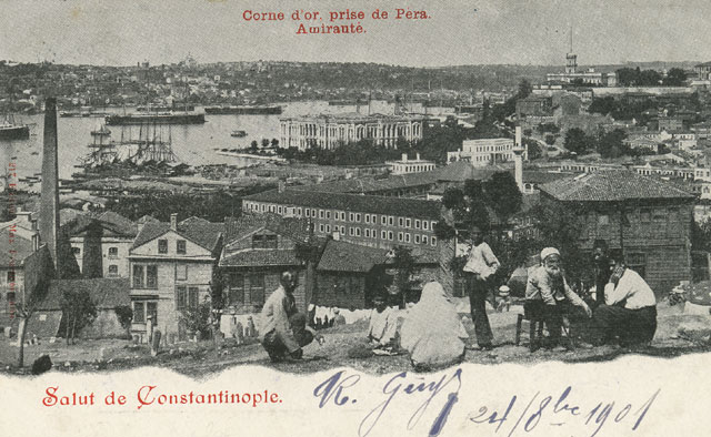 | |
| Postcard collection of Maggie Land Blanck Constantinople, Corne d'or prise de Pera, Amiraute (Golden Horn from Pera, Admiralty)
| |
| American Embassy | |
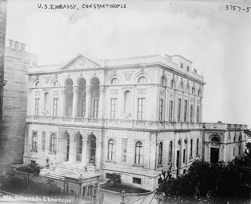 | |
| Copy of original from Amazon Aug 2011 The American Embassy
| |
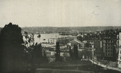 | |
| Paper collection of Maggie Land Blanck. From Work, April 1918 Constantinople from the American Embassy. "Showing (in the center of the picture) the building of the Ministry of Marine on the famous Golden Horn with the city below." This picture was taken from a slightly higher position on the hill than the picture above. | |
| Other Views | |
 |
Constantinople. Le Cimetiere d'Eyoub et la Corne d'Or. (The Cemetery of Eyoub and the Golden Horn). No date |
| Postcard collection of Maggie Land Blanck | |
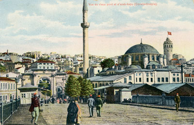 |
Vue du vieux pont et d'azab-kapu, Constantinople (View of the old bridge and azab-kapu) No date The old bridge looking towards Galata. Note the Galata tower in the upper right. |
| Postcard collection of Maggie Land Blanck | |
| Along the Bosporus | |
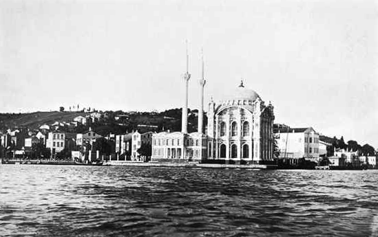 | |
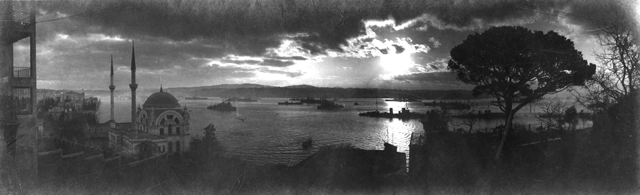
| Photo courtesy of Martin Sachse and
www.andystreasuretove.com 2011
Ortakoy Mosque which is just up the Bosporus (toward the Black Sea) from the city of Istanbul. | |
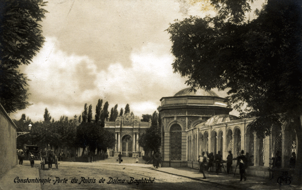 | |
| Postcard collection of Maggie Land Blanck, 2011 Constantinople - Porte du Palais de Dolma Baghtche
| |
 | |
| Photo courtesy of Martin Sachse and
www.andystreasuretove.com 2011 Dolma Boghtche from the Bosporus
| |
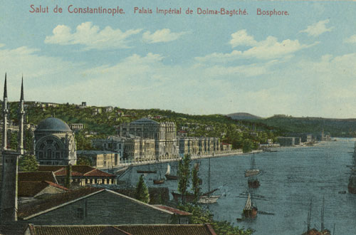 | |
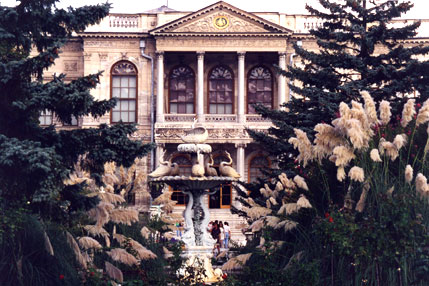
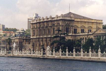
| Postcard collection of Maggie Land Blanck Constantinople, Palais Imperial de Dolma-Bagtche, Bosphore The Dolmabahce Palace is on the Bosporus below Taxim. Alice Azarian said that she and her sisters used to play in the gardens near the palace. | |
 |
Istanbul, Dolmabahce Sarayin Kapusu No postmark |
| Postcard collection of Maggie Land Blanck | |
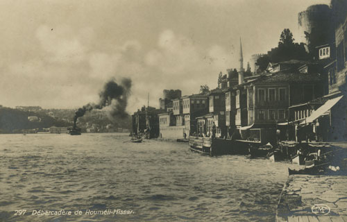 |
Debarcadere de Roumeli-Hissar No postmark. The Bosporus connected Constantinople to the Black Sea. Boats stopped at many places along the shore. |
| Postcard collection of Maggie Land Blanck | |
 |
| Postcard collection of Maggie Land Blanck
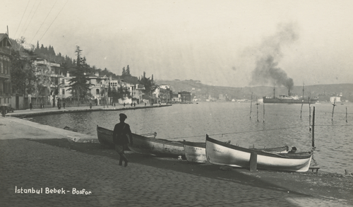
Istanbul Bebek Bebek is a wealthy neighborhood of Istanbul located along the Bosphorus between the old and new bridges from the European to Asian sides of the city. |
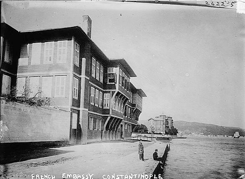 | |
| Copy of original from Amazon Aug 2011 The French Embassy
| |
| Stambul, The Moslem Section of the City | |
 |
|
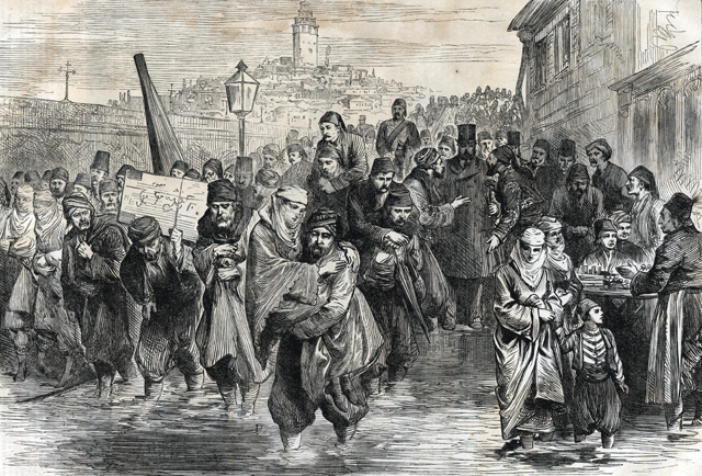
| Print collection of Maggie Land Blanck, 2011 HEAVY RAINS IAT CONSTANTINOPLE - THE PEOPLE GOING TO HEAR THE READING OF THE CONSTITUTION HARPERS WEEKLY, February 24, 1877
RAIN IN CONSTANTINOPLEMany residents of the city were curious about both events and tried to go from Pera to Stamboul. Apparently heavy rains the previous evening had flooded the area at the end of the Galata bridge on the Stamboul side forcing those on foot to either wade through or be carried. The carriers were paid for their service. Notice the two men haggling with the well dressed heavyset gentleman. People on horseback or in carriages were spared the indignity. | |
 |
La pont de Galata Posted 1905
|
| Postcard collection of Maggie Land Blanck | |
 |
Constantinople, Le Nouveau Pont et Vue de Galata Looking towards the New Mosque and the bazaar from the "European" side of the Golden Horn No date |
| Postcard collection of Maggie Land Blanck | |
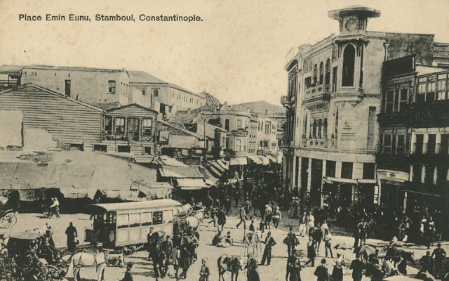 | |
| Postcard collection of Maggie Land Blanck
Place Emin Eunu Stamboul, Constantinople. No postmark The Emin Eunu Square was at the Stamboul side of the Galata Bridge. | |
 |
|
| Die Dardanellen, book collection of Maggie Land Blanck
Another view of Emin Euno Square with the New Mosque (Yeni Cami) | |
 |
|
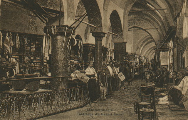
| Postcard collection of Maggie Land Blanck
Un des portes du Grand Bazar, Constantinople | |
 |
|
| Postcard collection of Maggie Land Blanck
Interieur du Grand Bazar, Constantinople | |
 |
|
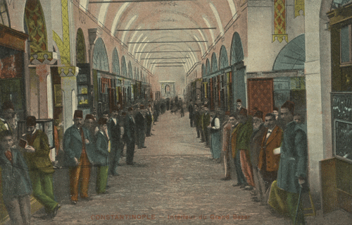
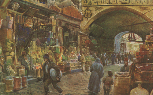
|
Collection of Maggie Land Blanck Grand Bazaar | |
 |
|
|
Collection of Maggie Land Blanck Stamboul. Bazar Fgyptien | |
 |
Entrance to Souks, Constan. 1918 |
| Lantern slide. Collection of Maggie Land Blanck | |
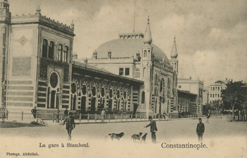 |
|
| Postcard collection of Maggie Land Blanck
La gare a Stamboul, Constantinople | |
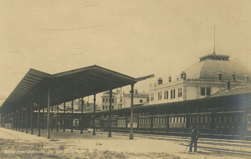 |
|
| Postcard collection of Maggie Land Blanck
Gare des Chemins de fer Orenteax de Constantinople | |
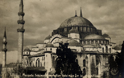 |
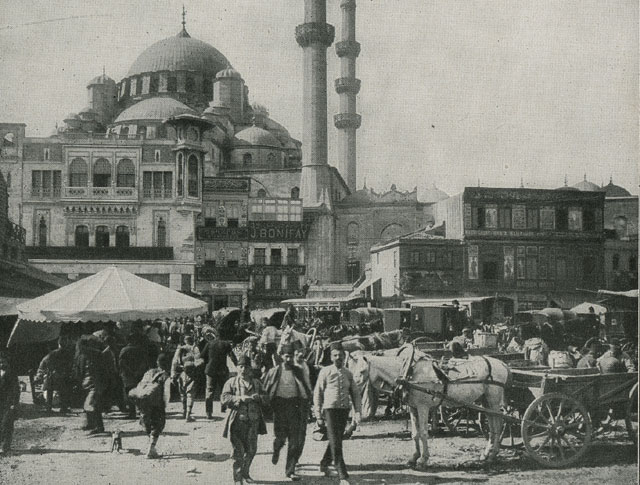
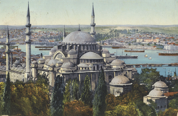
Suleiman Mosque. No date |
| Postcard collection of Maggie Land Blanck | |
 |
|
| Postcard collection of Maggie Land Blanck Suleiman Mosque. Posted from Pera to London, England 1909. The Sulieman Mosque overlooks the Golden Horn. The Galata Bridge is visible in the middle right. | |
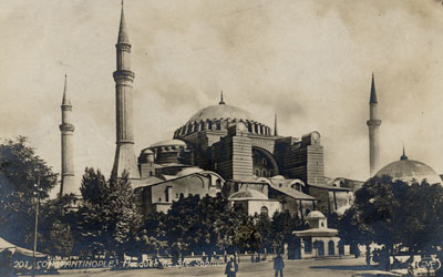 |
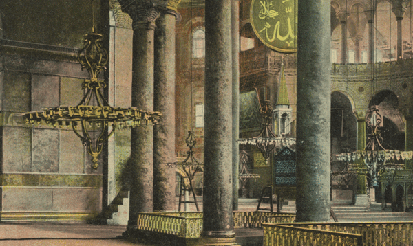
Ste Sophie. No date |
| Postcard collection of Maggie Land Blanck | |
 |
|
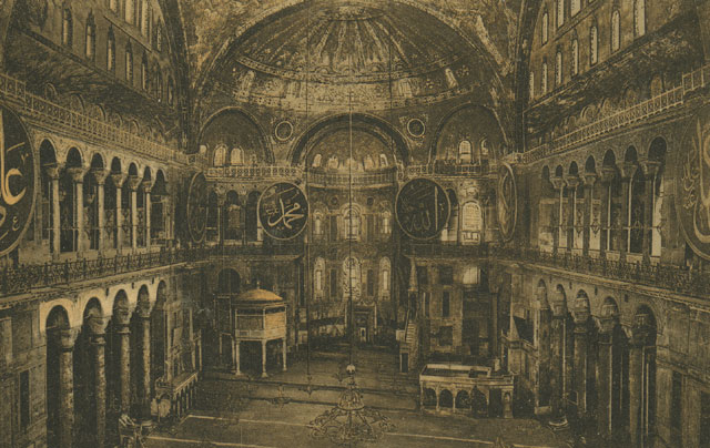
| Postcard collection of Maggie Land Blanck
Interieur de S.te Sophia, Constantinople | |
 |
|
| Postcard collection of Maggie Land Blanck Interieur St. Sophie | |
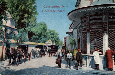 |
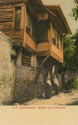
Constantinople. Chehzade Bachi. No date. |
| Postcard collection of Maggie Land Blanck | |
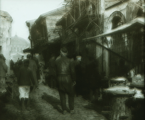
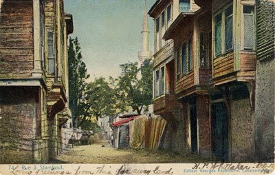 |
Rue a Stambul No date |
| Postcard collection of Maggie Land Blanck | |
 |
 |
| Postcard collection of Maggie Land Blanck Two postcards of the same view.
| |
| People of Constantinople | |
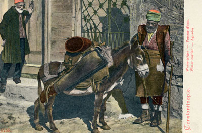 |
Water carrier
No date |
| Postcard collection of Maggie Land Blanck | |
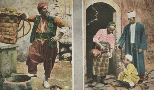 |
| Postcard collection of Maggie Land Blanck
Marchand de melons et Machand d'eau (Mellon merchant and water merchant) |
 |
|
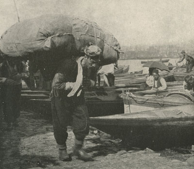
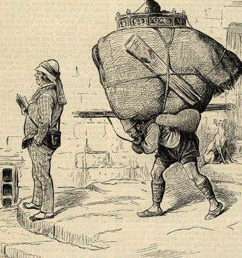
| Photo collection of Maggie Land Blanck Hamal or street porter. According to a National Geographic article of December 1914, most of the street porters were Kurds or Asia Miner Turks. Another National Geographic article from May 1915 says that the hamals had strong organized unions entirely controlled by the Kurds. Hamals proceed at a steady pace and carry everything from crates of chickens to up right pianos on their backs. | |
 |
|
| Print collection of Maggie Land Blanck Street Scene 1857 | |
 |
Bread vender, Constantinople |
| Photo collection of Maggie Land Blanck | |
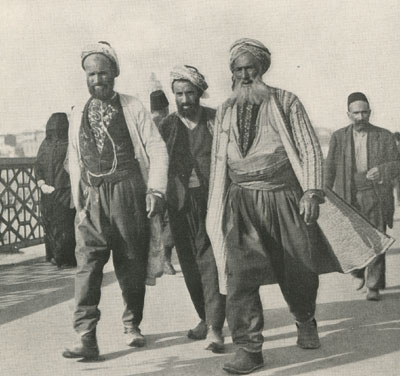 |
Turkish Gentlemen of the Old School, Constantinople |
| National Geographic May 1915, collection of Maggie Land Blanck | |
 |
| Collection of Maggie Land Blanck
An Armenian Scribner's 1893 |
 |
Harem Life in Turkey IV Fashions Past and Present, from sketches by a lady resident at Constantinople, |
| The Graphic, August 26, 1876, collection of Maggie Land Blanck | |
| Animals | |
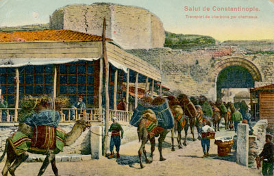 |
Salut de Constantinople Transport de carbons par chameaux Post marked 1913 |
| Postcard collection of Maggie Land Blanck | |
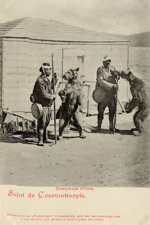 |
Bear Tamers
No date I love this postcard. When Tom and I were in Istanbul in 1969 we saw dancing bears. |
| Postcard collection of Maggie Land Blanck | |
 |
Les Chiens de rue (Street dogs)
Post marked 1909 When Tom and I were in Istanbul in 1969 there were still lots of street dogs. |
| Postcard collection of Maggie Land Blanck | |
 |
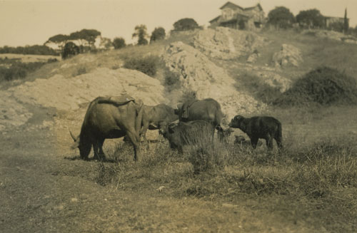
Chalot Turo (Bull Cart)
No postmark
|
| Postcard collection of Maggie Land Blanck | |
 |
|
| Photo collection of Maggie Land Blanck | |
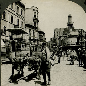 |
From the back in part: The streets are made of rough cobblestones over which long-horned oxen pull their heavy carts. Donkeys with panniers strapped to their backs, go in single file, guided by a Turkish driver. Most of the people are Turks, but the population is made up of Armenians, Bulgarians, Greeks, Jews--- almost every race is represented. |
| Stereo card collection of Maggie Land Blanck | |
| The Sweet (Fresh) Water of Europe | |
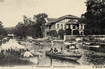 |
Eaux douces d'Europe
No date The eaux douces d'Europe were where a fresh water river entered the Golden Horn. |
| Postcard collection of Maggie Land Blanck | |
| Further Along the
Bosporus To escape the foul summer air in the city many wealthy people in Istanbul had summer retreats along the Bosporus and on various islands in the waters surrounding the city.
| |
 |
|
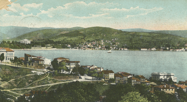
| Postcard collection of Maggie Land Blanck
"Salut de Constantinople - Bosphore Vue de Yenikevy et de Beycos" (Bosporus view of Yenikoy and Beykoz) Beykoz is on the Asian side of the Bosporus and Yenikoy is opposite on the European side. They are situated above the second bridge on the way to the Black Sea.
Mailed to France in 1906
| |
 |
|
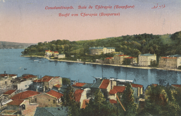
| Postcard collection of Maggie Land Blanck Constantinople - Buie de Therapia (Bosphore) (Therapia Cove, Bosphorus) Tharapia Cove is situated above the second bridge on the way to the Black Sea. | |
 |
|
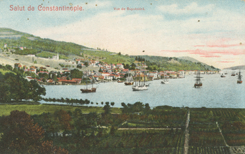
| Postcard collection of Maggie Land Blanck Vue de Buyukdere Buyudere is on the European coast of the Bosporus above the second bridge. | |
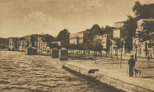 |
|
| Postcard collection of Maggie Land Blanck BOSPHORE Buyukdere - Vue de Quai
| |
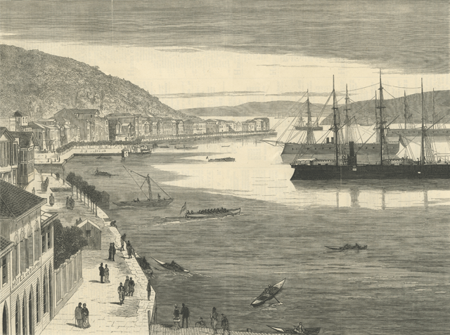 |
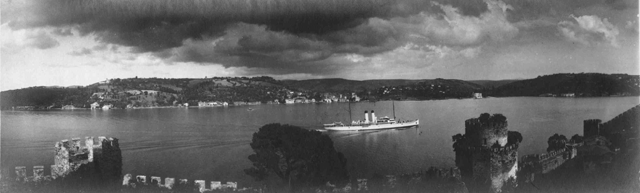
|
| Postcard collection of Maggie Land Blanck THE GRAPHIC MAY 5, 1871 - THE WAR IN THE EAST - TURKISH IRONCLADS AT BUYUKDERE The Azarian family had a summer home in Buyukdere. See Azarian
| |
| Earthquake July 10, 1894 Istanbul was hit by a sizable four shock earthquake between the 10th and 11th of July 1894. On July 10 an earthquake induced tsunami arose around the Prince Islands causing the sea to inundate the golden Horn, flooding the area around the harbor and other low lying areas of the city and damaging many small boats. The bridges across the golden Horne were under water. There was extensive damage along the coast between Istanbul and Adapazari where many villages were totally destroyed with a large loss of life. The earthquake itself caused much damage in the city toppling parts of the great walls of Theodosian (408-450) and causing major damage to the Grand Bazaar and other public buildings. Hundreds of lives were lost. At Pera four houses collapsed and many were damaged. Five people died. At Galata many houses and shops were damaged and ten people died. There was a lot of damage at Prinkipo in the Princess Islands. Towns along the Bosphorus "Generally escaped without much damage." (The Graphic). No English or Americans were reported killed. See Istanbul: a brief seismic history
|
 |
|
| Collection of Maggie Land Blanck Images of the 1894 Istanbul earthquake from the Illustrazione Populare - Giornale per la Famiglie |
 |
|
| Collection of Maggie Land Blanck The Graphic August 4, 1894
|
 |
|
| Collection of Maggie Land Blanck THE RESTAURANT AT THE GRAND BAZAAR The Graphic August 4, 1894
|
 |
|
| Collection of Maggie Land Blanck THE RUE SARACHCHE The Graphic August 4, 1894
|
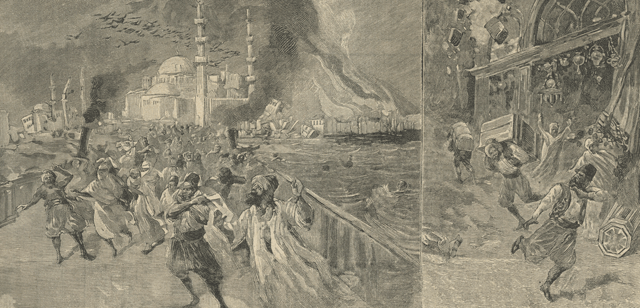
| Armenian Riots Constantinople 1895 See 1895-1896 and The Genocide
|
| Capture of Constantinople, April 1909
|
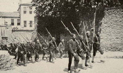
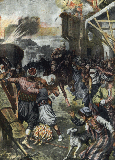
| In April 1909 Constantinople was captured by Macedonian
troops under the command of the Young Turks. The sultan, Abdul Mamit, was deposed and
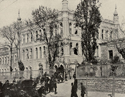
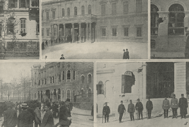
replaced by Mehmet V and the parliament and constitution were restored. It was the Young Turks who later undertook the attempt to exterminate the Armenians. The following three photos were taken from an article published by Scribners in 1909. It appears that the "capture" was relatively easy but there was firing in Pera and Taksim, the section of the city were the Azarians lived. According to the article many people fled the city. In connection with Taxime (Taksim) it says: "By the time I reached the vicinity of the Taxime artillery barracks, however, there were other reminders. I saw an iron shutter nearly perforated by dozens of small round holes. The windows of houses, in otherwise good repair, were riddled and broken. Walls were curiously pockmarked, and I saw a shell embedded in one."The article indicates that the barracks were near the Taksim Gardens.
|
 |
"Macedonian volunteers"
|
| Article in the collection of Maggie Land Blanck | |
 |
"Taxime atillery barracks shelled April 24" Taxime = Taksim |
| Article in the collection of Maggie Land Blanck | |
 |
"Mahmet V driving through
Stambul on his Accession Day" April 27, 1909 |
| Article in the collection of Maggie Land Blanck | |
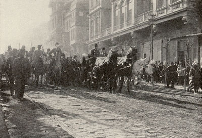
| The Illustrated London News of May 8, 1909 also covered the story. They
reported dead soldiers and horses on the streets of Pera.
The following images were taken from the Illustrated London News of May 8, 1909
| |
 |
|
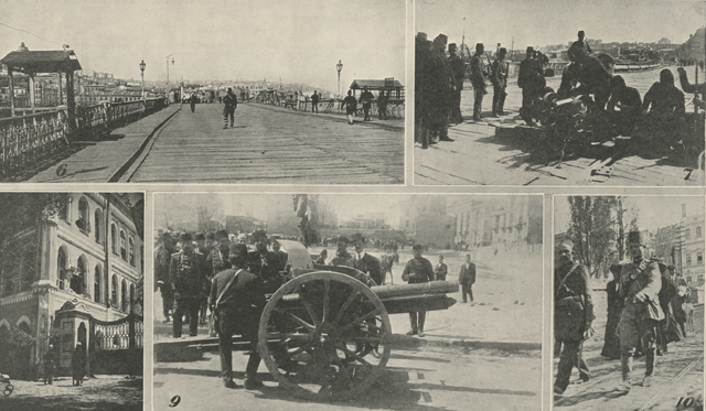
| Collection of Maggie Land Blanck THE ILLUSTRATED LONDON NEWS MAY 8, 1909 1. Damage don to a private house by the fire of the Young Turk's army. | |
 |
|
| Collection of Maggie Land Blanck THE ILLUSTRATED LONDON NEWS MAY 8, 1909 6. The Galata Bridge empty and in a state of siege for the first time. | |
 |
|
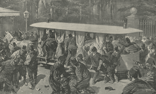
| Collection of Maggie Land Blanck THE ILLUSTRATED LONDON NEWS MAY 8, 1909 TRAMS AS AMBULANCES: PLACING MEN KILLED IN THE FIGHTING ON A CAR | |
 |
|
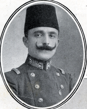
| Collection of Maggie Land Blanck THE ILLUSTRATED LONDON NEWS MAY 8, 1909 ENVER BEY
" Enver Bey is the idol of the Young Turk party. He is young, handsome, and very particular about his appearance, having been described as the "most elegant officer of the Ottoman army." An admiring crowd follows him whereever he goes, with shouts of acclamation. His portrait... (and that of others) ... has been on sale in the streets of Constantinople .... as "heros of liberty."Enver, Bey (also Ismail, Pasah and Efendi) was tried in absentia in the Turkish Courts-Martial of 1919-20 for crimes of "plunging the country into war without a legitimate reason, forced deportation of Armenians and leaving the country without permission" and condemned to death.* * This information comes of the Internet where things can be repeated hundreds of thousands of times without a real reference. | |
 |
|
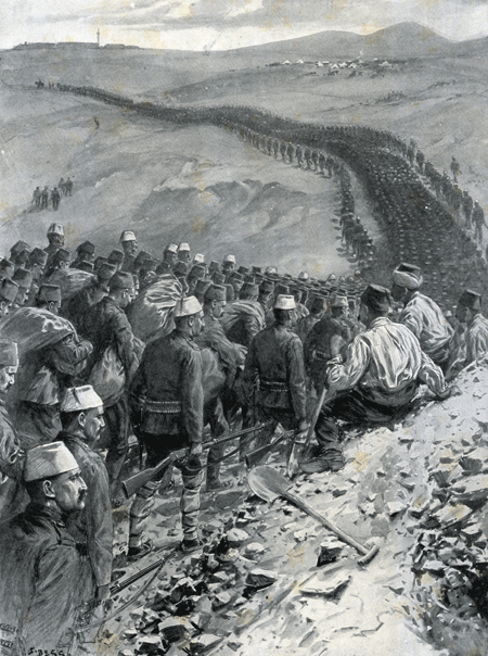
| Collection of Maggie Land Blanck 2500 PRISONERS AND SPIES; THE ARMY OF SHAME PASSING A GREAT TRENCH FRO THE DEAD: PRISONERS TAKEN BY THE YOUNG TURK ARMY BEING MARCHED OUT OF CONSTANTINOPLE "The Young Turk forces took many prisoners. Witness this illustration of some two thousand five hundred soldiers being marched out of Constantinople to the rail-head, that they may be tried and their fate decided. Describing his sketch, our correspondent says: "some of the men walked four abreast: some six. They were divided into groups, according to their regiments. The sketch shows prisoners (soldiers of various regiments from the capital). The disloyal Salonica men, bound together, being in front. Many carried bundles, and almost all looked dejected and pitiable. They were marched past a hugh trench which men were in the act of digging for the bodies of those who were killed in Saturday's fight.The prisoners wore their uniforms." THE ILLUSTRATED LONDON NEWS MAY 8, 1909
| |
| Bombing of Constantinople by the British April 1916
| |
 | |
| Newspaper collection of Maggie Land Blanck | |
| La Tribuna Illustrata, 30 April 7 May, 1916 "Aeroplani inglesi, durante un arditissimo raid, hanna bombardato Constantinopoli" (English airplanes, during a daring raid bombed Constantinople) See Turkey in the First World War, Aviation "The first air raid on Istanbul came on 12 April 1916, when two British aircrafts departing from Imbros dropped a total of 11 firebombs on the munitions plant in Zeytinburnu and on the aircraft hangars in Yesilkoy, as well as propaganda leaflets on the city itself. It was a small squadron, with limited armament capacity and apparently its aim was not inflict damage on the city, but to give the message that Istanbul was not untouchable." | |
| An Overview of the City With the European
Section on the Left Top
| |
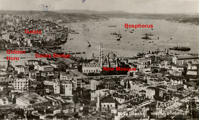 | |
| Postcard collection of Maggie Land Blanck | |
| Istanbul. No date. | |
| Pictures from The Graphic,
July 2, 1882 titled "THE CRISIS IN THE EAST: SKETCHES AT CONSTANTINOPLE" |
 |
The indispensable hamals |
 |
"Guarda!" and absent minded tourist |
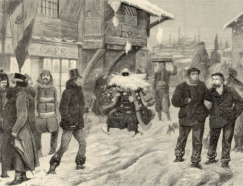 |
An avalanche in the Grande Rue in winter |
| Images Courtesy of Armen Gurekian
| |
 |
|
| Courtesy of Armen Gurekian, August 2010 | |
 |
|
| Courtesy of Armen Gurekian, August 2010 | |
 |
|
| Courtesy of Armen Gurekian, August 2010 | |
 |
 |
| Courtesy of Armen Gurekian, August 2010 |
| Scutari
| |
 |
Scutari, Turkey Scutari is the section of Istanbul that is on the Asian side of the Bosporus. |
| Print collection of Maggie Land Blanck | |
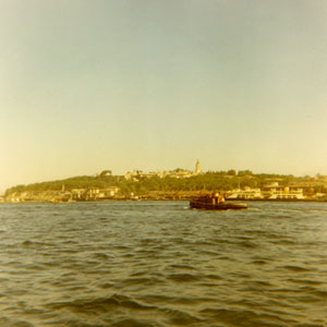
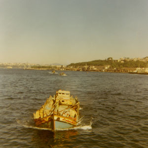
| Istanbul, 1969 | |
| The following photos were taken when Tom and I were in Istanbul in 1969. | |
 |
 |
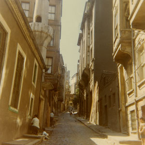
| One of the streets in the Beyoglu section of the city. | Hamals |
 |
 |
| The Hagia Sophia | The Blue Mosque |
 |
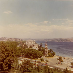
 |
| The Bosporus | The Bosporus |
 |
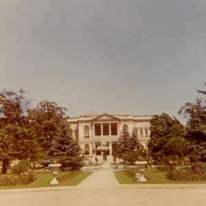 |
| Dolmabahce Palace | Dolmabahce Palace |
| Istanbul 1995 |
| The following photos were taken when Tom and I were in Istanbul in 1995 |
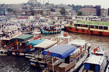 |
| Near the Galata Bridge/td> |
 |
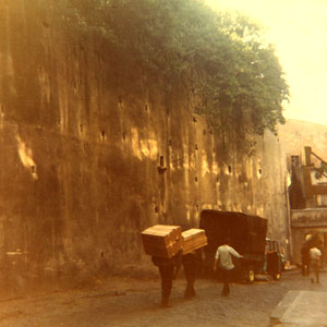
| A Hamal's Pack |
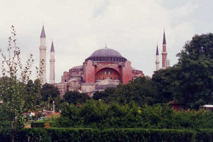 |
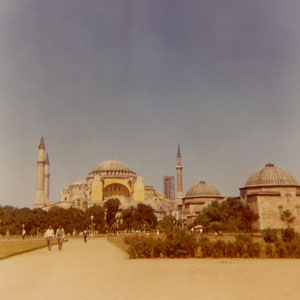
| The Hagia Sophia |
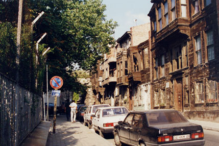 |
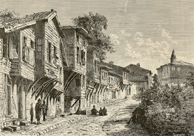
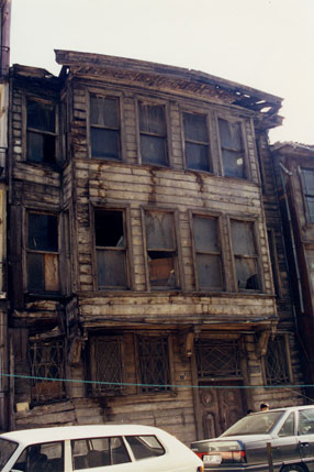
| Istanbul was once filled with ornate wooden houses. Many were still standing in good condition when Tom and I were there in 1969. Unfortunately, most of them have been torn down and replaced with very ugly cement buildings. There are still a few scattered shambles of the old buildings. Several, including the hotel we stayed at, have been restored. |
 |
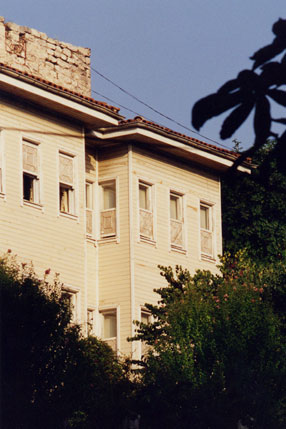 |
| Another Wooden House | Our Hotel |
 |
| Mosques |
 |
| The Bosporus |
 |
| Dolmabahce Palace |
 |
| Dolmabahce Palace |
| Istanbul 2008 |
| The following photos were taken when Tom and I were in Istanbul in 2008 |
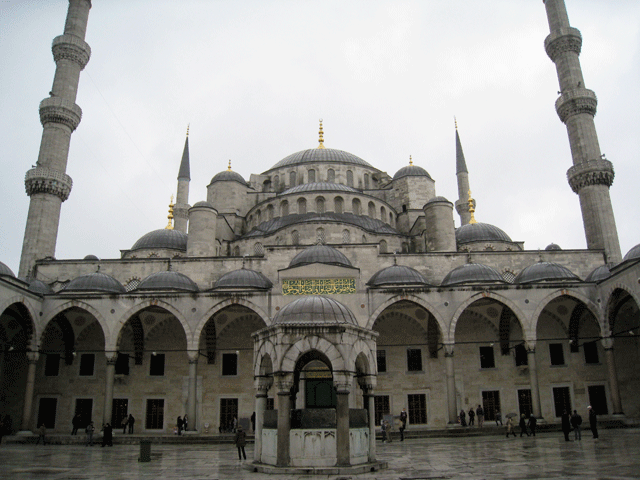 |
| Sultan Ahmed Mosque |
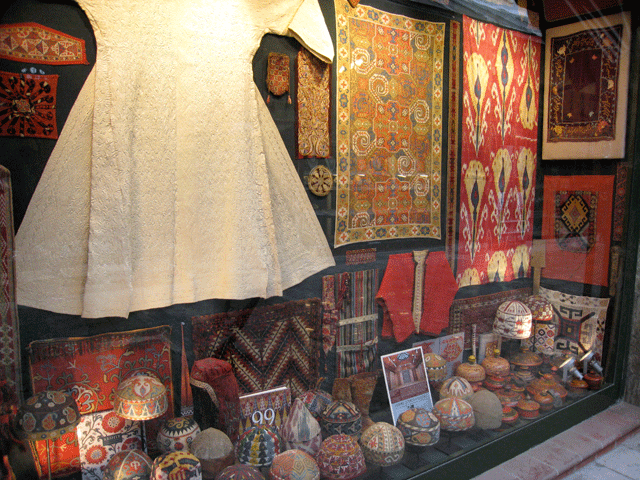 |
| A shop in the bazaar near Sultan Ahmed Mosque.
Much of the merchandise in the shops in this bazaar was not from Turkey. There were a lot of objects from further east: Uzbeki suzanis, embroidered skull caps, various ikat items and Indian wooden containers. Most of the artifacts were lovely but I was supprised that there was so little that was actually Turkish. |
 |
| Galata from near the spice market. In the distance are several of the high new rise buildings that are changing the skyline of the city. On the right and barely visible is the first of two bridges that span the Bosporus from Europe to Asia. |
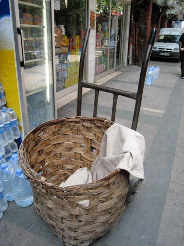 |
Turkey has become very "modern". Containers are now, for the most part, plastic. It was pleasant to see this older woven basket. |
 |
|
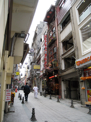
A side street off Istaklal Cadessi. We were told that real estate in Istanbul was very expensive. There were many buildings all over the city (like the one in this image and the next image) that where open to the elements with no apparent new construction going on. |
 |
| Another side street off Istaklal Cadessi |
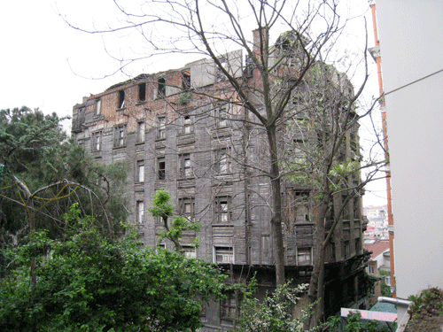 |
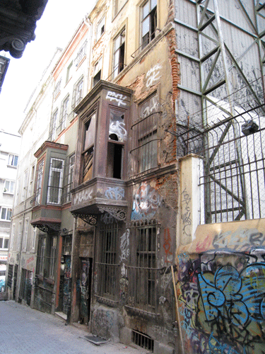
| This beautiful older wooden building is in very bad shape with no obvious attempt to save it or at least perserve it from the elements. |
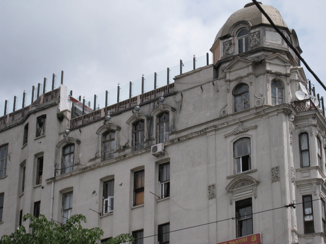 |
| This building on the Istaklal Cadessi looked to be occupied on the first few floors. However, the windows of the top two floors were covered with torn plastic. |
 |
|
The view from the Italian Hospital. Ther are attempts to perserve the old historic buildings. However, many of them are razed to make way for cement high rises. |
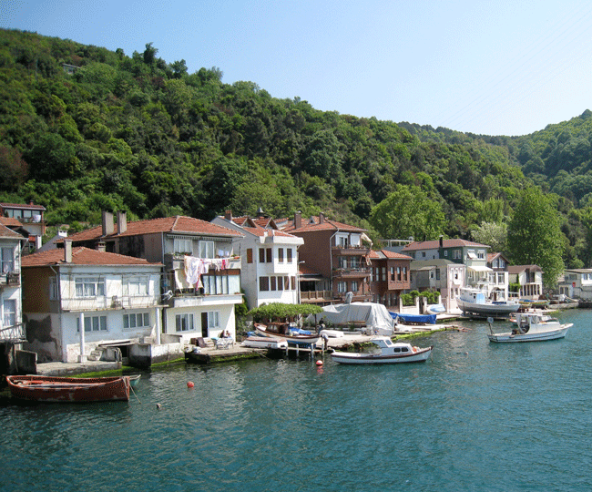 |
| One day we took a two hour ferry ride to the last village on the Bosporus where we had lunch. After lunch we walked through the village and ended up at the little pink house with the boat in dry dock at the right side of the photo (the smallest house in the village). There was a for sale sign on the building and just out of curiosity we called to ask the price. They were asking a mere 1,000,000 Turkish lira (about $800,000). |
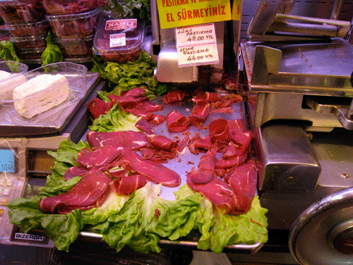 |
| Pastirma - a spicy dried beef. |
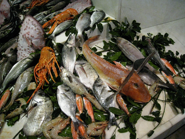 |
| The food, as always, was wonderful. Everything is so fresh. |
| 1880s Letter's From Constantinople
In August 2009 Robing Lorsch Wildfang wrote that she was working on a book of letters written in the "1880s from Constantinople to Germany by my great grandmother who was working as a governess for a German Jewish family living in Pera (Constantinople)." Robin has graciously shared these two letters: My dear parents! In November 2010 Jeanette Rosenberg wrote that she was related to the Traub family and to share this interesting web page Ken Kronenberg's Website, Looking for Signs of Life in Old Letters | |
| Pera, 1903
"The main street of Constantinople is the Grande Rue de Pera. I went into it first at night; there were but few shops open, a few men sitting on their chairs outside of the cafes, a few passers. Heaps of refuse lay in the gutters, dogs nosed into the refuse, dogs lay asleep in all the holes and jags of the pavement. As I passed, a strange dog was being led in leash through their midst, and a howling began which was caught up and continued along the street; dog after dog got up slowly and began to bark; there was a dense, uninterrupted noise, which I soon came to know as the unresting, inarticulate voice of the city.Arthur Symons was a Welch poet who was born in 1865 and died in 1945. He traveled widely and wrote several books about the cities he visited. There is quite a bit on the Internet about him. | |
| To see more pictures of Constantinople from John Stoddard's Lectures, 1897, click on the photo of the Bosporus | 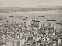
|
| HOME |
| The Azarians and other pages related to Constantinople |
| Roman Catholic Churches in Constantinople |
| Sivas, Sebastia |
| Pirkinik |
| RETURN TO TOP OF PAGE |
|
Please feel free to link to this web page. You may use images on this web page provided that you give proper acknowledgement to this web page and include the same acknowledgments that I have made to the provenance of the image. Please be judicious. Please don't use all the images. You may quote up to seventy five words of my original text from this web page and use any cited quotes on this web page provided you give proper acknowledgement to this web page and include the same acknowledgments that I have made to the provenance of the information. Please do not cut and paste the whole page. You may NOT make use any of the images or information on this web page for your personal profit. You may NOT claim any content of this web page as your original idea. Thanks, Maggie |
| Copyright by Maggie Land Blanck - Page created in 2004 - Latest update, August 2012 |