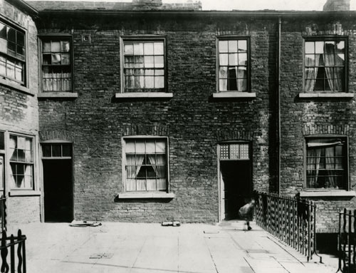
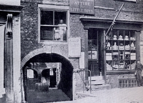
| Leodis, Leeds Library West Street #s 29. 31. 31A. 33 amd 35
|
| John Land, Back Nile Street, Mabgate, 1842 |
|
|
John Land, the son of Charles Land and Ann Dinsdell, was listed in the 1842 Leeds
Directory on Back Nile Street. I do not know if this was a residential or business address.
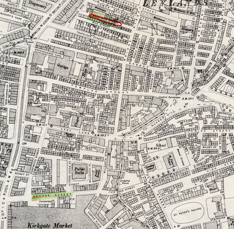
Back Nile Street, circled in red, is the "back of Nile Street".
The current map of Leeds lists the area in Mabgate.
|
| 1906 Ordnance Map
|
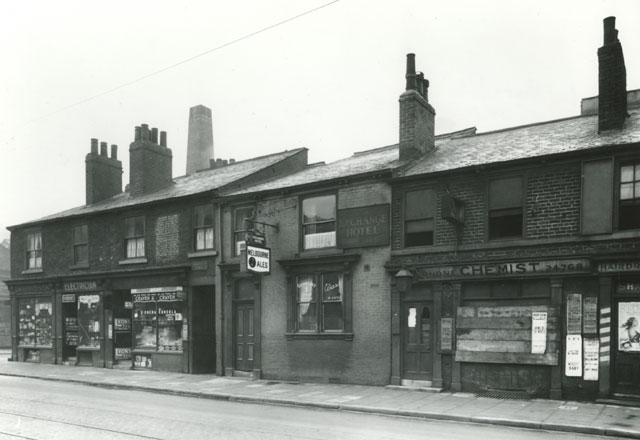
| Cottages in the working class sections of Leeds were back to back with no yards.
There was, on average, one privy to every four cottages. There were no bath facilities.
Baths were taken in a tub in the kitchen or in public bath houses. |
|
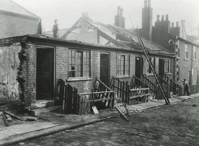 |
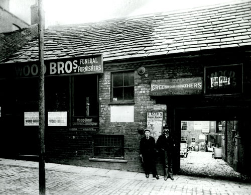
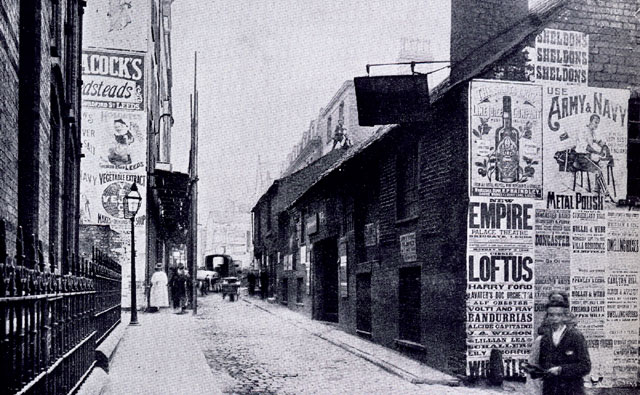
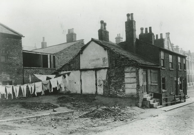
| Leodis, Leeds Library Back Nile Street demolition 1907.
The two workmen on the right are holding a measuring rod which indicates that the height of the
front of the one story house
is 11 feet from the sidewalk to the roof line and the height of the two story house is 17 feet from the sidewalk to the
roof line.
|
|
 |
| Leodis, Leeds Library Back Nile Street demolition 1907.
|
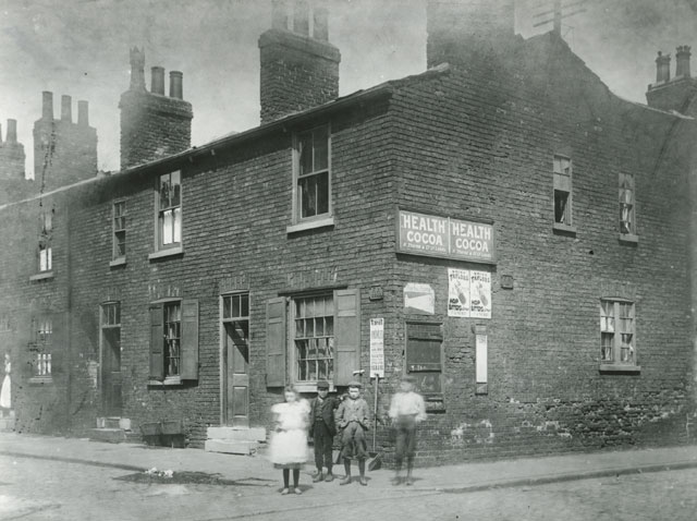 |
| Leodis, Leeds Library
Cottages on the north side of Back Nile Street looking from Bridge Street.
|
|
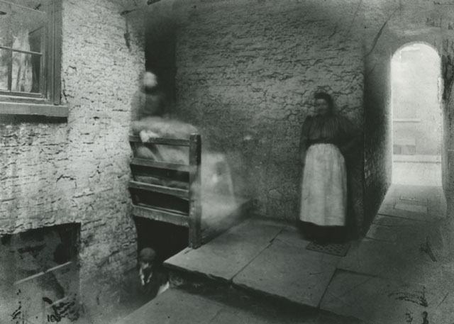 |
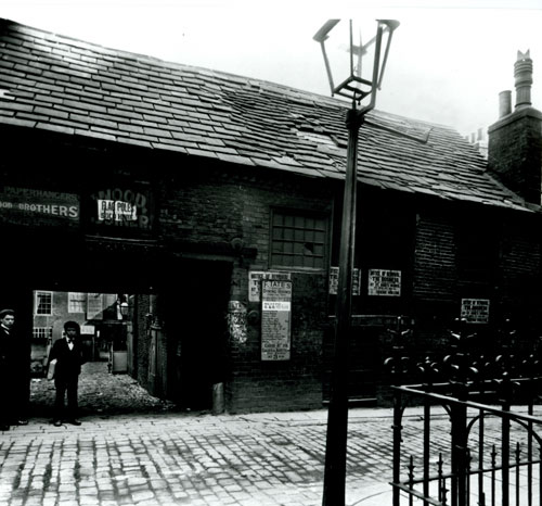
| Leodis, Leeds Library Back Nile Street yard. The access to the
street is through the archway.
|
|
John Land, Cherry Tree Yard, Kirkgate, City of Leeds, North, 1843
|
|
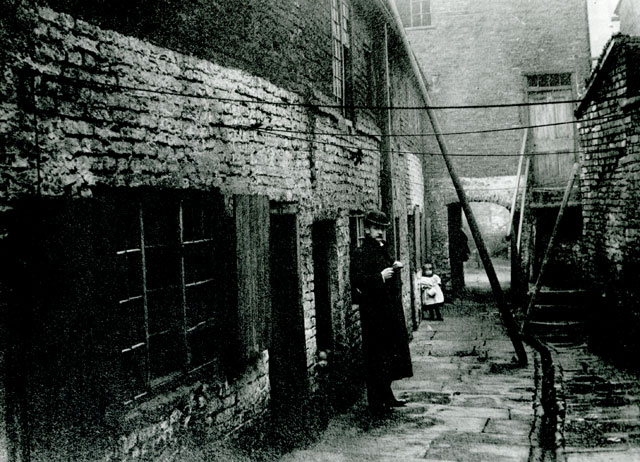 |
| Leodis, Leeds Library Cherry Tree Yard where
the Lands lived at the birth of
Samuel Land in 1843.
In 1834 cholera was an issue in Leeds.
One of the areas mentioned as having a hign incidence of the disease
was Cherry Tree Yard. (The Civil, Ecclesiastical, Literary, Commercial, and Miscellaneous ..., Volume 1
By Edward Parsons)
In 1904 Edmund Bogg wrote:
"Cherry Tree Yard, opposite to the church, with low, narrow entrance, is a type of those folds, peculiar, quaint, but dirty relics of
old Leeds."
"In Cherry-tree Yard was a house of two rooms on the ground floor where slept 7 persons, while the flat above held 6 " living over most offensive privies." Another house in the same yard gave but 145 cubic feet to each sleeper."
(Reports of the Medical Officer of the Privy Council and Local Government) 1866
|
|
| The Lands in Holbeck |
|
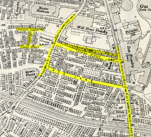
| Charles Land, Water Lane, Holbeck , 1826 |
|
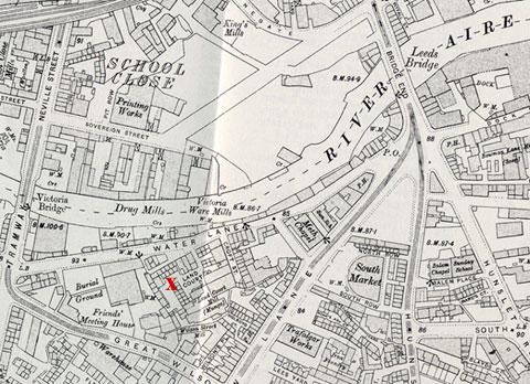 |
Charles Land was listed in 1826 on Water Lane in Holbeck. Holbeck is on the south side of the
Aire River from the city of Leeds.
There was, in fact, Land Court, off Water Lane, Holbeck, as shown in the
1906 Ordnance map (marked with the red "X").
Land's Court, Water Lane is between the Victoria Bridge to the west and the Leeds bridge to the east.
|
|
|
Holbeck
1857/58 Leeds Directory included a description of the township of Holbeck,
the "township" where the family of Charles Lewis Land was living from 1818 to 1833.
Holbeck township and Chapelry, on the south side of the Aire
(adjoining Hunslet) forms a populous south-western suburb of Leeds, commencing
at Christ Church, Meadow lane, and extending westward to the old village of
Holbeck, one mile S.W. and to Holbeck Moor and the Folly 1 _ miles S.S.W. of Briggate.
It is noted for several copious springs of Spa Water, which is slightly
impregnated with sulphur. Though it extends over only about 760 acres it had 14,152
souls in 1851.....The Methodists and Independents have commodious chapels in Holbeck township
....Holbeck cemetery, at Beeston hill, comprises about nine acres of land purchased at
the cost of about 2500 pounds in 1856. It was opened in 1857."
|
|
|
Other Lands at Land's Court, Water Lane
Children of Thomas Land:
Thomas, flax spinner born c. 1780 Wakefield,
Elizabeth born c. 1773 Outwood Wakefield married Samuel Musgraave, and Mary
- Thomas Land c 1780 - 1825) Flax spinner
Thomas Land born circa 1780. Married Mary unknown. Died 1825 Leeds.
Birth: circa 1780 (based on age at death) place unknown
??? Thomas of Thomas Land 22, Nov 1779 Wakefield All Saints
Marriage: Mary (based on will)
Mary born circa 1786 (per 1941 census)
1803 Wakefield St John the Baptist, Thomas Land and Mary Gill born to
the parish, witness Samuel Musgrave.
Children:
Note:
There are too many children of Thomas Land, Kirkgate, being baptized in
this time period - See below and also Ann of Thomas Nov 29, 1805.
Too close together to be one family. Not enough info to determine which children belong to which Thomas.
Thomas born circa 780 was known (based on other records) to have had a son Thomas born circa
1804,
and two daughters, Mary born circa 1811, Jane 1807 (?)
- Elizabeth of Thomas Land of Kirgate Aug 31 bapt Sept. 19, St Peters Leeds 1903
(Parish Records)
Note:
There are too many children of Thomas Land, Kirkgate, being baptized in
this time period - See below and also Ann of Thomas Nov 29, 1805.
Too close together to be one family. Not enough info to determine which children belong to which Thomas.
- Thomas
Thomas Land (1804-?) Flax spinner, Civil Servant, and Ann Bullman
Son of Thomas per 1825 will
Birth: Thomas of Thomas Land 5 February 1804, Leeds, St Peter
(Leeds St Peter's indexes) (IGI) Thomas Land born January 8 baptized February 5,
"Near the Church" father, Thomas (Leeds PR)
Marriage: Anne Bullman 04 July 1827 St Peter's Leeds (IGI)
Thomas Land, flax spinner, to Ann Bullman, witnesses Ewd Bullman and R Bullman (Leeds St. Peter's PR)
Occupation: Flax spinner, Office keeper, civil servant
Residence: 1841 Camp Lane, Kirkgate
Camp lane, 20 Water lane
A LIST OF STREETS, SQUARES, COURTS, LANES, &c. IN THE TOWN AND SUBURBS OF LEEDS FOR 1853.
Note: Land Court is off Water Lane
Children: He does not appear to have had children.
1841 Census: Camp Lane, Kirkgate, Leeds, Thomas Land age 35, "ind" (independent income) Mary, age 55,
Anne age 35, Mary age 30 and a female servant.
Notes:
Thomas, his mother (or step mother), Mary, age 55,
his wife, Ann, age 35 and his sister, Mary age 30.
On the same page and at the same "address" is William Land,
age 35, flax dresser Elizabeth 35, Eliza 4 and Emma 1. Ages in this census were
rounded up or down to the nearest 5.
1841: Land, Thomas, house, Land Court Leeds Township Poll Book
1851 Census: Chelsea, Ecclesiatical parish, Upper Chelsea, St Saviour Middlesex, St Lukes, 17 Walton Street, Thomas Land, head, age 47, office keeper treasury chambers geo---- house, born Leeds, Anna wife, age 46, born Leeds
1861 Census: St Martins Westminster, St Martins in the Feilds, London, Thomas Land, age 57, office keeper, and Ann wife age 58, born born Leeds
1871 Census: In Egham, Christ Church, Surrey, civil servant age 67, with wife Ann age 59 both Leeds.
1881 Census: Egham Surry, age 77 with wife Ann age 76 civil service super--- office ---The Lorrd Advocate of H--Land office London, born born Leeds.
- Mary (per will)
Mary Ann daughter of Thomas Land, Kirkgate Feb 2, bapt Feb 24, 1805
- Jane (per will)
Birth: 4 Aug 1807 baptized 30 Aug 1807, St Peters Leeds, father Thomas Land
-
Mary Land born circa 1811
Birth: Circa 1811, daughter of Thomas flax spinner per her marriage
Mary of Thomas Land Kirkgate March 3, 1809, bapt April 3, St. Peters Leeds
1841: Camp Lane, Thomas Land age 35 ind, Mary age 55, Ann age 35,
Mary age 30 and a female servant.
1851:
Unmarried, by herself, age 40 in 1851.
Marriage 1853: September 1853, Leeds parish church Mary Land age 41
spinster Water Lane daughter of Thomas Land, flax spinner, to George
Hebblethwaite, age 44 bachelor maltster Mirfield son of Samuel
Hebblethwaite Maltster. Both signed.
1861 census: Leeds, Yorkshire, England
Civil parish: Mirfield
Ecclesiastical parish: St Mary
County/Island: Yorkshire
Country: England
George Hebblethwaite 52, maltster, born Mirfield,
Mary Hebblethwaite 52, born Leeds,
Henry Lake 19, servant
1881: Mary Hebblethwaite
Age: 72
Estimated Birth Year: abt 1809
Relation: Head
Gender: Female
Where born: Leeds, Yorkshire, England
Civil parish: Mirfield
County/Island: Yorkshire
Country: England
Street Address: Water Hall East Thorpe
Condition as to marriage: Windower (Widower)
Occupation: Income From Property
Registration district: Dewsbury
Sub-registration district: Mirfield
ED, institution, or vessel: 8
Neighbors: View others on page
Piece: 4557
Folio: 17
Page Number: 27
Mary Hebblethwaite 72
Thomas (Jr.) Kirkby 36, nephew
George Hebblethwaite born 1809 was the son of
Samuel and Rachael Hebblethwaite. He had a sister, Jane,
born circa 1811 who married George Watkinson:
Jane Hebblethwaite,
Full Age, spinster, Easthorpe Lanes,
14 Apr 1841,
Mirfield, St Mary,
father, Samuel Hebblethwaite, maltster,
marriage to George Wathinson, full age, wool stapler, Halifax,
father, George Wathinson, wool stapler
Watkinson, George
[1814-1903] Son of George Watkinson. Born in Northowram [29th October 1814]. He was a woolstapler [1842]; a wool stapler employing ?? men [1861]; a farmer of 10 acres of land [1861]; a wool merchant and farm owner [1871]; a wool merchant [1881]; living on own means [1891]; Chairman of the Brighouse Brick, Tile & Stone Company Limited [1895]; a member of Halifax Town Council; Chairman of the Halifax Brick & Tile Company.
About 1870, he formed a partnership with his sons, George Watkinson& Sons. He made a substantial amount of money in wool, coal.
In 1874, he withdrew from day-to-day management of the woolstapling business, leaving these to his son George.
On 14th April 1841, he married Jane Hebblethwaite [1811-1890], at Mirfield.
Info from Constance Phillips March 2013
- Elizabeth of Thomas Land Kirkgate 30 June St. Peters Leeds
Elizabeth 1815 (per Anna Hughes)
Died Water Land, Leeds 1824 (per Anna Hughes)
Death 1825: Parish of Leeds St. John's Church,
Thomas Land, Water Lane, married man died July 7, age 45.
Will: Courtesy of Anna Hughes, March 2017
Will of Thomas Land the elder of Leeds, dated 26/4/1826, written 4/6/1825
son Thomas Land to pay funeral
gives Lands tenements within parish of Wakefield to his sister Mary and her heirs.
messages warehouses buildings to son Thomas Land and Friends Samuel Musgrave, dyer,
and William Atkinson of Leeds flock merchant to hold in trust
they hold trust for his wife Mary Land
wife to share rents with daughters Jane and Mary currently not married and under 25
dwelling house where resides frogland (or Troyland) place in or near Water Lane to
wife enjoy outhouses yard garden for her life
estate in Kirkgate rents to wife
wish for son Thomas to carry on flax spinning trade
According to Anna Hughes his son did not succeed at the flax business and
a year of so after the death of Thomas senior, Thomas
Junior was bankrupt and he and Samuel Musgrave were renting the flax mill.
1841: Camp Lane, Kirkgate Leeds, Thomas Land 35, ind,
Mary Land 55
Anne Land 35
Mary Land 30
Elizabeth (1773 - 1846) born Outwood Wakefield
Married Samuel Musgrave in Leeds
Birth: 1774 born Outwood, Wakefield per baptism of her children
Possible record - Wakefield All Saints, Eliza daughter of Thomas Land (word) 24,
May 1773.
Marriage: Samuel Musgrave, dyer, Wakefield, 1799, witness at marriage James Land (Anna Hughes)
Samuel Musgrave, of the parish to Elizabeth Land of the parish
by banns, 7 February 1799. Elizabeth made her mark, Samuel signed -
witness James Land
Children:
- William 6 Dec 1799 29 Dec 1799 of Samuel Musgrave and Elizabeth Land (born Outwood, Wakefield)
Leeds, Mill Hill Chapel (Presbyterian),
- Eliza Wakefield Out Wood, Samuel Musgrave and Elizabeth Land,
Dec 1801 3 Jan 1802 Leeds, Mill Hill Chapel (Presbyterian),
- Samuel, 8 July 1804, bapt July 22, father Samuel Musgrave, Mother Elizabeth Land, residence,
Leeds, fathers, birth
Leeds, mother birth place, Outwood, Wakefield,
Non conformist Mill Hill Chapel Leeds Presbyterian (Baptized
on the same day Matthew of James Musgrave and Sarah Walker both born Leeds.)
- Benjamin of Samuel Musgrave and Elizabeth Land, Feb,10, March 2, 1806,
mother born Outwood Wakefield, Leeds, Mill Hill Chapel (Presbyterian),
- Sarah of Samuel Musgrave and Elizabeth Land (or Outwood Wakefield), December 11, Jan 10, 1808 (?), Leeds, Mill Hill Chapel (Presbyterian),
Death of Samuel Musgrave: 01 May 1835 (1 May 1835) - Leeds,
1841
Leeds, Elizabeth Musgrave ind age 65 Oxford Terrace
Mary
Birth:
Relationship: Sister of Thomas born 1780 per will of Thomas at his death in 1825
1811: The Tradesman Vol 6 1811 listed T. Land, G Evers and
J Umpleby of Hunslet, York flax spinners.
Directory Listings for the Occupation of Thomas Land, Water Lane, Flax spinner :
- 1822 Baines Directory: Thomas Land, flax spinner, Water Lane
- 1829 Pigot's Directory for Leeds: Thomas Land Flax spinner Land's Court, Water Lane
Holbeck
- 1830 Leeds directory: Thomas Land, flax spinner, canvas
and sacking mfr., Land's Court, Water Lane,
home, 10 Providence Row
- 1842 Leeds directory: Thomas Land, "gent", 19 Water Lane
1826:
BANKRUPTS
T. Land, Leeds flax spinner
The examiner, Volume 9 By Leigh Hunt, 1826
WHEREAS the acting Commissioners in a
Commission of Bankrupt awarded and issued forth against
Thomas Land, of Leeds, in the county of YOrk, Flax Spinner, Dealer and Chapman,
intend to meet at Eleven of the Clock in the Forenoon at the Court-House
in Leeds etc. 1826 London Gazette
Thomas Land flax spinner, dealer and Chapman was ordered to appear
on the 13th of April, the 2nd of May, at the Court House in Leeds to make a disclosure of his Estate and Effects.
London Gazette
1826:
MACHINERY, Ac. complete, situate in Water-Lane, nearly adjoining the River Aire, lately in ttie Occupation of Mr. Thomas Land, Flax-Spinner The Whole is in excellent Repair nnd Condition, and well suited for any Person wisiiing to commence the above Busin.
1892: Death of Thomas Land - National Probate calendar Land, Thomas
20 Grove Terrace, Camp Road Leeds, died 20 January 1892 administered Wakefield
25 April to John Land hotel proprietor effects 436 pounds
Lands at Water Lane and Land's Court
Thomas Land and his wife, Anne Shirt, were listed in the Queen's Street congregation baptismal records
at Water Lane in 1817 and 1822. Charles Land and Ann Dinsdell Land also belonged to the Queens Street
congregation.
The 1830 Leeds Directory listed three Lands on Land's Court, Water
Lane: - Mrs Mary Land, 24 Land's Ct, Water Ln (most likely the widow of Thomas)
- Thomas Land, flax spinner, canvas and sacking mfr.
Land's Ct, Water Ln: h.
10 Providence row (possibly the son of Thomas)
- Wm Land, flax dresser, 21 Land's Ct, Water Ln.
The 1834 Directory listed two Lands at Water Lane:-
Mrs. Mary Land, 26 Land's ct, Water lane
- William Land, retail ale and porter dealers, Jolly Sailor, 10 Camp Land Water Lane.
The 1837 White's Directory listed three Lands in Leeds:
- Thomas Land whs man (warehouse man), Kaye Street
- William Land, beer house, Camp lane and Land's Ct
- John Land, druggist, Kaye Street
The 1857-58 Leeds directory listed Elizabeth Land, shopkeeper, at 14 Water Ln.
The 1861 Leeds directory listed Elizabeth Land, shopkeeper, at 14 Water Ln.
Elizabeth was the widow of William Land, flax dresser.
I do not know, at this point, if these other Lands were related.
See Above.
For more information on Thomas Land and Ann shirt Land
go to Lands in Queen Street Chapel
Land's court in 1841
The 1841 Census lists a number of families in Land's court - none of the Lands.
Water Lane, Camp Lane and Land's court are in district
8 Kirkgate and also include Bridge End, Meadow Lane, Shipyard Fold,and
something I cannot read.
The occupations of the inhabitants of Land's Court include several labourers,
John Phillips, joiner, Charles Morely, mason, Thomas Sharp, flax dresser,
George Davis, currier, John Bentley, tailor, William Fell, mechanic,
George Shillito ??, porter, Thomas Wilby, plumber,
William Lazenby ?? porter,
Benjamin Atkinson, warehouseman, George Goodyear, waterman, William Sothill,
cabinet maker,
George McDowell, joiner, George Parker, overlooker, William Alderson machine maker??,
and Thomas Pierce flax dresser.
The two Lands in the area were listed on CAMP Lane: -
William age 35, flax dresser, Elizabeth age 35, Eliza age 15,
Emma age 4, and Ann age 1
- Thomas, age 35, ind, Mary, age 55, Ann age 25, Mary age 30 and a female servant.
(This is the son and wife of Thomas Land who died in 1825)
The listings for Land court and Camp Lane are interspersed.
William Land (1803-1847) Water Lane Flax Dresser and Elizabeth Kent
Birth: 1803: I did not find a baptismal record. Year of birth based on death.
Marriage:
William Land, Flax spinner, to Elizabeth Kent by banns St Peter Leeds 4 May 1823 (PR)
Children: -
Eliza, 19 June 1824 of William Land, Water Lane, Flax spinner, and Elizabeth
Marriage: January 24, 1848 Michael Caton full age bachelor pattern card
maker, Swinegate, father John Caton, bootmaker to
Eliza Land, full age spinster, Water Lane, father William Land, flax dresser, parish church after banns,
both signed.
1851 census: Water Lane, Michael Caton, head widow, age 55, warehouseman,
Michael Caton 14, son, warehouseman,
Eliza Caton 27, daughter in law, married,
Ann Land 10, visitor, flax doffer
Fanny Ward 18, visiter, flax doffer,
Ann Ward 14, visiter, flax doffer
On the same page as Mary Land head un[married] age 40 annuitant, born Leeds
1871 Census: Croft Street (near Land court)
Elizabeth Land, head, widow, age 68 provisions dealer and Eliza Caton, widow, age 46
- Thomas of William and Elizabeth Land Water Lane flax dresser, born Nov 25, 1825 baptized
Dec 25, 1825
Death:
- William Thomas Land
Birth Date: 21 Jan 1831
Parish: Leeds, St Peter (Leeds Parish Church)
Baptism Date: 11 Jul 1831
Father's Name: William Land
Mother's Name: Elizabeth Land, Land's court, flax dresser
Death:
- Jane Land
Birth Date: 15 Oct 1833
Parish: Leeds, St Peter (Leeds Parish Church)
Baptism Date: 2 Jan 1834
Father's Name: William Land
Mother's Name: Elizabeth Land, Water Lane flax dresser
Death:
-
Emma Land
Birth Date: 21 Jun 1836
Parish: Leeds, Christchurch
Baptism Date: 21 Dec 1836
Father's Name: William Land
Mother's Name: Elizabeth Land, Christchurch, William Land flax dresser and
Elizabeth, Dec 21, 1836 (PR)
- William Arthur Land
Birth Date: 15 Jun 1838
Parish: Leeds, St Peter (Leeds Parish Church)
Baptism Date: 3 Jul 1838
Father's Name: William Land
Mother's Name: Elizabeth Land, Water Lane Flax dresser
-
Ann
Ann Land
Birth Date: 2 May 1840
Parish: Leeds, St Peter (Leeds Parish Church)
Baptism Date: 9 Jun 1842
Father's Name: William Land
Mother's Name: Elizabeth Land, Camp Lane flax dresser
1851 Census: With her sister Eliza see above.
1841 Census: Camp Lane, Leed (20 Water Lane) William, 35 flax dresser, Elizabeth 35, Eliza 15, Emma 4, Ann 1
Listed on same page as Thomas in the 1841 census
Death: 8 July 1847 William Land married man Water Lane age 44
1871 Census: See Eliza above
See Queens Street Chapel
|
|
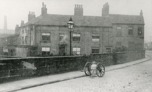 |
Water Hall, Water Lane cottages, Holbeck, Undated
|
| leodis (Leeds Library)
|
|
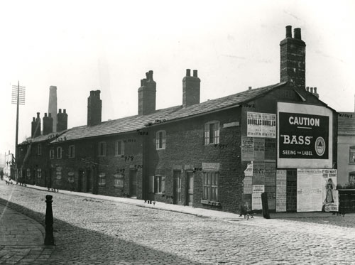 |
Water Lane cottages, Holbeck, 1903
Old cottages scheduled for demolition |
| leodis (Leeds Library)
|
|
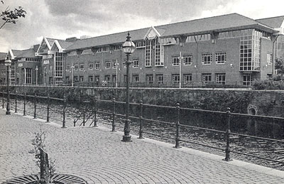
| ASDA Headquarters
In 1986-8 ASDA (a dairy association) build their headquarters
on a seven acre riverside site on the south side of the river Aire between the Leeds Bridge
and the Victoria Bridge
right on top
of where Lands Court was shown in the 1906 Ordnance map. |
| Picture from Leeds Waterfront Heritage Trail by Peter Brears
|
|
| Engraving by William Lodge, Date Unknown
Leeds bridge is on the right with St Peter's church in the background.
This view is from just about where Land's Court once stood and where the ASDA building
stands today.
|
| Picture from Leeds Waterfront Heritage Trail by Peter Brears
|
|
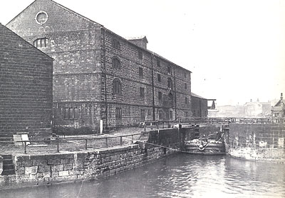
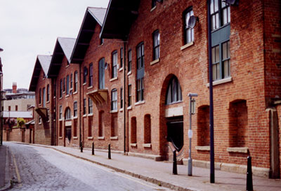
| Leeds and Liverpool Canal warehouse beside River Lock, date unknown
Just west of Victoria Bridge and the ASDA building is the Leeds Liverpool Canal
warehouse and the River Lock.
The River Lock marks the entrance to the canal
from the River Aire. |
| Picture from Leeds Waterfront Heritage Trail by Peter Brears
|
|
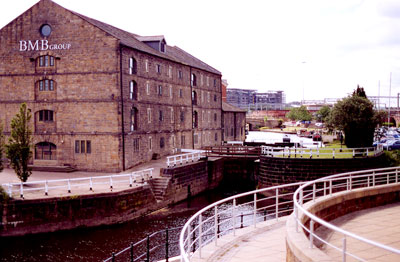
| Leeds and Liverpool Canal warehouse beside River Lock, 2002
The warehouse was built in 1777. |
| Photo by Tom Blanck
|
|
 |
"Bridge End, looking from Water Land in 1869"
Bridge End" is also known as the Leeds Bridge.
|
| Changing Leeds
|
|
 |
"In Water Lane in the past" |
| Changing Leeds
|
|
 |
Old Leeds Bridge
1849. Looking north to the entrance of Briggate.
Engraver T A Prior. |
| Changing Leeds
|
|
 |
|
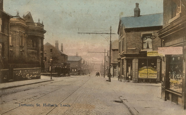
| Postcard collection of Maggie Land Blanck
Domestic Street Holbeck, Leeds.
Posted Holbeck, Leeds 1906
In March 2017 Roger Walker wrote that as of that date the chapel on Domestic street was still
standing at the junction of Domestic Street and Ingram View as shown on Google Maps.
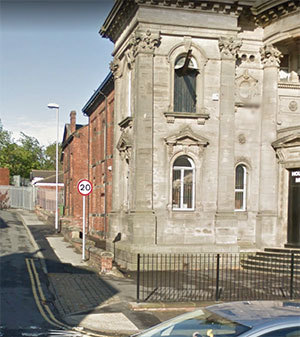
google maps 2017
|
|
 |
| Print collection of Maggie Land Blanck |
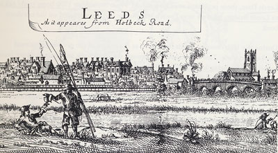
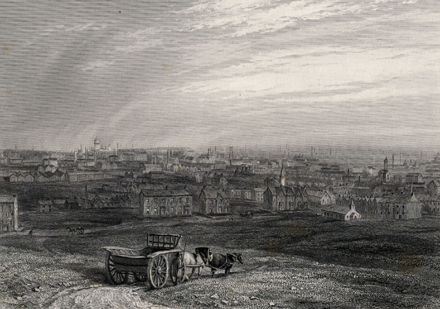
| Leeds from Holbeck
There is no date on this print. However, I believe that the white tower of the City Hall can be seen in the background on the
left. The City Hall was dedicated in 1858. |
|
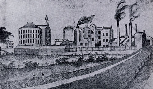 |
Old Round Foundry, Holbeck |
| Changing Leeds
|
|
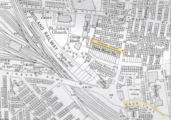
| Charles Lewis Land and Ann
Dinsdell, Brewery Field, Holbeck
|
|
| Charles Lewis Land and Ann Dinsdell were listed
in "Brewery Field", Holbeck
in 1833. I cannot find anything marked "Brewery Field" on any of the maps I possess.
1845: Williams's Directory of the Borough of Leeds lists the following streets in Brewery Field:
Balloon st., Green street, Green Mount street, Carlton Row, Moore street, top Meadow Lane,
A record for an 1840 marriage listed an address as Terrace street
Brewery field.
Ann Dinsdell Land was listed on Terrace street, Holbeck in 1841 to 1871.
In 1849 there was mention of a 27 yards deep well in
Balloon street, Brewery Fields, Leeds ( Proceedings of the Yorkshire Geological Society, Volume 2
By Yorkshire Geological and Polytechnic Society)
In 1852 Brewery Fields was referred to as a "district" in the parish of Leeds and Hunslet.(Bulletins and Other State Intelligence )
The church of St. Barnabas was in the district of Brewery Fields.
See - St. Barnabas and
Brewery Fields
1860:
"In every part of the town there has been the same rapid accumulation of buildings.
Nearly the whole of the Westend, Armley hall, New Wortley, Camp field, Brewery field, a vast part of Hunslet and Holbeck
and at the east end of the town, the Leylands, &c, have been built since the year 1800. "
(The Annals and History of Leeds, and Other Places in the County of York, 1860)
1906 Ordnance Survey Map Holbeck and New Wortley
Charles Lewis Land and Ann Dinsdale Land
|
| |
|
|
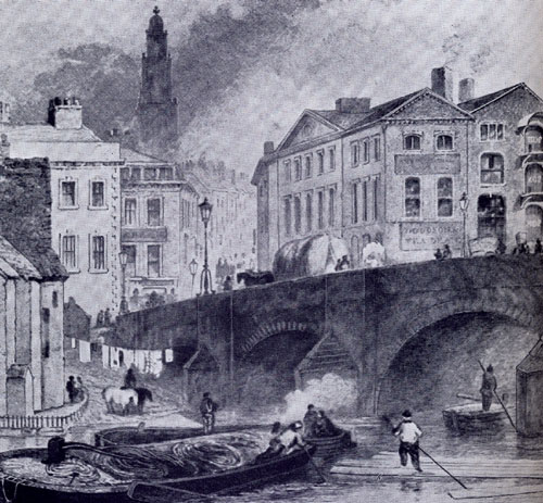
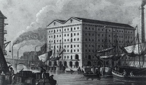
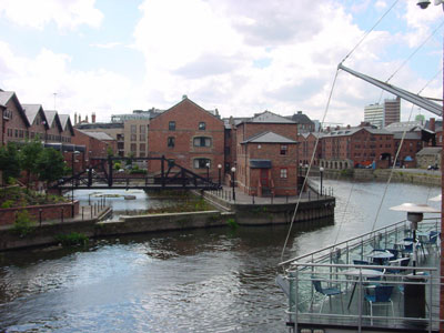
1829, Aire and Calder Canal near Leeds Bridge
Drawn by N Whittock
|
| Leodis, Leeds Library |
|
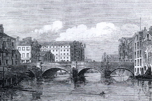 |
A view down river from above the Leeds Bridge
|
| Leodis, Leeds Library |
|
 |
A view down river from above the Leeds Bridge
Date unknown. However, pre 1873 as the bridge was changed from stone to metal in 1873. |
| Leodis
|
|
 |
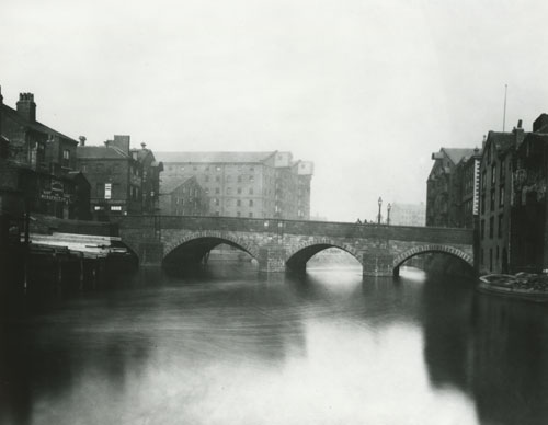
A view down river from the Leeds Bridge
The steeple of the parish church can be seen in the background. |
| Changing Leeds |
|
 |
Another view down river from near the Leeds Bridge
The steeple of the parish church can be seen in the background.
|
| A Souvenir of Leeds, date unknown
|
|
 |
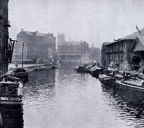
A view down river from the Leeds Bridge, 2002
If Charles and Ann lived near the Tetley Brewery, they would have been somewhere to the right of this photo.
|
| Photo by Maggie Blanck
|
|
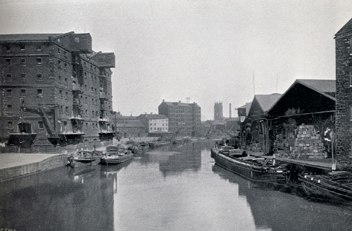
| Looking up river from the Crown Point Bridge, near the Tetley Brewery, 2002
Looking up river the view of the Leeds Bridge is blocked by the buildings.
The Tetley Brewery is out of view to the left. |
| Photo by Maggie Blanck
|
|
 |
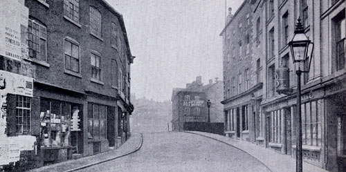
Dock Street, 2002
Dock Street connects Water Lane to
the Tetley Brewery. |
| Photo by Tom Blanck
|
I had this street incorrectly labeled as "Waterloo Lane" in Mach
2010 Grant Barker wrote to alert me to my error.
Dear Maggie,
The title and location of one of the photographs on web
page http://maggieblanck.com/Land/LandLeeds.html is wrong. The location is given as:
"Waterloo Lane, 2002 - Waterloo Lane connects Water lane to the Tetley Brewery."
But it is actually Dock Street, one of the very few remaining cobbled streets left
in the centre of Leeds. I live right next door to this street and our street (Bowman Lane)
lost its original cobbled street last year when the council decided to "renovate"
the street and destroyed it, replacing the road with tarmac. Sacrilege! Dock
Street retains the original cobbled street. The buildings in your photograph
are the original frontage of the warehouse that was there. Only the frontage was
retained, to keep the area's character, but the rest of the warehouse was
demolished and Victoria Quays (apartments) were built there. Dock Street connects
Hunslet Road to Kendell Street.
Dock Street and Kendell Street remain in the same location as
in the 1906 OS map, however the Bowman Lane parallel to Waterloo Street has
disappeared and Waterloo Street now finishes at Kendell Street and continues
in an uninterrupted line (with only a street sign denoting this) as Bowman Lane until
it comes out near Crown Point Bridge.
Best Regards,
Grant Barker
|
|
Holbeck in 1872
"The Mill of Messrs. Marshall and Co., flax spinners,
in Marshal Street, is worthy, form an architectural point of view alone,
of a
far better situation than the one which it occupies in the crowded,
dismal, smoke-blackened purlieus of Holbeck. If our readers can picture to
themselves an ancient Egyptian temple, set down in the midst of a densely
populated region of workmen's cottages, blast furnaces, and
glass manufactories, they will have realized the scene completely.
The building is, of course, private property; and, when we see such remarkable edifices erected solely
at the instance of a single firm of manufacturers, we are prepared to learn
that public buildings in Leeds take a high rank among the architectural glories
of the kingdom."
The Graphic September 31, 1872.
In April 2016 Roger Quick alerted me to
Temple Works
- the history of the Marschall Flax mills in Holbeck.
|
|
|
Hunslet |
|
|
Charles Lewis Land and Ann Dinsdall, Canning Street, Hunslet |
|
| Charles Lewis Land and Ann Dinsdell Land were listed in
Hunslet from 1834 until Charles' death in 1844.
The 1841 censuses describes the Enumeration District where Charles and Ann Land lived as:
"All between north side of Ansley Street east side of Dale Street and south side of Charlotte Street to
Meadow Lane and all north of Jack Lane to Dewsbury Road on the west side and east side of Meadow
Lane.
At Charles' death in 1844 the address was given as Canning Street, Hunslet.
I do not have any pictures of this area.
The 1906 OS map shows Canning Street a bit south of Land court between Meadow Lane
and Dewsbury Road. |
|
 |
| 1905 Ordnance Map |
| Canning Street Hunslet
The 1841 census description of the Enumeration District where Charles and Ann Land lived is
highlighted in yellow as is Canning Street. |
|
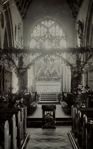 |
Interior of Hunslet church, not dated
|
| Postcard collection Maggie Land Blanck |
|
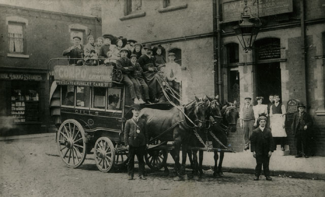 |
| Photo collection Maggie Land Blanck
Last horse bus to run from Hunslet
Carr to Briggate Leeds c. 1904. Part of the Mc Kenna collection.
In reply to my inquiry about the McKenna collection Rodger Parnell, on the behalf of Graham
McKenna wrote in February 2006 about Graham McKenna:
He was many years ago an early member of the Leeds Cine club and filmed in and around Leeds including the last trams to run in Leeds which were shown on T.V. in a programme "All our Yesterdays".
About the McKenna collection of photos Rodger Parnell wrote:
The photos in the
McKenna collection originally belonged to a man called Ramsden Farrar. Apparently he was a sign
writer in Leeds and had these photos taken as examples for potential clients. The photos were
given to Graham by the daughter of Ramsden Farrar for safekeeping and for Graham to keep and show
to future generations, which he has done. Both Ramsden Farrar and his daughter have long since
passed away.
The photos were copied by the Leeds Library and the original retained by Graham McKenna.
Ramsden Farrar
Ramsden Farrar born March Quarter 1864 (Leeds, 9b, 364, Free BMD) was the son of John Farrar.
He was listed in 1871 at 25 Garden Street Leeds East
with his father as follows:
John Farrar, head, age 51, silk dyer,
Sarah A, wife, age 49,
Mary, daughter, age 23, woolen weaver,
Sarah A, daughter, age 21, cap finisher,
John, son, age 19, butcher,
Angelina, daughter, age 17, cap machinist,
Thomas son, age 15, grocers assistant,
William, son, age 13, drapers assistant,
Fred, son, age 9, scholar,
Ramsden, son, age 7, scholar,
Arthur, son, age 4, scholar all born Leeds
He was listed in 1881 at 25a Garden Street Leeds East
with his father as follows:
John Farrar, head, age 62, dyer and cleaner,
Sarah A, wife, age 60,
Mary, daughter, age 34, cloth weaver,
William, son, age 24, shoe rivitter,
Ramsden, son, age 17, sign writer,
Arthur, son, age 14, errand boy,
Sarah Ann Lyneh (?), granddaughter, age 5
all born Leeds.
Next door was Angelina Leneh, wife, age 27, and her husband, Frederick Lyneh, age 30,
beer seller, Frederick W Leneh, son, age 1, and
Thomas Farrar, bother in law, age 24, brewer and tapster.
Ramsden Farrar married Sarah E. Moss St Peter, Leeds September quarter 1885 Leeds (9b 605 Free BMD)
They were not listed in the 1891 or 1901 census by Ancestry.com
The Gill Family
The bus pictured above was owned and opperporated by the Gill family.
John Gill age 56 cab proprietor and his wife, Isabelle, lived on Church Street in 1901.
The family included their 5 sons, Edmound age 19, Oliver age 16, Arthur age 15,
Willie age 12 and James age 9. John Gill died between the 1901 and 1911 censuses.
Isabelle Gill, widow, was listed with the five boys at 11 Branch Street in 1922.
The Gill family were listed in 1891 at 20 Church Street: John Gill 45 cab proprietor,
Isabella Gill 44 wife,
Tom Gill 20,
Sarah Gill 17,
Alfred Gill 15,
Herbert Gill 12,
Edmond Gill 10,
Oliver Gill 7,
Arthur Gill 4,
William Gill 2
In 1881 John Gill was listed on Low Road Hunslet as a "joiner".
John was the son of Joseph Gill, joiner, and Sarah Gill.
|
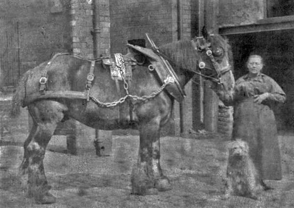 |
| Photo courtesy Cynthia, January 2012
Hannah Gill
|
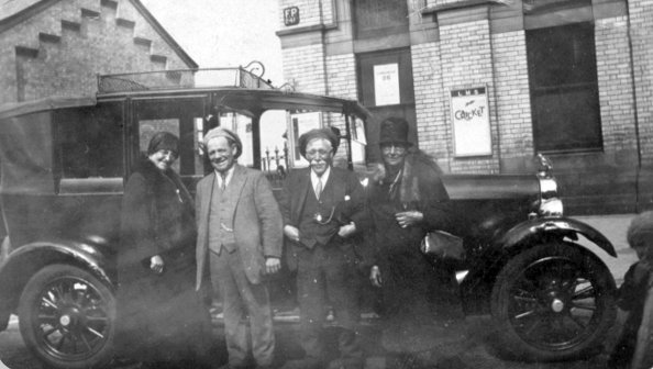 |
| Photo courtesy Cynthia, January 2012
Grandma and Grandpa Gill with car.
|
|
 |
Farr Street Hunslet, undated |
| Leodis (Leeds Library)
|
|
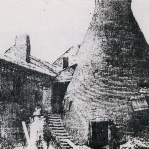 |
The Leeds Pottery
Leeds Pottery was located in Jack Lane (not far from where the Charles Lewis Land and
Ann Dinsdall lived). It
established by Richard Humble and John and Joshua Green in 1770.
They made creamware that was popular in middle class homes.
Leeds
Pottery went though some financial ups and downs: it closed in 1806, reopened in 1813, went bankrupt in 1830, reopened again in 1849. It finally closed in 1881.
It was made again from 1983-1986.
|
| From Hunslet, S Clark and M Wilson, Hunslet
Social History Group, undated, book collection of Maggie Land Blanck
|
|
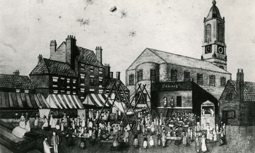 |
Hunslet Feast
The Hunslet Feast featured
shows and rides.
It was originally held near the Hunslet church (St Mary's). In 1888 it moved to Hunslet Moor.
|
| Leodis, Leeds Library
|
|
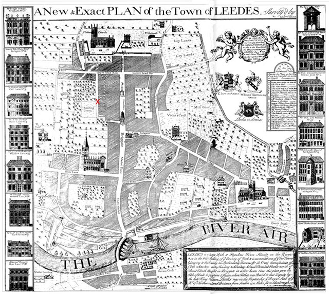
Cossin's 1725 map of Leeds. The red x marks Land's Lane.
|
|
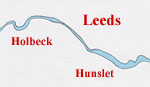
| This sketch shows the relationship of
Holbeck and
Hunslet to the city of Leeds.
| 
|
|
| If you have any suggestions,
corrections, information, copies of documents, or photos that you would like to
share with this
page, please contact me at
maggie@maggieblanck.com |
|
|
Please feel free to link to this web page.
|
|
| ©Maggie Land Blanck - Page created 2004 -
Latest update, June 2020
|
|
| |